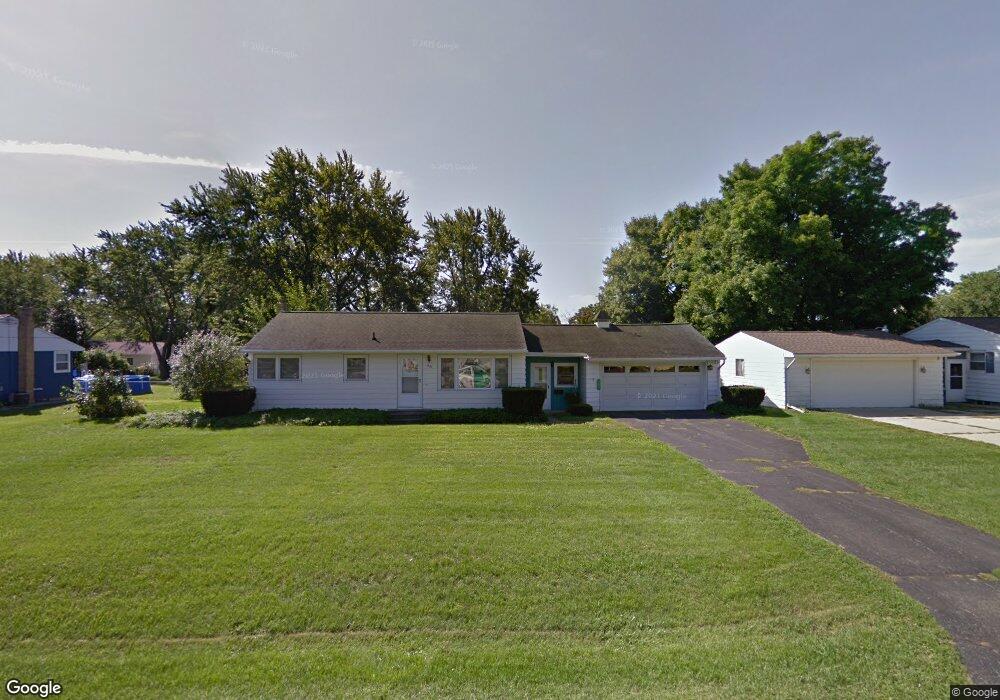
1337 Joseph St Jackson, MI 49202
Estimated Value: $173,087 - $217,000
Studio
--
Bath
912
Sq Ft
$209/Sq Ft
Est. Value
About This Home
This home is located at 1337 Joseph St, Jackson, MI 49202 and is currently estimated at $190,272, approximately $208 per square foot. 1337 Joseph St is a home located in Jackson County with nearby schools including Northwest Early Elementary School, Northwest Elementary School, and Northwest Middle School.
Ownership History
Date
Name
Owned For
Owner Type
Purchase Details
Closed on
May 27, 2021
Sold by
Heins Frederick J and Hamon Mary Margaret
Bought by
Smith Justiin and Degarmo Danielle K
Current Estimated Value
Home Financials for this Owner
Home Financials are based on the most recent Mortgage that was taken out on this home.
Original Mortgage
$136,576
Outstanding Balance
$123,653
Interest Rate
2.9%
Mortgage Type
New Conventional
Estimated Equity
$66,619
Create a Home Valuation Report for This Property
The Home Valuation Report is an in-depth analysis detailing your home's value as well as a comparison with similar homes in the area
Home Values in the Area
Average Home Value in this Area
Purchase History
| Date | Buyer | Sale Price | Title Company |
|---|---|---|---|
| Smith Justiin | $140,800 | Midstate Ttl Agcy Of Souther |
Source: Public Records
Mortgage History
| Date | Status | Borrower | Loan Amount |
|---|---|---|---|
| Open | Smith Justiin | $136,576 |
Source: Public Records
Tax History
| Year | Tax Paid | Tax Assessment Tax Assessment Total Assessment is a certain percentage of the fair market value that is determined by local assessors to be the total taxable value of land and additions on the property. | Land | Improvement |
|---|---|---|---|---|
| 2025 | $2,606 | $80,050 | $0 | $0 |
| 2024 | $12 | $83,000 | $0 | $0 |
| 2023 | $1,176 | $76,000 | $0 | $0 |
| 2022 | $2,354 | $67,000 | $0 | $0 |
| 2021 | $1,425 | $60,300 | $0 | $0 |
| 2020 | $1,458 | $57,200 | $0 | $0 |
| 2019 | $1,377 | $51,200 | $0 | $0 |
| 2018 | $1,263 | $48,900 | $0 | $0 |
| 2017 | $1,193 | $46,600 | $0 | $0 |
| 2016 | $788 | $45,830 | $45,830 | $0 |
| 2015 | $1,144 | $38,069 | $38,069 | $0 |
| 2014 | $1,144 | $35,949 | $35,949 | $0 |
| 2013 | -- | $35,949 | $35,949 | $0 |
Source: Public Records
Map
Nearby Homes
- 0 Lansing Ave Unit 26003476
- 1417 Gerry Dr
- 3335 Clinton Way
- 4223 Aspen Way
- 0 Burt Ave
- VL 69 Clinton Way
- VL Morrill Rd
- 3576 Clinton Way
- 3580 Clinton Way
- 109 Bradley Dr
- 3556 Clinton Way
- 3560 Clinton Way
- 3564 Clinton Way
- 3568 Clinton Way
- 3572 Clinton Way
- 5123 S Granite St
- 100 Burt Ave
- 5038 Fieldstone St
- 2013 Cooper St
- 0 Shirley Dr Unit 24064060
- 1333 Joseph St
- 1338 Michael Dr
- 1334 Michael Dr
- 1342 Michael Dr
- 1345 Joseph St
- 1329 Joseph St
- 1336 Joseph St
- 1332 Joseph St
- 1340 Joseph St
- 1330 Michael Dr
- 1346 Michael Dr
- 1344 Joseph St
- 1328 Joseph St
- 1325 Joseph St
- 1326 Michael Dr
- 1323 Gerry Dr
- 1337 Michael Dr
- 1321 Gerry Dr
- 1333 Michael Dr
- 1325 Gerry Dr
Your Personal Tour Guide
Ask me questions while you tour the home.