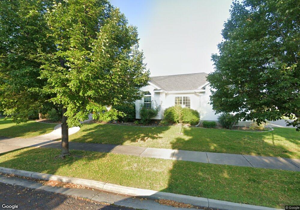
1337 N 1400 E Logan, UT 84341
Hillcrest NeighborhoodEstimated Value: $705,000 - $871,000
5
Beds
3
Baths
4,486
Sq Ft
$175/Sq Ft
Est. Value
About This Home
This home is located at 1337 N 1400 E, Logan, UT 84341 and is currently estimated at $783,316, approximately $174 per square foot. 1337 N 1400 E is a home located in Cache County with nearby schools including Hillcrest Elementary School, Mount Logan Middle School, and Logan High School.
Ownership History
Date
Name
Owned For
Owner Type
Purchase Details
Closed on
Sep 12, 2025
Sold by
Laub Jack and Laub John Ivan
Bought by
John Ivan Laub And Sheryl Lee Madsen Laub Rev and Laub
Current Estimated Value
Purchase Details
Closed on
Jul 1, 2022
Sold by
Vikas Garg
Bought by
Laub Jack and Laub Sheryl
Home Financials for this Owner
Home Financials are based on the most recent Mortgage that was taken out on this home.
Original Mortgage
$600,000
Interest Rate
5.25%
Mortgage Type
Seller Take Back
Purchase Details
Closed on
Jan 22, 2007
Sold by
Olsen Eugene K and Olsen Colleen D
Bought by
Garg Vikas
Home Financials for this Owner
Home Financials are based on the most recent Mortgage that was taken out on this home.
Original Mortgage
$349,000
Interest Rate
6.1%
Mortgage Type
New Conventional
Create a Home Valuation Report for This Property
The Home Valuation Report is an in-depth analysis detailing your home's value as well as a comparison with similar homes in the area
Home Values in the Area
Average Home Value in this Area
Purchase History
| Date | Buyer | Sale Price | Title Company |
|---|---|---|---|
| John Ivan Laub And Sheryl Lee Madsen Laub Rev | -- | None Listed On Document | |
| Laub Jack | -- | Hickman Land Title | |
| Garg Vikas | -- | Heritage West Title |
Source: Public Records
Mortgage History
| Date | Status | Borrower | Loan Amount |
|---|---|---|---|
| Previous Owner | Laub Jack | $600,000 | |
| Previous Owner | Garg Vikas | $349,000 |
Source: Public Records
Tax History
| Year | Tax Paid | Tax Assessment Tax Assessment Total Assessment is a certain percentage of the fair market value that is determined by local assessors to be the total taxable value of land and additions on the property. | Land | Improvement |
|---|---|---|---|---|
| 2025 | $2,988 | $386,425 | $0 | $0 |
| 2024 | $3,085 | $386,425 | $0 | $0 |
| 2023 | $3,223 | $384,840 | $0 | $0 |
| 2022 | $3,452 | $384,845 | $0 | $0 |
| 2021 | $3,103 | $534,570 | $90,000 | $444,570 |
| 2020 | $3,161 | $489,993 | $90,000 | $399,993 |
| 2019 | $3,303 | $489,993 | $90,000 | $399,993 |
| 2018 | $3,233 | $437,820 | $90,000 | $347,820 |
| 2017 | $3,120 | $223,410 | $0 | $0 |
| 2016 | $3,235 | $206,910 | $0 | $0 |
| 2015 | $2,828 | $195,080 | $0 | $0 |
| 2014 | $2,556 | $195,080 | $0 | $0 |
| 2013 | -- | $195,080 | $0 | $0 |
Source: Public Records
Map
Nearby Homes
- 1335 N 1275 Ln E Unit 55
- 1454 N 1400 E
- 1354 N 1250 E Unit 46
- 1336 E Talmage Ln Unit 38
- 1535 E 1385 N
- 1512 E 1260 N
- 1374 N 1250 E Unit 48
- 1341 N 1250 E Unit 41
- 1352 N Talmage Ln
- 1352 N Talmage Ln Unit 36
- 1551 E 1455 N
- 1440 N 1600 E
- 1133 N 1520 E
- 1491 N 1600 E
- 1424 N 1640 E
- 1441 Ellendale Ave
- 1672 N 1560 E
- 1309 E 900 N
- 909 Evergreen Dr
- 871 Hillcrest Ave
- 1376 Box Elder Cir
- 1315 N 1400 E
- 1397 Box Elder Cir
- 1397 E 1340 N
- 1352 N 1400 E
- 1383 E 1850 N
- 1359 Box Elder Cir
- 1351 Box Elder Cir
- 1367 Box Elder Cir
- 1384 N 1400 E
- 1395 N 1400 E
- 1392 N 1400 E
- 1291 N 1400 E
- 1410 E 1300 N
- 1376 E 1400 Cir N
- 1395 Elderberry Cir
- 1412 E 1425 N
- 1428 E 1300 N
- 1393 Boxwood Cir
- 1435 E 1300 N
Your Personal Tour Guide
Ask me questions while you tour the home.