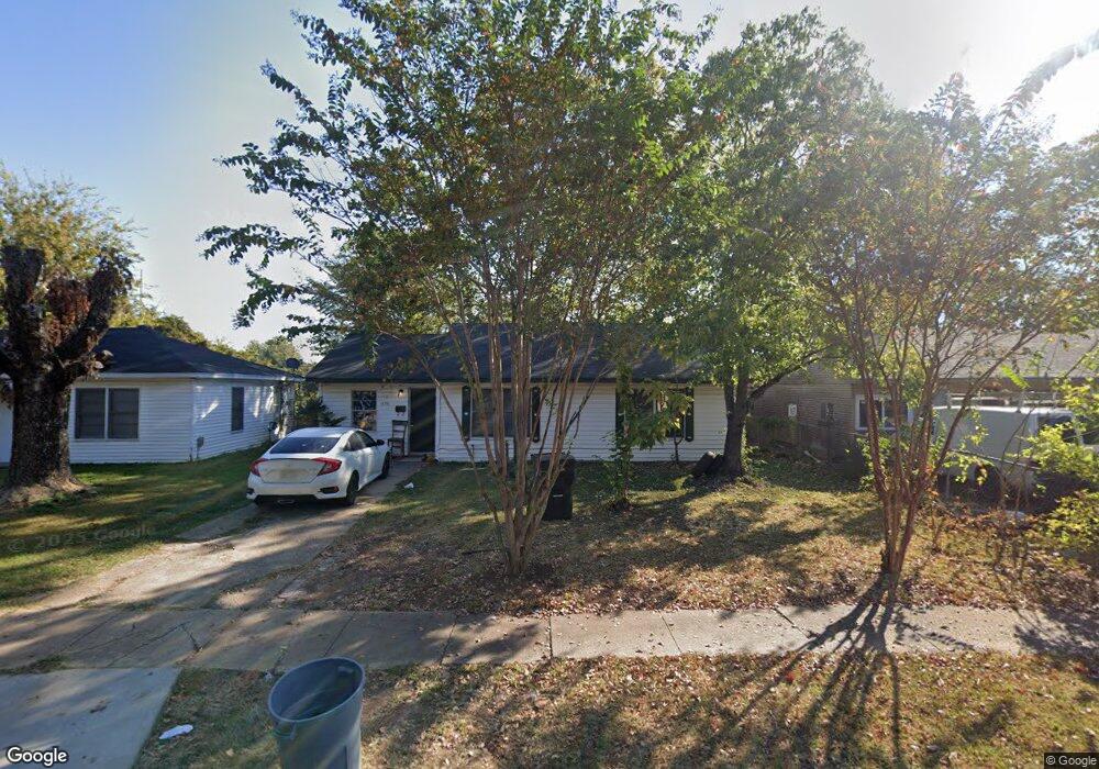
1338 Michael St Bossier City, LA 71112
Barksdale North NeighborhoodEstimated Value: $86,000 - $115,000
3
Beds
1
Bath
1,048
Sq Ft
$95/Sq Ft
Est. Value
About This Home
This home is located at 1338 Michael St, Bossier City, LA 71112 and is currently estimated at $99,282, approximately $94 per square foot. 1338 Michael St is a home located in Bossier Parish with nearby schools including Waller Elementary School, Rusheon Middle School, and Bossier High School.
Ownership History
Date
Name
Owned For
Owner Type
Purchase Details
Closed on
Aug 25, 2010
Sold by
Parker William Andrew
Bought by
Powell Michael S and Powell Deanna L
Current Estimated Value
Home Financials for this Owner
Home Financials are based on the most recent Mortgage that was taken out on this home.
Original Mortgage
$35,000
Outstanding Balance
$23,208
Interest Rate
4.6%
Mortgage Type
Future Advance Clause Open End Mortgage
Estimated Equity
$76,074
Create a Home Valuation Report for This Property
The Home Valuation Report is an in-depth analysis detailing your home's value as well as a comparison with similar homes in the area
Home Values in the Area
Average Home Value in this Area
Purchase History
| Date | Buyer | Sale Price | Title Company |
|---|---|---|---|
| Powell Michael S | $26,000 | Pierremont Title -Bossier Of |
Source: Public Records
Mortgage History
| Date | Status | Borrower | Loan Amount |
|---|---|---|---|
| Open | Powell Michael S | $35,000 |
Source: Public Records
Tax History Compared to Growth
Tax History
| Year | Tax Paid | Tax Assessment Tax Assessment Total Assessment is a certain percentage of the fair market value that is determined by local assessors to be the total taxable value of land and additions on the property. | Land | Improvement |
|---|---|---|---|---|
| 2024 | $843 | $6,941 | $1,550 | $5,391 |
| 2023 | $881 | $6,759 | $1,550 | $5,209 |
| 2022 | $725 | $6,759 | $1,550 | $5,209 |
| 2021 | $120 | $5,307 | $1,550 | $3,757 |
| 2020 | $568 | $5,307 | $1,550 | $3,757 |
| 2019 | $648 | $5,960 | $1,550 | $4,410 |
| 2018 | $648 | $5,960 | $1,550 | $4,410 |
| 2017 | $775 | $5,960 | $1,550 | $4,410 |
| 2016 | $775 | $5,960 | $1,550 | $4,410 |
| 2015 | $139 | $6,100 | $1,550 | $4,550 |
| 2014 | $139 | $6,100 | $1,550 | $4,550 |
Source: Public Records
Map
Nearby Homes
- 1333 Michael St
- 1333 Mark Ave
- 3235 Sarah St
- 3224 Galaxy Dr
- 3217 Thunderbird Ln
- 3001 Jamie Place
- 1245 Dudley Ln
- 1509 Anita St
- 3105 Donald Dr
- 1219 Fullilove Dr
- 1620 Anita St
- 2545 Lamar St
- 2383 Julia St
- 1609 Northgate Rd
- 2454 Barbara St
- 2464 Barbara St
- 3305 Jefferson Place
- 1617 Margaret St
- 2712 Foster St
- 2722 Barksdale Blvd
- 1336 Michael St
- 1340 Michael St
- 1334 Michael St
- 1342 Michael St
- 1332 Michael St
- 1344 Michael St
- 1377 Airline Dr
- 1331 Michael St
- 1335 Michael St
- 1330 Michael St
- 1346 Michael St
- 1401 Airline Dr
- 1329 Michael St
- 1337 Michael St
- 1407 Airline Dr
- 1327 Michael St
- 1328 Michael St
- 1348 Michael St
- 1339 Michael St
- 1325 Michael St