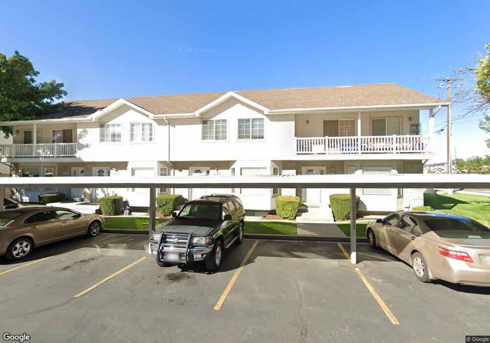
1338 S 1370 E Provo, UT 84606
Provost NeighborhoodEstimated Value: $393,000 - $419,176
4
Beds
4
Baths
2,370
Sq Ft
$172/Sq Ft
Est. Value
About This Home
This home is located at 1338 S 1370 E, Provo, UT 84606 and is currently estimated at $406,725, approximately $171 per square foot. 1338 S 1370 E is a home located in Utah County with nearby schools including Spring Creek Elementary School, Centennial Middle School, and Timpview High School.
Ownership History
Date
Name
Owned For
Owner Type
Purchase Details
Closed on
Aug 25, 2014
Sold by
Rock Jeffrey Butler
Bought by
Meese Matthew
Current Estimated Value
Home Financials for this Owner
Home Financials are based on the most recent Mortgage that was taken out on this home.
Original Mortgage
$175,700
Outstanding Balance
$134,311
Interest Rate
4.1%
Mortgage Type
New Conventional
Estimated Equity
$272,414
Purchase Details
Closed on
Mar 18, 2008
Sold by
Rock Patrick Dale
Bought by
Rock Jeffrey Butler
Purchase Details
Closed on
Dec 15, 2000
Sold by
Emprise Llc
Bought by
Rock Patrick Dale and Rock Jeffrey B
Home Financials for this Owner
Home Financials are based on the most recent Mortgage that was taken out on this home.
Original Mortgage
$153,484
Interest Rate
7.81%
Mortgage Type
FHA
Create a Home Valuation Report for This Property
The Home Valuation Report is an in-depth analysis detailing your home's value as well as a comparison with similar homes in the area
Home Values in the Area
Average Home Value in this Area
Purchase History
| Date | Buyer | Sale Price | Title Company |
|---|---|---|---|
| Meese Matthew | -- | Title West | |
| Rock Jeffrey Butler | -- | Backman | |
| Rock Patrick Dale | -- | Metro National Title |
Source: Public Records
Mortgage History
| Date | Status | Borrower | Loan Amount |
|---|---|---|---|
| Open | Meese Matthew | $175,700 | |
| Previous Owner | Rock Patrick Dale | $153,484 |
Source: Public Records
Tax History
| Year | Tax Paid | Tax Assessment Tax Assessment Total Assessment is a certain percentage of the fair market value that is determined by local assessors to be the total taxable value of land and additions on the property. | Land | Improvement |
|---|---|---|---|---|
| 2025 | $2,185 | $211,970 | -- | -- |
| 2024 | $2,128 | $215,050 | $0 | $0 |
| 2023 | $2,128 | $206,470 | $0 | $0 |
| 2022 | $2,095 | $204,985 | $0 | $0 |
| 2021 | $1,642 | $280,200 | $42,000 | $238,200 |
| 2020 | $1,646 | $263,300 | $39,500 | $223,800 |
| 2019 | $1,434 | $238,600 | $30,000 | $208,600 |
| 2018 | $1,376 | $232,200 | $30,000 | $202,200 |
| 2017 | $1,219 | $113,025 | $0 | $0 |
| 2016 | $1,158 | $100,100 | $0 | $0 |
| 2015 | $1,146 | $100,100 | $0 | $0 |
| 2014 | $991 | $90,200 | $0 | $0 |
Source: Public Records
Map
Nearby Homes
- 1347 S 1370 E
- 1141 E 1320 S Unit A404
- 1141 E 1320 S Unit B401
- 1141 E 1320 S Unit D104
- 1141 E 1320 S Unit D303
- 1141 E 1320 S Unit 302
- 1402 S 1470 E
- 1482 E 1280 S
- 1261 E 1500 S
- 1154 S 1430 E
- 1225 E 1600 South St Unit 12
- 1225 E 1600 South St Unit 4
- 1263 S 1000 E
- 1184 S 1000 E
- 976 E 1230 S
- 1156 S 1000 E
- 1353 E 1640 S Unit H101
- 1353 E 1640 S Unit H103
- 1332 Cinnamon Ridge Way
- 1304 E 900 S
- 1342 S 1370 E
- 1334 S 1370 E
- 1346 S 1370 E
- 1354 S 1370 E
- 1358 S 1370 E
- 1331 S State St
- 1362 S 1370 E
- 1362 S 1370 E Unit 14-B
- 1339 S 1370 E
- 1343 S 1370 E
- 1335 S 1370 E
- 1347 S 1370 E Unit 13D
- 1366 S 1370 E
- 1377 E 1370 S
- 1381 E 1370 S
- 1385 E 1370 S
- 1336 S 1400 E
- 1336 S 1400 E Unit 16C
- 1344 S 1400 E
- 1344 S 1400 E Unit 16B
Your Personal Tour Guide
Ask me questions while you tour the home.