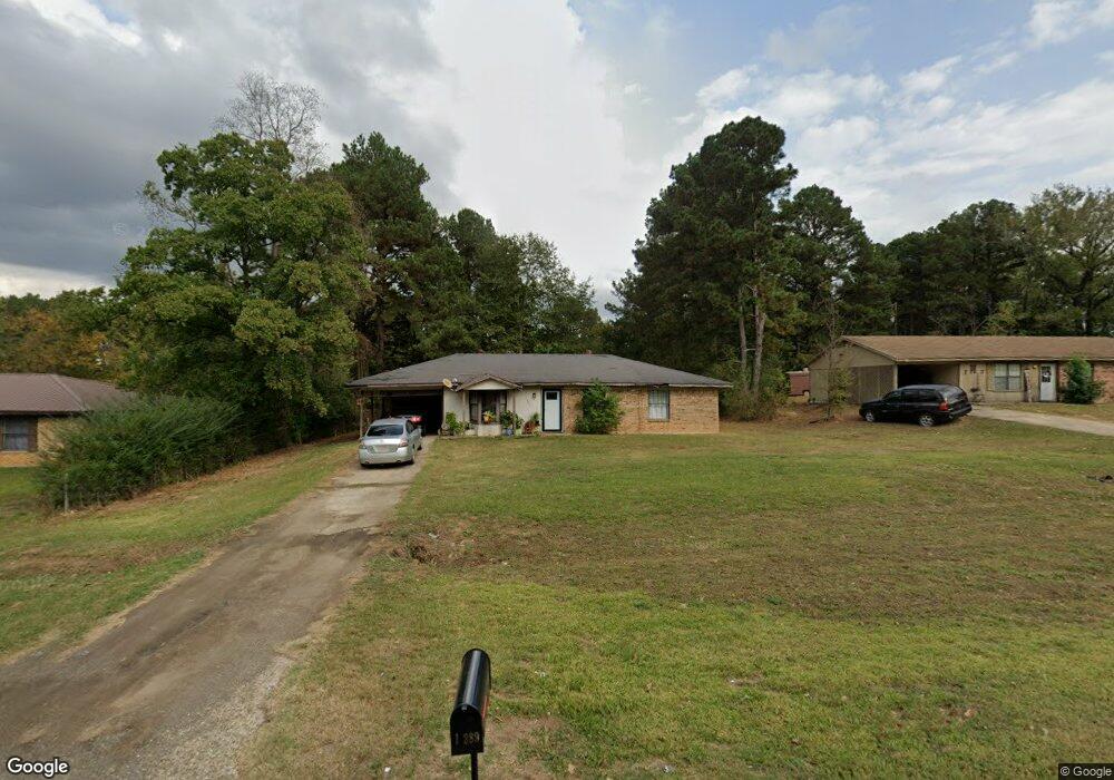
13389 Highway 175 Mansfield, LA 71052
Estimated Value: $57,054 - $159,000
--
Bed
--
Bath
--
Sq Ft
2
Acres
About This Home
This home is located at 13389 Highway 175, Mansfield, LA 71052 and is currently estimated at $102,264. 13389 Highway 175 is a home located in De Soto Parish with nearby schools including Mansfield Elementary School, Mansfield Middle School, and Mansfield High School.
Ownership History
Date
Name
Owned For
Owner Type
Purchase Details
Closed on
Jul 4, 2025
Sold by
Dwellingham Suan and Dwellingham Beverly
Bought by
City Of Mansfield
Current Estimated Value
Purchase Details
Closed on
Apr 25, 2025
Sold by
Dwellingham Suan
Bought by
Tatum Management Llc
Purchase Details
Closed on
May 9, 2024
Sold by
City Of Mansfield
Bought by
B & C Hauling Contractors Llc
Purchase Details
Closed on
Apr 20, 2023
Sold by
Desoto
Bought by
Byrd Birdie
Create a Home Valuation Report for This Property
The Home Valuation Report is an in-depth analysis detailing your home's value as well as a comparison with similar homes in the area
Home Values in the Area
Average Home Value in this Area
Purchase History
| Date | Buyer | Sale Price | Title Company |
|---|---|---|---|
| City Of Mansfield | -- | -- | |
| Tatum Management Llc | -- | -- | |
| B & C Hauling Contractors Llc | -- | None Listed On Document | |
| Byrd Birdie | -- | None Listed On Document |
Source: Public Records
Tax History Compared to Growth
Tax History
| Year | Tax Paid | Tax Assessment Tax Assessment Total Assessment is a certain percentage of the fair market value that is determined by local assessors to be the total taxable value of land and additions on the property. | Land | Improvement |
|---|---|---|---|---|
| 2024 | $278 | $4,100 | $330 | $3,770 |
| 2023 | $485 | $4,100 | $330 | $3,770 |
| 2022 | $482 | $4,100 | $330 | $3,770 |
| 2021 | $480 | $4,100 | $330 | $3,770 |
| 2020 | $480 | $4,100 | $330 | $3,770 |
| 2019 | $476 | $4,100 | $330 | $3,770 |
| 2018 | $477 | $4,100 | $330 | $3,770 |
| 2017 | $483 | $4,100 | $330 | $3,770 |
| 2016 | $483 | $4,100 | $330 | $3,770 |
| 2015 | $274 | $4,100 | $330 | $3,770 |
| 2014 | $276 | $4,100 | $330 | $3,770 |
| 2013 | $276 | $4,100 | $330 | $3,770 |
Source: Public Records
Map
Nearby Homes
- 0 Eloise St
- 617 Laura St
- 1505 Mcarthur Dr
- 121 Honeysuckle Dr
- 440 Myra St
- 128 Honeysuckle Dr
- 408 Myra St
- 7292 Highway 509 Unit BADER
- 107 Crosby St
- 191 Circle Dr
- 337 Jefferson St
- 814 Jefferson St
- 1015 Highland Dr
- 1005 Susan St
- 316 Kings Hwy
- 122 Post Oak Dr
- 509 Lee St
- 708 S Princeton Dr
- 278 Brown
- 180 Amy Ln
- 13399 Highway 175
- 13381 Highway 175
- 13407 Highway 175
- 1206 Sandhill Dr
- 1203 Sandhill Dr
- 13361 Highway 175
- 604 Vista Ln
- 1205 Sandhill Dr
- 1207 Sandhill Dr
- 605 Vista Ln
- 13441 Highway 175
- 13444 Highway 175
- 601 Vista Ln
- 1209 Sandhill Dr
- 1213 Sandhill Dr
- 1214 Sandhill Dr
- 1218 Sandhill Dr
- 1217 Sandhill Dr
- 1222 Sandhill Dr
- 7666 Highway 509