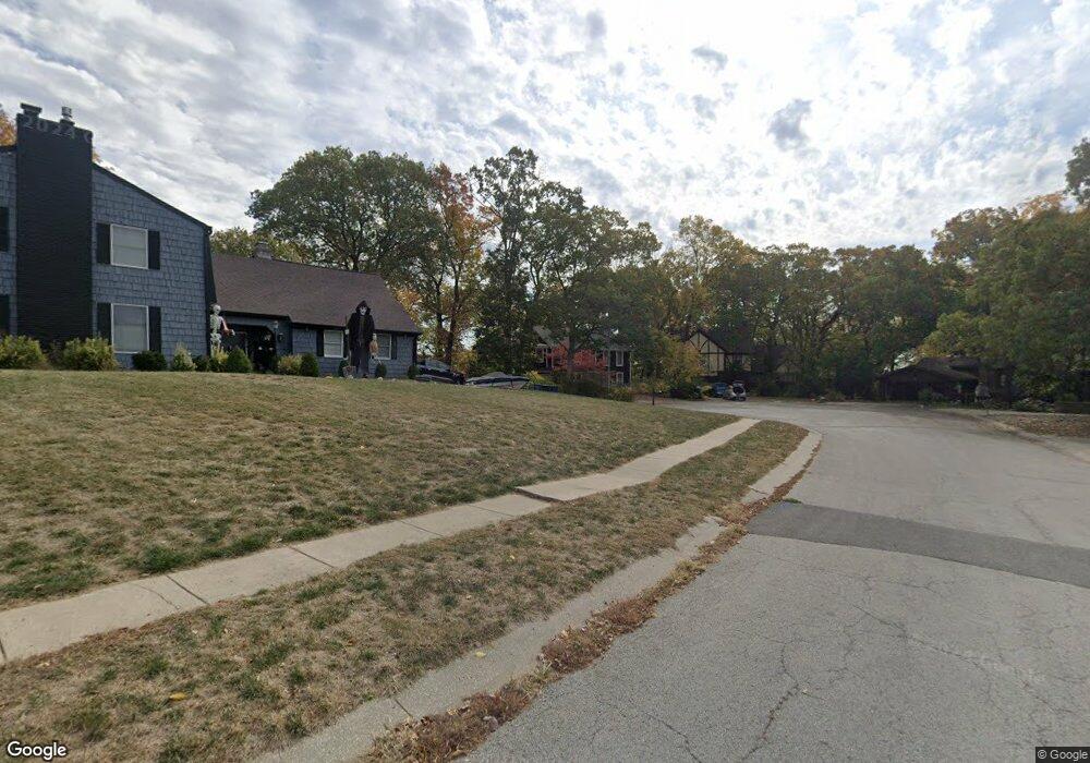
1339 Camelot Dr Liberty, MO 64068
Estimated Value: $381,000 - $434,000
4
Beds
5
Baths
2,568
Sq Ft
$159/Sq Ft
Est. Value
About This Home
This home is located at 1339 Camelot Dr, Liberty, MO 64068 and is currently estimated at $407,654, approximately $158 per square foot. 1339 Camelot Dr is a home located in Clay County with nearby schools including Lewis And Clark Elementary School, Heritage Middle School, and Liberty North High School.
Ownership History
Date
Name
Owned For
Owner Type
Purchase Details
Closed on
Jul 1, 2016
Sold by
Sears Christopher Brian
Bought by
Sears Frances Marie and Sears Christopher Brian
Current Estimated Value
Purchase Details
Closed on
May 14, 2008
Sold by
Trout Troy
Bought by
Trout Maria
Purchase Details
Closed on
Sep 1, 1998
Sold by
Capps Robert C
Bought by
Trout Troy J and Trout Maria C
Home Financials for this Owner
Home Financials are based on the most recent Mortgage that was taken out on this home.
Original Mortgage
$227,150
Interest Rate
6.9%
Create a Home Valuation Report for This Property
The Home Valuation Report is an in-depth analysis detailing your home's value as well as a comparison with similar homes in the area
Home Values in the Area
Average Home Value in this Area
Purchase History
| Date | Buyer | Sale Price | Title Company |
|---|---|---|---|
| Sears Frances Marie | -- | None Available | |
| Trout Maria | -- | None Available | |
| Trout Troy J | -- | Thomson Title Corp |
Source: Public Records
Mortgage History
| Date | Status | Borrower | Loan Amount |
|---|---|---|---|
| Previous Owner | Trout Troy J | $227,150 |
Source: Public Records
Tax History Compared to Growth
Tax History
| Year | Tax Paid | Tax Assessment Tax Assessment Total Assessment is a certain percentage of the fair market value that is determined by local assessors to be the total taxable value of land and additions on the property. | Land | Improvement |
|---|---|---|---|---|
| 2025 | $4,465 | $61,310 | -- | -- |
| 2024 | $4,465 | $58,050 | -- | -- |
| 2023 | $4,540 | $58,050 | $0 | $0 |
| 2022 | $3,890 | $49,100 | $0 | $0 |
| 2021 | $3,859 | $49,096 | $5,700 | $43,396 |
| 2020 | $3,847 | $45,960 | $0 | $0 |
| 2019 | $3,846 | $45,961 | $5,700 | $40,261 |
| 2018 | $3,616 | $42,430 | $0 | $0 |
| 2017 | $3,382 | $42,430 | $5,700 | $36,730 |
| 2016 | $3,382 | $40,050 | $6,460 | $33,590 |
| 2015 | $3,382 | $40,050 | $6,460 | $33,590 |
| 2014 | $3,409 | $40,050 | $6,460 | $33,590 |
Source: Public Records
Map
Nearby Homes
- 527 Lancelot Dr
- 523 Lancelot Dr
- 900 Wildbriar Dr
- 417 Locust St
- 1484 Hemlock Dr
- 1487 Spruce Dr
- 1107 Wildbriar Dr
- 815 Kings Ridge
- 194 Camelot Dr
- 412 N Fairview Ave
- 1304 Nashua Rd
- 1207 Linden Rd
- 1208 Linden Rd
- 506 W Mississippi St
- 1575 Oakwood Ln
- 1408 Telford Dr
- 1541 N Withers Rd
- 15 Valley Rd
- 606 N Morse Ave
- 1014 N Forest Ln
- 1343 Camelot Dr
- 606 Lancelot Dr
- 612 Lancelot Dr
- 1331 Camelot Dr
- 600 Lancelot Dr
- 540 Lancelot Dr
- 616 Lancelot Dr
- 1347 Camelot Dr
- 1329 Camelot Dr
- 618 Lancelot Dr
- 1351 Camelot Dr
- 1355 Camelot Dr
- 528 Lancelot Ct
- 611 Lancelot Dr
- 609 Lancelot Dr
- 1323 Camelot Dr
- 613 Lancelot Dr
- 535 Lancelot Dr
- 615 Lancelot Dr
- 620 Lancelot Dr