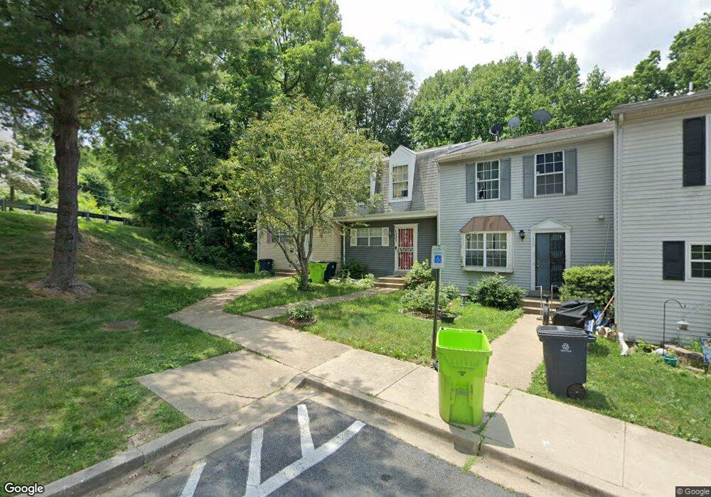
1339 Upcot Ct Capitol Heights, MD 20743
Estimated Value: $280,000 - $313,000
Studio
2
Baths
1,200
Sq Ft
$249/Sq Ft
Est. Value
About This Home
This home is located at 1339 Upcot Ct, Capitol Heights, MD 20743 and is currently estimated at $298,662, approximately $248 per square foot. 1339 Upcot Ct is a home located in Prince George's County with nearby schools including Doswell E. Brooks Elementary, Walker Mill Middle School, and Suitland High School.
Ownership History
Date
Name
Owned For
Owner Type
Purchase Details
Closed on
Oct 24, 2003
Sold by
Greater Suburban Properties Inc
Bought by
Smith Nicole
Current Estimated Value
Purchase Details
Closed on
Dec 2, 2002
Sold by
Secretary Of H U D
Bought by
Greater Suburban Properties Inc
Purchase Details
Closed on
Jun 24, 2002
Sold by
Cave Latonya T
Bought by
Secretary Of H U D and Union Center Plaza Phase Ii
Purchase Details
Closed on
Apr 17, 1997
Sold by
Atchison Stephon R
Bought by
Cave Latonya T
Create a Home Valuation Report for This Property
The Home Valuation Report is an in-depth analysis detailing your home's value as well as a comparison with similar homes in the area
Home Values in the Area
Average Home Value in this Area
Purchase History
| Date | Buyer | Sale Price | Title Company |
|---|---|---|---|
| Smith Nicole | $149,900 | -- | |
| Greater Suburban Properties Inc | $116,000 | -- | |
| Secretary Of H U D | $140,213 | -- | |
| Cave Latonya T | $116,000 | -- |
Source: Public Records
Tax History
| Year | Tax Paid | Tax Assessment Tax Assessment Total Assessment is a certain percentage of the fair market value that is determined by local assessors to be the total taxable value of land and additions on the property. | Land | Improvement |
|---|---|---|---|---|
| 2025 | $4,723 | $271,567 | -- | -- |
| 2024 | $4,723 | $245,833 | -- | -- |
| 2023 | $4,248 | $220,100 | $50,000 | $170,100 |
| 2022 | $4,128 | $212,400 | $0 | $0 |
| 2021 | $4,062 | $204,700 | $0 | $0 |
| 2020 | $3,526 | $197,000 | $45,000 | $152,000 |
| 2019 | $3,681 | $182,767 | $0 | $0 |
| 2018 | $3,486 | $168,533 | $0 | $0 |
| 2017 | $3,265 | $154,300 | $0 | $0 |
| 2016 | -- | $152,867 | $0 | $0 |
| 2015 | $4,424 | $151,433 | $0 | $0 |
| 2014 | $4,424 | $150,000 | $0 | $0 |
Source: Public Records
Map
Nearby Homes
- 6021 Applegarth Place
- 5936 Applegarth Place
- 0 Rollins Ave Unit MDPG2158618
- 5814 Folgate Ct
- 5625 Oakford Rd
- 5815 Falkland Place
- 5627 Prescott Ct
- 1702 Rollins Place
- 5505 Vergo Rd
- 5503 Vergo Rd
- 1004 Veneer Ct
- 908 Evers Ave
- 5404 Vergo Rd
- 5600 Walker Mill Rd
- 2107 Weber Dr
- 5908 Nassau St
- 6103 Westin Ct
- 2017 County Rd
- 1301 Karen Blvd Unit 201
- 606 Chance Place
Your Personal Tour Guide
Ask me questions while you tour the home.