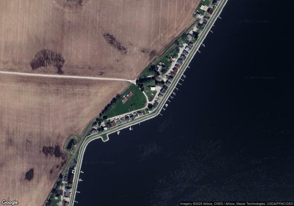
13396 W Bank Dr NE Millersport, OH 43046
Estimated Value: $753,190 - $988,000
3
Beds
1
Bath
2,222
Sq Ft
$406/Sq Ft
Est. Value
About This Home
This home is located at 13396 W Bank Dr NE, Millersport, OH 43046 and is currently estimated at $901,063, approximately $405 per square foot. 13396 W Bank Dr NE is a home located in Fairfield County with nearby schools including Millersport Elementary School and Millersport Jr/Sr High School.
Ownership History
Date
Name
Owned For
Owner Type
Purchase Details
Closed on
Nov 18, 2019
Sold by
Frear Donald Nelson
Bought by
Frear Normajean C
Current Estimated Value
Purchase Details
Closed on
Mar 24, 2006
Sold by
Slater Robert W and Slater Mary Sue
Bought by
Frear Daniel L and The Daniel L Frear Living Trust
Purchase Details
Closed on
Mar 10, 2005
Sold by
Bell Richard M
Bought by
Frear Daniel L and Daniel L Frear Living Trust
Purchase Details
Closed on
Apr 10, 1997
Sold by
Paul A Bates Est
Bought by
Bell Richard M
Purchase Details
Closed on
Sep 29, 1995
Sold by
Boren Russell T
Bought by
Bates Paul A and Bates Sara A
Home Financials for this Owner
Home Financials are based on the most recent Mortgage that was taken out on this home.
Original Mortgage
$58,400
Interest Rate
8%
Mortgage Type
New Conventional
Purchase Details
Closed on
Jul 21, 1994
Sold by
Wright Tommy W
Bought by
Boren Russell T and Boren Cinda
Home Financials for this Owner
Home Financials are based on the most recent Mortgage that was taken out on this home.
Original Mortgage
$50,000
Interest Rate
8.38%
Mortgage Type
New Conventional
Create a Home Valuation Report for This Property
The Home Valuation Report is an in-depth analysis detailing your home's value as well as a comparison with similar homes in the area
Home Values in the Area
Average Home Value in this Area
Purchase History
| Date | Buyer | Sale Price | Title Company |
|---|---|---|---|
| Frear Normajean C | -- | None Available | |
| Frear Daniel L | $19,300 | Lawyers Title Agency Of Lanc | |
| Frear Daniel L | $213,000 | -- | |
| Bell Richard M | $150,000 | -- | |
| Bates Paul A | $155,000 | -- | |
| Boren Russell T | $129,000 | -- |
Source: Public Records
Mortgage History
| Date | Status | Borrower | Loan Amount |
|---|---|---|---|
| Previous Owner | Bates Paul A | $58,400 | |
| Previous Owner | Boren Russell T | $50,000 |
Source: Public Records
Tax History Compared to Growth
Tax History
| Year | Tax Paid | Tax Assessment Tax Assessment Total Assessment is a certain percentage of the fair market value that is determined by local assessors to be the total taxable value of land and additions on the property. | Land | Improvement |
|---|---|---|---|---|
| 2024 | $12,823 | $213,360 | $69,050 | $144,310 |
| 2023 | $8,436 | $213,360 | $69,050 | $144,310 |
| 2022 | $8,482 | $213,360 | $69,050 | $144,310 |
| 2021 | $7,000 | $158,350 | $57,670 | $100,680 |
| 2020 | $7,024 | $158,350 | $57,670 | $100,680 |
| 2019 | $7,165 | $158,350 | $57,670 | $100,680 |
| 2018 | $6,682 | $131,740 | $54,510 | $77,230 |
| 2017 | $6,683 | $133,610 | $54,510 | $79,100 |
| 2016 | $6,166 | $133,610 | $54,510 | $79,100 |
| 2015 | $6,118 | $130,410 | $54,510 | $75,900 |
| 2014 | $4,966 | $130,410 | $54,510 | $75,900 |
| 2013 | $4,966 | $130,410 | $54,510 | $75,900 |
Source: Public Records
Map
Nearby Homes
- 13404 W Bank Dr NE
- 13474 W Bank Dr NE
- 13244 W Bank Dr NE
- 13180 W Bank Dr NE
- 3308 Shepard Ave
- 13556 Richards St NE
- 3483 N Bank Rd
- 12946 W Bank Dr NE
- 12580 W Bank Dr NE
- 3863 N Bank Rd NE
- 12656 W Bank Dr NE
- 12700 Onion Island NE
- 2486 Mallard Point Ln
- 12291 Ohio Ave
- 4255 N Bank Rd NE
- 2592 Summit St
- 3621 S Bank Rd NE
- 2582 E Park St
- 12055 7th Ave
- 2595 Canal Dr
- 13388 W Bank Dr NE
- 13412 W Bank Dr NE
- 13418 W Bank Dr NE
- 13424 W Bank Dr NE
- 13430 W Bank Dr NE
- 13436 W Bank Dr NE
- 13444 W Bank Rd
- 13444 W Bank Dr NE
- 13464 W Bank Dr NE
- 13322 W Bank Dr NE
- 13482 W Bank Dr Unit NE
- 13482 W Bank Dr NE
- 13304 W Bank Dr
- 13490 W Bank Dr NE
- 13284 W Bank Dr NE
- 3131 Lakeside Rd NE
- 13268 W Bank Dr NE
- 3165 Lakeside Rd NE
- 3165 Lakeside Rd NE
- 3165 Lakeside Rd NE
