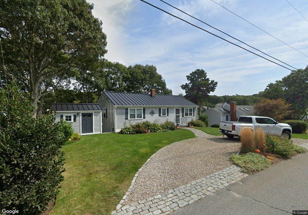
134 Antlers Shore Dr East Falmouth, MA 02536
East Falmouth NeighborhoodEstimated Value: $1,012,000 - $1,446,000
3
Beds
2
Baths
1,644
Sq Ft
$704/Sq Ft
Est. Value
About This Home
This home is located at 134 Antlers Shore Dr, East Falmouth, MA 02536 and is currently estimated at $1,156,737, approximately $703 per square foot. 134 Antlers Shore Dr is a home located in Barnstable County with nearby schools including East Falmouth Elementary School, Morse Pond School, and Lawrence School.
Ownership History
Date
Name
Owned For
Owner Type
Purchase Details
Closed on
Jun 1, 2018
Sold by
Blodgett Ft and Hearty
Bought by
Rsc Rt and Sperry
Current Estimated Value
Purchase Details
Closed on
Nov 7, 2016
Sold by
Blodgett Nancy W
Bought by
Blodgett Ft and Hearty
Purchase Details
Closed on
Oct 16, 1992
Sold by
Hussey John W
Bought by
Boldgett Nancy W
Purchase Details
Closed on
Jul 2, 1991
Sold by
Odonnell Joseph J
Bought by
Hussey John W
Home Financials for this Owner
Home Financials are based on the most recent Mortgage that was taken out on this home.
Original Mortgage
$50,000
Interest Rate
9.44%
Mortgage Type
Purchase Money Mortgage
Create a Home Valuation Report for This Property
The Home Valuation Report is an in-depth analysis detailing your home's value as well as a comparison with similar homes in the area
Home Values in the Area
Average Home Value in this Area
Purchase History
| Date | Buyer | Sale Price | Title Company |
|---|---|---|---|
| Rsc Rt | $527,000 | -- | |
| Rsc Rt | $527,000 | -- | |
| Blodgett Ft | -- | -- | |
| Blodgett Ft | -- | -- | |
| Boldgett Nancy W | $165,000 | -- | |
| Boldgett Nancy W | $165,000 | -- | |
| Hussey John W | $150,000 | -- | |
| Hussey John W | $150,000 | -- |
Source: Public Records
Mortgage History
| Date | Status | Borrower | Loan Amount |
|---|---|---|---|
| Previous Owner | Hussey John W | $50,000 |
Source: Public Records
Tax History Compared to Growth
Tax History
| Year | Tax Paid | Tax Assessment Tax Assessment Total Assessment is a certain percentage of the fair market value that is determined by local assessors to be the total taxable value of land and additions on the property. | Land | Improvement |
|---|---|---|---|---|
| 2025 | $6,603 | $1,124,800 | $748,800 | $376,000 |
| 2024 | $6,341 | $1,009,700 | $662,400 | $347,300 |
| 2023 | $6,100 | $881,500 | $576,000 | $305,500 |
| 2022 | $5,654 | $702,300 | $432,700 | $269,600 |
| 2021 | $5,273 | $620,300 | $432,700 | $187,600 |
| 2020 | $4,850 | $564,600 | $393,400 | $171,200 |
| 2019 | $4,759 | $555,900 | $393,400 | $162,500 |
| 2018 | $3,623 | $534,400 | $393,400 | $141,000 |
| 2017 | $4,521 | $530,000 | $393,400 | $136,600 |
| 2016 | $4,436 | $530,000 | $393,400 | $136,600 |
| 2015 | $4,341 | $530,000 | $393,400 | $136,600 |
| 2014 | $4,313 | $529,200 | $393,500 | $135,700 |
Source: Public Records
Map
Nearby Homes
- 231 Edgewater Dr W
- 11 Pershing Dr
- 15 Pershing Dr
- 7 Yale Dr
- 15 Ovington Dr
- 285 Edgewater Dr W
- 42 Hanson Cir
- 0 Tobey Ln
- 23 Meadowood Ln
- 53 Eel River Rd
- 381 Seacoast Shores Blvd
- 23 N Bournes Pond Rd
- 23 N Bournes Pond Rd
- 27 Emerald Ln
- 68 Baptiste Ln
- 0 Elsies Way Unit 22505181
- 0 Elsies Way Unit 73443603
- 50 Rivers Edge Rd
- 14 Old Meeting House Rd
- 30 Weatherglass Ln
- 132 Antlers Shore Dr
- 138 Antlers Shore Dr
- 133 Antlers Shore Dr
- 139 Antlers Shore Dr
- 126 Antlers Shore Dr
- 144 Antlers Shore Dr
- 80 Madeline Rd
- 125 Antlers Shore Dr
- 145 Antlers Shore Dr
- 122 Antlers Shore Dr
- 84 Madeline Rd
- 72 Madeline Rd
- 148 Antlers Shore Dr
- 151 Antlers Shore Dr
- 171 Edgewater Dr W
- 171 Edgewater Dr W Unit WEST
- 171 Edgewater Dr W Unit 1
- 117 Antlers Shore Dr
- 88 Madeline Rd
- 163 Edgewater Dr W