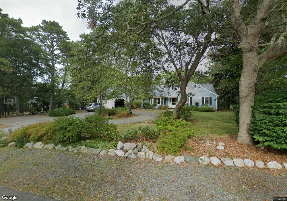
134 Blue Rock Rd South Yarmouth, MA 02664
South Yarmouth NeighborhoodEstimated Value: $1,415,000 - $1,898,000
3
Beds
3
Baths
2,200
Sq Ft
$740/Sq Ft
Est. Value
About This Home
This home is located at 134 Blue Rock Rd, South Yarmouth, MA 02664 and is currently estimated at $1,628,036, approximately $740 per square foot. 134 Blue Rock Rd is a home located in Barnstable County with nearby schools including Dennis-Yarmouth Regional High School and St. Pius X. School.
Ownership History
Date
Name
Owned For
Owner Type
Purchase Details
Closed on
Sep 11, 2008
Sold by
Majewski Eugene W
Bought by
Majewski Robert E
Current Estimated Value
Home Financials for this Owner
Home Financials are based on the most recent Mortgage that was taken out on this home.
Original Mortgage
$417,000
Outstanding Balance
$278,158
Interest Rate
6.58%
Mortgage Type
Purchase Money Mortgage
Estimated Equity
$1,349,878
Create a Home Valuation Report for This Property
The Home Valuation Report is an in-depth analysis detailing your home's value as well as a comparison with similar homes in the area
Home Values in the Area
Average Home Value in this Area
Purchase History
| Date | Buyer | Sale Price | Title Company |
|---|---|---|---|
| Majewski Robert E | $900,000 | -- |
Source: Public Records
Mortgage History
| Date | Status | Borrower | Loan Amount |
|---|---|---|---|
| Open | Majewski Robert E | $417,000 |
Source: Public Records
Tax History Compared to Growth
Tax History
| Year | Tax Paid | Tax Assessment Tax Assessment Total Assessment is a certain percentage of the fair market value that is determined by local assessors to be the total taxable value of land and additions on the property. | Land | Improvement |
|---|---|---|---|---|
| 2025 | $11,508 | $1,625,400 | $879,000 | $746,400 |
| 2024 | $10,706 | $1,450,700 | $765,100 | $685,600 |
| 2023 | $9,799 | $1,208,300 | $598,700 | $609,600 |
| 2022 | $9,372 | $1,020,900 | $535,800 | $485,100 |
| 2021 | $9,050 | $946,700 | $535,800 | $410,900 |
| 2020 | $5,693 | $893,900 | $527,400 | $366,500 |
| 2019 | $5,232 | $840,500 | $527,400 | $313,100 |
| 2018 | $8,329 | $809,400 | $496,300 | $313,100 |
| 2017 | $4,814 | $809,400 | $496,300 | $313,100 |
| 2016 | $8,078 | $809,400 | $496,300 | $313,100 |
| 2015 | $7,939 | $790,700 | $496,300 | $294,400 |
Source: Public Records
Map
Nearby Homes
- 85 Keel Cape Dr
- 62 Old Fish House Rd
- 6 Hawthorn St
- 91 Chipping Green Cir
- 17 Fairmount Rd
- 17 Fairmount Rd
- 7 Vinland Dr
- 23 Fairwood Rd
- 21 Green Way
- 10 Joanne Dr
- 1 Norseman Dr
- 25 Skerry Rd
- 401 Main St Unit 201
- 401 Main St Unit 101
- 30 Pebble Beach Way
- 295 Main St
- 1 Country Club Dr
- 129 Driftwood Ln
- 293 Main St
- 293 Main St
- 128 Blue Rock Rd
- 140 Blue Rock Rd
- 135 Blue Rock Rd
- 129 Blue Rock Rd
- 120 Blue Rock Rd
- 141 Blue Rock Rd
- 148 Blue Rock Rd
- 22 Legend Dr
- 7 Liefs Ln
- 16 Legend Dr
- 121 Blue Rock Rd
- 1 Legend Dr
- 114 Blue Rock Rd
- 156 Blue Rock Rd
- 36 Legend Dr
- 7 Legend Dr
- 4 Runestone Rd
- 115 Blue Rock Rd
- 25 Legend Dr
- 17 Legend Dr