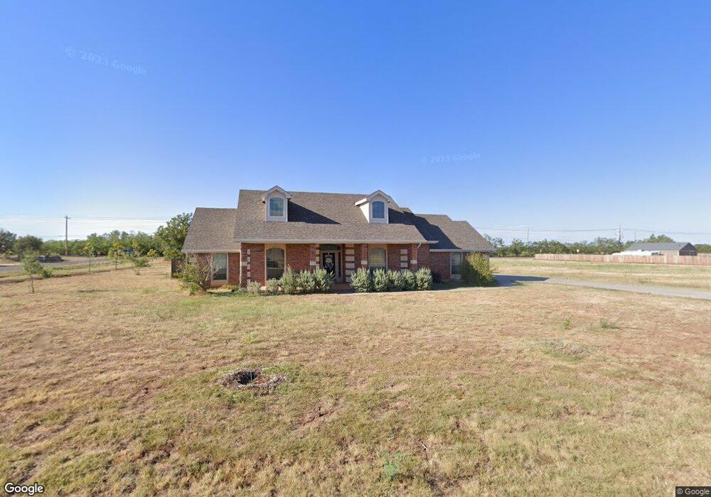
134 Buckshot Rd Abilene, TX 79602
Estimated Value: $373,000 - $408,000
4
Beds
2
Baths
2,038
Sq Ft
$193/Sq Ft
Est. Value
About This Home
This home is located at 134 Buckshot Rd, Abilene, TX 79602 and is currently estimated at $392,973, approximately $192 per square foot. 134 Buckshot Rd is a home located in Taylor County with nearby schools including Wylie West Early Childhood Center, Wylie West Intermediate School, and Wylie West Elementary School.
Ownership History
Date
Name
Owned For
Owner Type
Purchase Details
Closed on
Feb 17, 2009
Sold by
New Rudy
Bought by
Mathis Charles G and Mathis Dawn R
Current Estimated Value
Home Financials for this Owner
Home Financials are based on the most recent Mortgage that was taken out on this home.
Original Mortgage
$153,800
Outstanding Balance
$96,228
Interest Rate
4.91%
Mortgage Type
Purchase Money Mortgage
Estimated Equity
$296,745
Purchase Details
Closed on
Jul 23, 2008
Sold by
Westex Custom Homes Inc
Bought by
New Rudy and New Way Custom Homes
Home Financials for this Owner
Home Financials are based on the most recent Mortgage that was taken out on this home.
Original Mortgage
$158,400
Interest Rate
6.36%
Mortgage Type
Construction
Create a Home Valuation Report for This Property
The Home Valuation Report is an in-depth analysis detailing your home's value as well as a comparison with similar homes in the area
Home Values in the Area
Average Home Value in this Area
Purchase History
| Date | Buyer | Sale Price | Title Company |
|---|---|---|---|
| Mathis Charles G | -- | None Available | |
| New Rudy | -- | None Available |
Source: Public Records
Mortgage History
| Date | Status | Borrower | Loan Amount |
|---|---|---|---|
| Open | Mathis Charles G | $153,800 | |
| Previous Owner | New Rudy | $158,400 |
Source: Public Records
Tax History Compared to Growth
Tax History
| Year | Tax Paid | Tax Assessment Tax Assessment Total Assessment is a certain percentage of the fair market value that is determined by local assessors to be the total taxable value of land and additions on the property. | Land | Improvement |
|---|---|---|---|---|
| 2025 | $2,477 | $368,513 | $17,825 | $350,688 |
| 2023 | $2,477 | $317,578 | $0 | $0 |
| 2022 | $4,612 | $288,707 | $0 | $0 |
| 2021 | $4,694 | $262,461 | $17,825 | $244,636 |
| 2020 | $4,631 | $252,921 | $17,825 | $235,096 |
| 2019 | $4,736 | $247,698 | $17,825 | $229,873 |
| 2018 | $4,168 | $241,174 | $17,825 | $223,349 |
| 2017 | $3,974 | $238,700 | $17,825 | $220,875 |
| 2016 | $3,699 | $222,190 | $17,825 | $204,365 |
| 2015 | $3,147 | $219,658 | $17,825 | $201,833 |
| 2014 | $3,147 | $213,369 | $0 | $0 |
Source: Public Records
Map
Nearby Homes
- 133 Buckshot Rd
- 159 Boeing Ln
- 126 Beechcraft
- 219 Beechcraft
- 225 Beechcraft
- 325 Nora Miller Rd
- 231 Beechcraft
- 228 Long Ranger Rd
- 145 Cessna Ct
- 113 Sage Brush Dr
- 136 Cessna Ct
- 234 Long Ranger Rd
- 231 Long Ranger Rd
- 240 Long Ranger Rd
- 246 Long Ranger Rd
- 106 Cessna Ct
- 105 Cessna Ct
- 138 Jet Ranger Rd
- 310 Long Ranger Rd
- 341 Long Ranger Rd
- 126 Buckshot Rd
- 102 Raymonds Way
- 118 Raymonds Way
- 118 Buckshot Rd
- 125 Buckshot Rd
- 134 Raymonds Way
- 1101 Fm 1750
- 109 Buckshot Rd
- 101 Buckshot Rd
- 117 Buckshot Rd
- 110 Buckshot Rd
- 157 Raymonds Way
- 150 Raymonds Way
- 165 Raymonds Way
- 166 Raymonds Way
- 181 Raymonds Way
- 1009 Fm 1750
- 182 Raymonds Way
- 189 Raymonds Way
- 28.2 a Nora Miller Rd