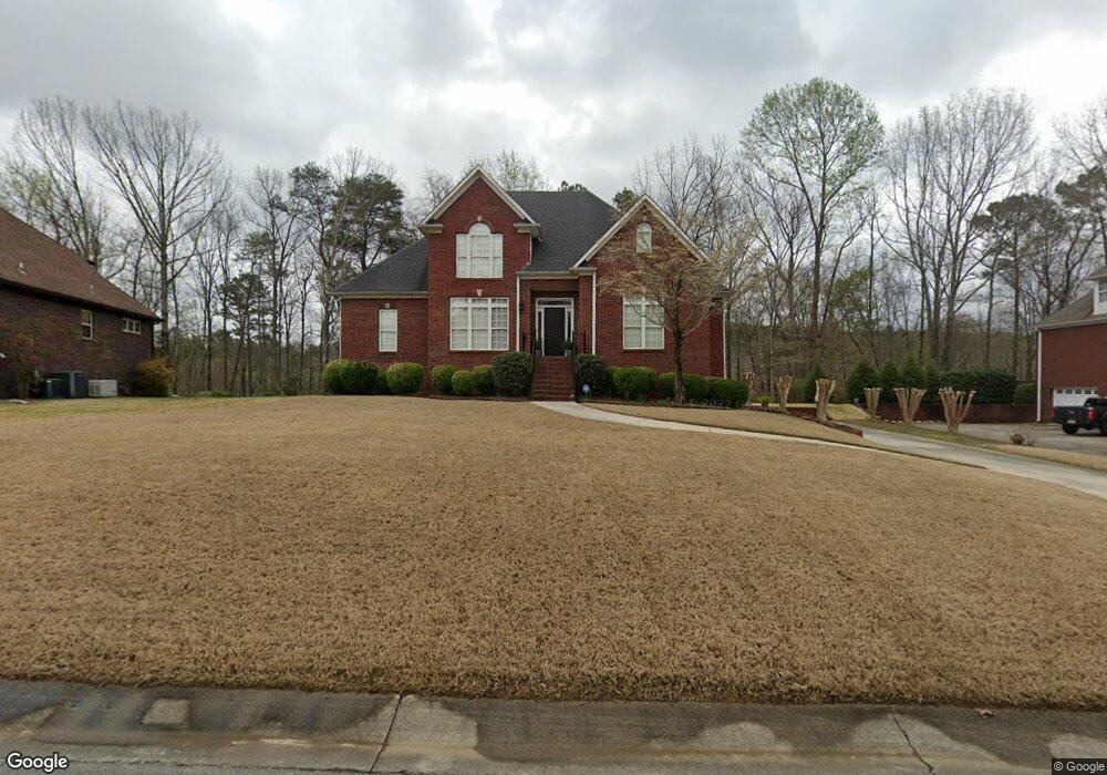
134 Cluster Springs Cir Gardendale, AL 35071
Estimated Value: $388,000 - $452,000
4
Beds
4
Baths
3,308
Sq Ft
$128/Sq Ft
Est. Value
About This Home
This home is located at 134 Cluster Springs Cir, Gardendale, AL 35071 and is currently estimated at $424,453, approximately $128 per square foot. 134 Cluster Springs Cir is a home located in Jefferson County with nearby schools including Gardendale Elementary School, Bragg Middle School, and Gardendale High School.
Ownership History
Date
Name
Owned For
Owner Type
Purchase Details
Closed on
Oct 15, 1998
Sold by
D & N Excavation Co Inc
Bought by
Casaday J William and Casaday Kathy C
Current Estimated Value
Home Financials for this Owner
Home Financials are based on the most recent Mortgage that was taken out on this home.
Original Mortgage
$168,000
Interest Rate
6.8%
Purchase Details
Closed on
Mar 12, 1998
Sold by
Woodbury Forest Llc
Bought by
D & N Excavation Co Inc
Create a Home Valuation Report for This Property
The Home Valuation Report is an in-depth analysis detailing your home's value as well as a comparison with similar homes in the area
Home Values in the Area
Average Home Value in this Area
Purchase History
| Date | Buyer | Sale Price | Title Company |
|---|---|---|---|
| Casaday J William | $210,000 | Magic City Title Company Inc | |
| D & N Excavation Co Inc | $27,000 | -- |
Source: Public Records
Mortgage History
| Date | Status | Borrower | Loan Amount |
|---|---|---|---|
| Closed | Casaday J William | $168,000 | |
| Closed | D & N Excavation Co Inc | $0 |
Source: Public Records
Tax History Compared to Growth
Tax History
| Year | Tax Paid | Tax Assessment Tax Assessment Total Assessment is a certain percentage of the fair market value that is determined by local assessors to be the total taxable value of land and additions on the property. | Land | Improvement |
|---|---|---|---|---|
| 2024 | $1,975 | $36,500 | -- | -- |
| 2022 | $1,746 | $29,930 | $3,900 | $26,030 |
| 2021 | $1,468 | $25,300 | $3,900 | $21,400 |
| 2020 | $1,457 | $25,110 | $3,900 | $21,210 |
| 2019 | $1,340 | $23,180 | $0 | $0 |
| 2018 | $1,371 | $23,700 | $0 | $0 |
| 2017 | $1,425 | $24,600 | $0 | $0 |
| 2016 | $1,421 | $24,520 | $0 | $0 |
| 2015 | $1,421 | $23,540 | $0 | $0 |
| 2014 | $1,113 | $23,560 | $0 | $0 |
| 2013 | $1,113 | $23,560 | $0 | $0 |
Source: Public Records
Map
Nearby Homes
- 118 Cluster Springs Cir
- 165 Cluster Springs Cir
- 873 Fieldstown Cir
- 890 Fieldstown Cir
- 709 Odum Rd
- 658 Odum Rd
- 4515 Shady Grove Ln Unit 2
- 4848 Cornelius Dr
- 4507 Shady Grove Rd
- 4555 Eldorado Dr
- 4436 Shady Grove Rd Unit 16n
- 716 Kerr Dr
- 4723 Crestview Dr
- 4681 Northridge Dr
- 4674 Northridge Dr
- 4362 Shivas Way Unit 238
- 4358 Shivas Way Unit 239
- 4354 Shivas Way Unit 240
- 4350 Shivas Way Unit 241
- 4351 Shivas Way Unit 242
- 138 Cluster Springs Cir
- 130 Cluster Springs Cir
- 142 Cluster Springs Cir
- 129 Cluster Springs Cir
- 139 Cluster Springs Cir
- 126 Cluster Springs Cir
- 123 Cluster Springs Cir
- 146 Cluster Springs Cir
- 143 Cluster Springs Cir
- 122 Cluster Springs Cir
- 775 Cluster Springs Rd
- 771 Cluster Springs Rd
- 113 Cluster Springs Cir
- 150 Cluster Springs Cir
- 147 Cluster Springs Cir
- 767 Cluster Springs Rd
- 779 Cluster Springs Rd
- 154 Cluster Springs Cir
- 153 Cluster Springs Cir
- 114 Cluster Springs Cir