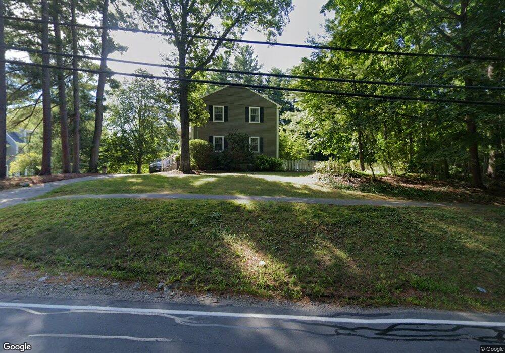
134 Cushing St Hingham, MA 02043
South Hingham NeighborhoodEstimated Value: $935,000 - $1,401,000
4
Beds
3
Baths
2,284
Sq Ft
$522/Sq Ft
Est. Value
About This Home
This home is located at 134 Cushing St, Hingham, MA 02043 and is currently estimated at $1,193,118, approximately $522 per square foot. 134 Cushing St is a home located in Plymouth County with nearby schools including South Elementary School, Hingham Middle School, and Hingham High School.
Ownership History
Date
Name
Owned For
Owner Type
Purchase Details
Closed on
Dec 8, 2000
Sold by
Murray-Brown Andrew J and Murray-Brown Eugenie B
Bought by
Hite Jane M and Syed Aziz
Current Estimated Value
Purchase Details
Closed on
Jul 13, 1995
Sold by
Condito David L and Condito Michele R
Bought by
Murray-Brown Andrew J and Murray-Brown Eugenie B
Purchase Details
Closed on
May 18, 1988
Sold by
Naughton Kevin F
Bought by
Condito David L
Create a Home Valuation Report for This Property
The Home Valuation Report is an in-depth analysis detailing your home's value as well as a comparison with similar homes in the area
Home Values in the Area
Average Home Value in this Area
Purchase History
| Date | Buyer | Sale Price | Title Company |
|---|---|---|---|
| Hite Jane M | $387,500 | -- | |
| Murray-Brown Andrew J | $200,000 | -- | |
| Condito David L | $177,000 | -- |
Source: Public Records
Mortgage History
| Date | Status | Borrower | Loan Amount |
|---|---|---|---|
| Open | Condito David L | $260,000 | |
| Closed | Condito David L | $275,000 |
Source: Public Records
Tax History
| Year | Tax Paid | Tax Assessment Tax Assessment Total Assessment is a certain percentage of the fair market value that is determined by local assessors to be the total taxable value of land and additions on the property. | Land | Improvement |
|---|---|---|---|---|
| 2025 | $10,008 | $936,200 | $453,800 | $482,400 |
| 2024 | $9,696 | $893,600 | $453,800 | $439,800 |
| 2023 | $8,534 | $853,400 | $453,800 | $399,600 |
| 2022 | $8,234 | $712,300 | $390,800 | $321,500 |
| 2021 | $8,070 | $683,900 | $390,800 | $293,100 |
| 2020 | $7,855 | $681,300 | $390,800 | $290,500 |
| 2019 | $7,825 | $662,600 | $390,800 | $271,800 |
| 2018 | $7,799 | $662,600 | $390,800 | $271,800 |
| 2017 | $7,306 | $596,400 | $377,200 | $219,200 |
| 2016 | $7,224 | $578,400 | $359,200 | $219,200 |
| 2015 | $7,031 | $561,100 | $341,900 | $219,200 |
Source: Public Records
Map
Nearby Homes
- 2 Black Rock Dr Unit 21
- 2 Black Rock Dr
- 5 Old County Rd
- 1 Hemlock Rd
- 1 Kerri Ln
- 4 Kerri Ln
- 22 Longmeadow Rd
- 183 Gardner St
- 32-70 Lazell St
- 21 S Bradford Rd
- 18 Whiting Ln
- 1276 Washington St Unit A
- 1297 Pleasant St
- 70 Lazell St
- 14 Old Stone Way Unit 11
- 32 Lazell St
- 10 Colby Rd
- 6 Brewer Way
- 9 Mast Hill Rd
- 14 Cross St
- 140 Cushing St
- 140 Cushing St
- 126 Cushing St
- 48 Pioneer Rd
- 46 Pioneer Rd
- 145 Cushing St
- 45 Pioneer Rd
- 44 Pioneer Rd
- 49 Pioneer Rd
- 149 Cushing St
- 26 Volunteer Rd
- 43 Pioneer Rd
- 155 Cushing St
- 24 Volunteer Rd
- 41 Pioneer Rd
- 42 Pioneer Rd
- 19 Volunteer Rd
- 164 Cushing St Unit 1
- 164 Cushing St
- 164 Cushing St
Your Personal Tour Guide
Ask me questions while you tour the home.