Estimated Value: $1,119,000 - $1,370,000
4
Beds
3
Baths
3,788
Sq Ft
$328/Sq Ft
Est. Value
About This Home
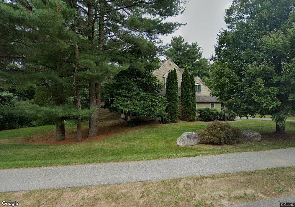
This home is located at 134 Davis Rd, Acton, MA 01720 and is currently estimated at $1,241,079, approximately $327 per square foot. 134 Davis Rd is a home located in Middlesex County with nearby schools including Acton-Boxborough Regional High School and Oak Meadow Montessori School.
Ownership History
Date
Name
Owned For
Owner Type
Purchase Details
Closed on
Sep 24, 2009
Sold by
Makonahalli Manjunath D and Manjunath Jayashree
Bought by
Ramachandran Gowrishankar and Gowrishankar Preeth R
Current Estimated Value
Home Financials for this Owner
Home Financials are based on the most recent Mortgage that was taken out on this home.
Original Mortgage
$403,000
Interest Rate
5.31%
Mortgage Type
Purchase Money Mortgage
Purchase Details
Closed on
May 13, 1999
Sold by
Bellows Farm Llc
Bought by
Makonahalli Manjunath and Vittal Jayashree
Home Financials for this Owner
Home Financials are based on the most recent Mortgage that was taken out on this home.
Original Mortgage
$333,600
Interest Rate
6.92%
Mortgage Type
Purchase Money Mortgage
Create a Home Valuation Report for This Property
The Home Valuation Report is an in-depth analysis detailing your home's value as well as a comparison with similar homes in the area
Home Values in the Area
Average Home Value in this Area
Purchase History
| Date | Buyer | Sale Price | Title Company |
|---|---|---|---|
| Ramachandran Gowrishankar | $672,000 | -- | |
| Makonahalli Manjunath | $417,500 | -- |
Source: Public Records
Mortgage History
| Date | Status | Borrower | Loan Amount |
|---|---|---|---|
| Open | Makonahalli Manjunath | $275,000 | |
| Closed | Ramachandran Gowrishankar | $403,000 | |
| Closed | Ramachandran Gowrishankar | $72,000 | |
| Previous Owner | Makonahalli Manjunath | $50,000 | |
| Previous Owner | Makonahalli Manjunath | $333,600 | |
| Closed | Makonahalli Manjunath | $41,700 |
Source: Public Records
Tax History
| Year | Tax Paid | Tax Assessment Tax Assessment Total Assessment is a certain percentage of the fair market value that is determined by local assessors to be the total taxable value of land and additions on the property. | Land | Improvement |
|---|---|---|---|---|
| 2025 | $17,256 | $1,006,200 | $0 | $1,006,200 |
| 2024 | $15,038 | $902,100 | $0 | $902,100 |
| 2023 | $17,240 | $981,800 | $0 | $981,800 |
| 2022 | $13,874 | $713,300 | $0 | $713,300 |
| 2021 | $13,582 | $671,400 | $0 | $671,400 |
| 2020 | $14,328 | $744,700 | $0 | $744,700 |
| 2019 | $13,892 | $717,200 | $0 | $717,200 |
| 2018 | $13,698 | $706,800 | $0 | $706,800 |
| 2017 | $14,453 | $758,300 | $0 | $758,300 |
| 2016 | $14,144 | $735,500 | $0 | $735,500 |
| 2015 | $13,463 | $706,700 | $0 | $706,700 |
| 2014 | $12,660 | $650,900 | $0 | $650,900 |
Source: Public Records
Map
Nearby Homes
- 11 Davis Rd Unit A5
- 15 Davis Rd Unit B-8
- 380A Great Rd Unit 301
- 388 Great Rd Unit B14
- 386 Great Rd Unit A8
- 390 Great Rd Unit B16
- 134 Pope Rd
- 524 Main St
- 709 Main St
- 853 Strawberry Hill Rd
- 104 Channing Rd
- 159 Skyline Dr Unit 159
- 5 Samantha Way Unit 5
- 11 Walnut St
- 491 Main St
- 33 Meadowbrook Rd
- 1 Bayberry Rd
- 110 Spencer Brook Rd
- 405 Great Elm Way
- 293 Old Beaverbrook Unit 293
- 136 Davis Rd
- 1 Old Oregon Trail
- 138 Davis Rd
- 2 Farmers Row
- 1 Oxbow Dr
- 2 Old Oregon Trail
- 3 Old Oregon Trail
- Lot 17 Kayla Ln
- 17 Kayla Ln
- Lot 17 Kayla Ln Unit 17
- Lot 4 Edgar Dr Unit 4
- Lot 4 Edgar Dr
- 1 Farmers Row
- 1 Farmers Row Unit 52
- 4 Farmers Row
- 140 Davis Rd
- 5 Old Oregon Trail
- 3 Oxbow Dr
- 4 Old Oregon Trail
- 3 Farmers Row
Your Personal Tour Guide
Ask me questions while you tour the home.