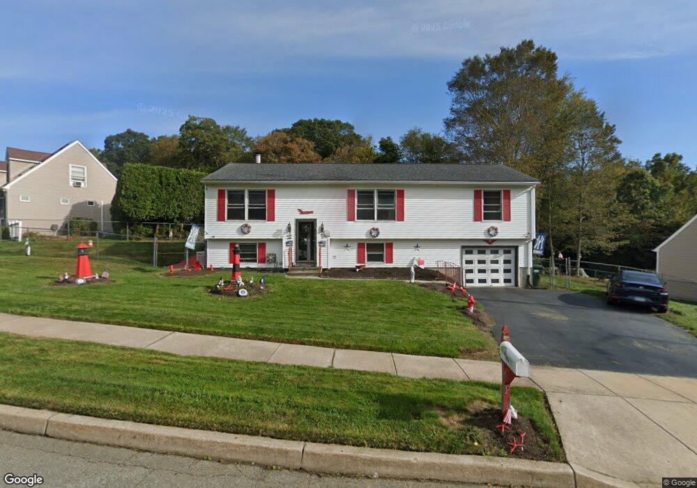
134 Deerfield Ridge Dr Mystic, CT 06355
Old Mystic NeighborhoodEstimated Value: $510,512 - $604,000
3
Beds
2
Baths
1,800
Sq Ft
$302/Sq Ft
Est. Value
About This Home
This home is located at 134 Deerfield Ridge Dr, Mystic, CT 06355 and is currently estimated at $543,628, approximately $302 per square foot. 134 Deerfield Ridge Dr is a home located in New London County with nearby schools including Northeast Academy Arts Magnet School, Groton Middle School, and Robert E. Fitch High School.
Ownership History
Date
Name
Owned For
Owner Type
Purchase Details
Closed on
Aug 28, 1997
Sold by
Deerfield-At-Mystic Lp
Bought by
Pellegrino Anthony J and Pellegrino Patricia A
Current Estimated Value
Create a Home Valuation Report for This Property
The Home Valuation Report is an in-depth analysis detailing your home's value as well as a comparison with similar homes in the area
Home Values in the Area
Average Home Value in this Area
Purchase History
| Date | Buyer | Sale Price | Title Company |
|---|---|---|---|
| Pellegrino Anthony J | $136,000 | -- |
Source: Public Records
Mortgage History
| Date | Status | Borrower | Loan Amount |
|---|---|---|---|
| Open | Pellegrino Anthony J | $280,000 | |
| Closed | Pellegrino Anthony J | $30,000 | |
| Closed | Pellegrino Anthony J | $236,000 |
Source: Public Records
Tax History Compared to Growth
Tax History
| Year | Tax Paid | Tax Assessment Tax Assessment Total Assessment is a certain percentage of the fair market value that is determined by local assessors to be the total taxable value of land and additions on the property. | Land | Improvement |
|---|---|---|---|---|
| 2025 | $6,746 | $247,030 | $116,788 | $130,242 |
| 2024 | $6,319 | $247,030 | $116,788 | $130,242 |
| 2023 | $6,060 | $247,030 | $60,970 | $186,060 |
| 2022 | $6,015 | $247,030 | $60,970 | $186,060 |
| 2021 | $4,939 | $171,010 | $48,720 | $122,290 |
| 2020 | $4,886 | $171,010 | $48,720 | $122,290 |
| 2019 | $4,677 | $171,010 | $48,720 | $122,290 |
| 2018 | $4,629 | $171,010 | $48,720 | $122,290 |
| 2017 | $4,545 | $171,010 | $48,720 | $122,290 |
| 2016 | $4,317 | $174,930 | $57,330 | $117,600 |
| 2015 | $4,172 | $174,930 | $57,330 | $117,600 |
| 2014 | $4,055 | $174,930 | $57,330 | $117,600 |
Source: Public Records
Map
Nearby Homes
- 2590 Gold Star Hwy Unit 210
- 22 Spring Valley Rd
- 115 Lamphere Rd
- 17 Lamphere Rd
- 186 Haley Rd
- 46 Hillside Dr
- 36 Watrous Ave
- 116 Indigo St
- 254 Haley Rd
- 308 Shewville Rd
- 314 Shewville Rd
- 1198 River Rd
- 173 Lambtown Rd
- 40 Riverbend Dr
- 86 Fair Acres Cir
- 3 Whitehall Pond Unit 3
- 452 Colonel Ledyard Hwy
- 375 Allyn St Unit 2
- 375 Allyn St Unit 4
- 518 Noank Ledyard Rd
- 148 Deerfield Ridge Dr
- 122 Deerfield Ridge Dr
- 154 Deerfield Ridge Dr
- 118 Deerfield Ridge Dr
- 137 Deerfield Ridge Dr
- 129 Deerfield Ridge Dr
- 112 Deerfield Ridge Dr
- 160 Deerfield Ridge Dr
- 123 Deerfield Ridge Dr
- 102 Deerfield Ridge Dr
- 106 Deerfield Ridge Dr
- 117 Deerfield Ridge Dr
- 164 Deerfield Ridge Dr
- 153 Deerfield Ridge Dr
- 147 Deerfield Ridge Dr
- 133 Deerfield Ridge Dr
- 157 Deerfield Ridge Dr
- 29 Cheseborough Farm Rd
- 170 Deerfield Ridge Dr
- 141 Deerfield Ridge Dr