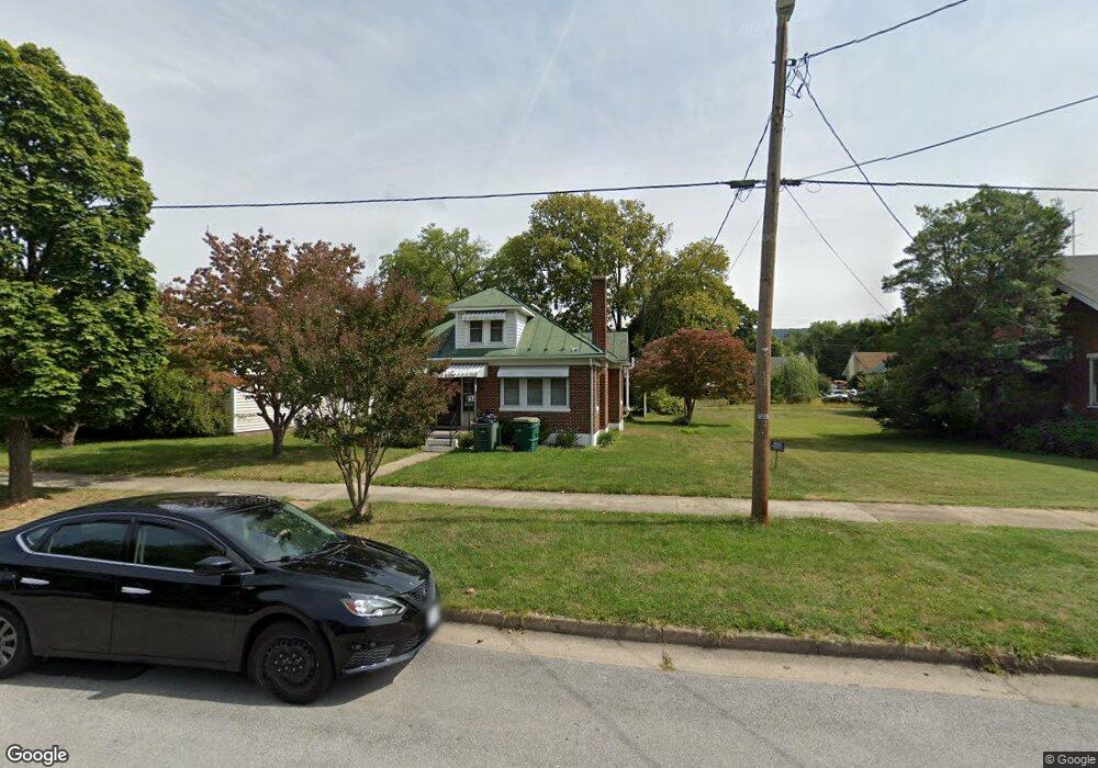
134 Dupont Blvd Waynesboro, VA 22980
Estimated Value: $206,000 - $249,000
2
Beds
1
Bath
1,307
Sq Ft
$171/Sq Ft
Est. Value
About This Home
This home is located at 134 Dupont Blvd, Waynesboro, VA 22980 and is currently estimated at $223,277, approximately $170 per square foot. 134 Dupont Blvd is a home located in Waynesboro City with nearby schools including Wenonah Elementary School, Kate Collins Middle School, and Waynesboro High School.
Ownership History
Date
Name
Owned For
Owner Type
Purchase Details
Closed on
Nov 8, 2018
Sold by
Miller Clyde W and Baugh Sharon G
Bought by
Miller Dawn L
Current Estimated Value
Home Financials for this Owner
Home Financials are based on the most recent Mortgage that was taken out on this home.
Original Mortgage
$124,500
Outstanding Balance
$109,249
Interest Rate
4.7%
Mortgage Type
VA
Estimated Equity
$114,028
Create a Home Valuation Report for This Property
The Home Valuation Report is an in-depth analysis detailing your home's value as well as a comparison with similar homes in the area
Home Values in the Area
Average Home Value in this Area
Purchase History
| Date | Buyer | Sale Price | Title Company |
|---|---|---|---|
| Miller Dawn L | $124,500 | Court Square Title |
Source: Public Records
Mortgage History
| Date | Status | Borrower | Loan Amount |
|---|---|---|---|
| Open | Miller Dawn L | $124,500 |
Source: Public Records
Tax History Compared to Growth
Tax History
| Year | Tax Paid | Tax Assessment Tax Assessment Total Assessment is a certain percentage of the fair market value that is determined by local assessors to be the total taxable value of land and additions on the property. | Land | Improvement |
|---|---|---|---|---|
| 2025 | $1,569 | $191,300 | $31,800 | $159,500 |
| 2024 | $1,210 | $157,200 | $27,100 | $130,100 |
| 2023 | $1,210 | $157,200 | $27,100 | $130,100 |
| 2022 | $1,049 | $116,600 | $23,800 | $92,800 |
| 2021 | $1,049 | $116,600 | $23,800 | $92,800 |
| 2020 | $953 | $105,900 | $23,800 | $82,100 |
| 2019 | $953 | $105,900 | $23,800 | $82,100 |
| 2018 | $830 | $92,200 | $23,800 | $68,400 |
| 2017 | $802 | $92,200 | $23,800 | $68,400 |
| 2016 | $702 | $87,800 | $22,500 | $65,300 |
| 2015 | $702 | $87,800 | $22,500 | $65,300 |
| 2014 | -- | $87,400 | $22,500 | $64,900 |
| 2013 | -- | $0 | $0 | $0 |
Source: Public Records
Map
Nearby Homes
- 600 E Main St
- 164 N Delphine Ave Unit 356-360-364,164-166,
- 238 N Charlotte Ave
- 229 S Winchester Ave
- 268 N Delphine Ave
- 329 S Winchester Ave
- 364 N Bath Ave
- 360 Dinwiddie Ave Unit 356-360-364,164-166,
- 421 N Charlotte Ave
- 252 Port Republic Rd
- 529 N Augusta Ave
- 1200 5th St
- 0 5th St
- 1200 5th St Unit 1200, 1204, 1208
- LOT 2 Port Republic Rd
- 564 N Bath Ave
- 600 N Bayard Ave
- 528 Arch Ave
- 314 13th St
- 601 N Bayard Ave
- 144 Dupont Blvd
- 112 Dupont Blvd
- 123 S Bayard Ave
- 156 Dupont Blvd
- 500 E Main St
- 131 S Bayard Ave
- 158 Dupont Blvd
- 133 S Bayard Ave
- 516 E Main St
- 133 Dupont Blvd
- 137 Dupont Blvd
- 532 E Main St
- 162 Dupont Blvd
- 430 E Main St
- 159 Dupont Blvd
- 158 S Bayard Ave Unit 12
- 158 S Bayard Ave
- 169 Dupont Blvd
- 126 S Bayard Ave
- 600 E Main St