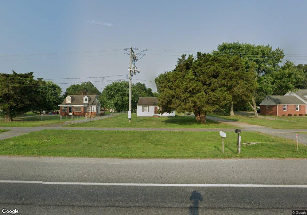
134 E Cedar Ln Fruitland, MD 21826
Estimated Value: $240,000 - $351,000
--
Bed
1
Bath
780
Sq Ft
$403/Sq Ft
Est. Value
About This Home
This home is located at 134 E Cedar Ln, Fruitland, MD 21826 and is currently estimated at $314,221, approximately $402 per square foot. 134 E Cedar Ln is a home located in Wicomico County with nearby schools including Fruitland Primary School, Fruitland Intermediate School, and Bennett Middle School.
Ownership History
Date
Name
Owned For
Owner Type
Purchase Details
Closed on
Sep 10, 2013
Sold by
Fields John H and Fields Gwendolyn E
Bought by
Fields Johnna Elaine
Current Estimated Value
Purchase Details
Closed on
Mar 6, 1987
Sold by
Jones Hooper R and Mary Gladys
Bought by
Fields John H and Fields Gwendolyn E
Home Financials for this Owner
Home Financials are based on the most recent Mortgage that was taken out on this home.
Original Mortgage
$8,000
Interest Rate
9.03%
Create a Home Valuation Report for This Property
The Home Valuation Report is an in-depth analysis detailing your home's value as well as a comparison with similar homes in the area
Home Values in the Area
Average Home Value in this Area
Purchase History
| Date | Buyer | Sale Price | Title Company |
|---|---|---|---|
| Fields Johnna Elaine | -- | Pinderhughes Title Inc | |
| Fields Johnna Elaine | -- | Pinderhughes Title Inc | |
| Fields John H | $18,000 | -- |
Source: Public Records
Mortgage History
| Date | Status | Borrower | Loan Amount |
|---|---|---|---|
| Closed | Fields John H | $8,000 |
Source: Public Records
Tax History Compared to Growth
Tax History
| Year | Tax Paid | Tax Assessment Tax Assessment Total Assessment is a certain percentage of the fair market value that is determined by local assessors to be the total taxable value of land and additions on the property. | Land | Improvement |
|---|---|---|---|---|
| 2025 | $3,179 | $335,067 | $0 | $0 |
| 2024 | $3,179 | $331,600 | $84,000 | $247,600 |
| 2023 | $3,153 | $316,133 | $0 | $0 |
| 2022 | $3,064 | $300,667 | $0 | $0 |
| 2021 | $2,916 | $285,200 | $84,000 | $201,200 |
| 2020 | $1,056 | $283,867 | $0 | $0 |
| 2019 | $717 | $282,533 | $0 | $0 |
| 2018 | $2,958 | $281,200 | $84,000 | $197,200 |
| 2017 | $2,958 | $281,200 | $0 | $0 |
| 2016 | $3,436 | $281,200 | $0 | $0 |
| 2015 | $3,436 | $320,700 | $0 | $0 |
| 2014 | $3,436 | $320,700 | $0 | $0 |
Source: Public Records
Map
Nearby Homes
- 222 N Dulany Ave
- 207 & 209 N Dulany Ave
- 214 N Dulany Ave
- 202 Hunter's Way
- 210 Hunter's Way
- 103 W Main St
- 105 Russell Ave
- 227 N Brown St
- 415 Creekside Trail
- 212 Green St
- 209 W Main St
- 224 Canal Park Dr Unit 101
- 228 Canal Park Dr Unit G7
- 228 Canal Park Dr Unit G106
- 228 Canal Park Dr Unit G208
- 225 Canal Park Dr Unit 15
- 404 Sheldon Ave
- 110 Moore Ave
- 401 Cobblers Green
- 231 Canal Park Dr Unit A200
- 138 E Cedar Ln
- 132 E Cedar Ln
- 316 N Dulany Ave
- 321 N Dulany Ave
- 314 N Dulany Ave
- 130 E Cedar Ln
- 319 N Dulany Ave
- 314 Morris St
- 315 N Dulany Ave
- 312 N Dulany Ave
- 317 N Dulany Ave
- 311 Morris St
- 312 Morris St
- 310 N Dulany Ave
- 128 E Cedar Ln
- 313 N Dulany Ave
- 310 Poplar St
- 310 Morris St
- 309 Morris St
- 300 Morris St