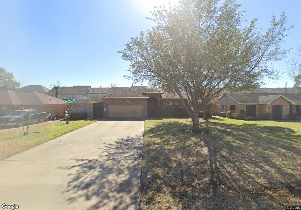
134 E Thornton Rd Houston, TX 77022
Independence Heights NeighborhoodEstimated Value: $327,377 - $450,000
3
Beds
2
Baths
1,858
Sq Ft
$205/Sq Ft
Est. Value
About This Home
This home is located at 134 E Thornton Rd, Houston, TX 77022 and is currently estimated at $381,594, approximately $205 per square foot. 134 E Thornton Rd is a home located in Harris County with nearby schools including Kennedy Elementary School, Williams Middle, and Booker T Washington Sr High.
Ownership History
Date
Name
Owned For
Owner Type
Purchase Details
Closed on
May 30, 2013
Sold by
Fortier Michel J
Bought by
Tomjack Dennis
Current Estimated Value
Home Financials for this Owner
Home Financials are based on the most recent Mortgage that was taken out on this home.
Original Mortgage
$17,500
Outstanding Balance
$12,415
Interest Rate
3.43%
Mortgage Type
New Conventional
Estimated Equity
$369,179
Purchase Details
Closed on
Aug 17, 2011
Sold by
Fortier Michel J and Fortier Michael J
Bought by
Fortier Michel J
Home Financials for this Owner
Home Financials are based on the most recent Mortgage that was taken out on this home.
Original Mortgage
$168,900
Interest Rate
3.5%
Mortgage Type
New Conventional
Purchase Details
Closed on
Mar 13, 2006
Sold by
Scott Willie and Scott Lydia J
Bought by
Fortier Michael J
Create a Home Valuation Report for This Property
The Home Valuation Report is an in-depth analysis detailing your home's value as well as a comparison with similar homes in the area
Home Values in the Area
Average Home Value in this Area
Purchase History
| Date | Buyer | Sale Price | Title Company |
|---|---|---|---|
| Tomjack Dennis | -- | Infinity Title Co | |
| Fortier Michel J | -- | Transtar National Title | |
| Fortier Michael J | -- | Stewart Title Company |
Source: Public Records
Mortgage History
| Date | Status | Borrower | Loan Amount |
|---|---|---|---|
| Open | Tomjack Dennis | $17,500 | |
| Previous Owner | Fortier Michel J | $168,900 |
Source: Public Records
Tax History
| Year | Tax Paid | Tax Assessment Tax Assessment Total Assessment is a certain percentage of the fair market value that is determined by local assessors to be the total taxable value of land and additions on the property. | Land | Improvement |
|---|---|---|---|---|
| 2025 | $1,526 | $356,512 | $167,700 | $188,812 |
| 2024 | $1,526 | $421,484 | $167,700 | $253,784 |
| 2023 | $1,526 | $390,140 | $134,160 | $255,980 |
| 2022 | $6,862 | $353,859 | $134,160 | $219,699 |
| 2021 | $6,603 | $283,309 | $134,160 | $149,149 |
| 2020 | $7,435 | $311,345 | $67,080 | $244,265 |
| 2019 | $7,679 | $303,460 | $67,080 | $236,380 |
| 2018 | $5,776 | $313,682 | $39,130 | $274,552 |
| 2017 | $6,868 | $313,682 | $39,130 | $274,552 |
| 2016 | $6,243 | $254,134 | $27,950 | $226,184 |
| 2015 | $5,246 | $254,134 | $27,950 | $226,184 |
| 2014 | $5,246 | $204,060 | $27,950 | $176,110 |
Source: Public Records
Map
Nearby Homes
- 144 Knightsbridge Park Ln
- 126 Knightsbridge Park Ln
- 4510 Trevor Park Ln
- 148 W Whitney St
- 115 E Thornton Rd
- 108 Knightsbridge Park Ln
- 4510 Old Yale St Unit A
- 107 W Whitney St Unit E
- 121 Norview Dr
- 4423 Yale St
- 241 Norview Dr
- 218 Victoria Dr
- 4711 Yale St
- 4516 Werner St
- 4711 Thornton Villas Ln
- 4709 Thornton Villas Ln
- 4710 Thornton Villas Ln
- 0 Victoria Unit 54691087
- 407 Sikes St
- 4602 Crown Grove Ln
- 134 E Thornton Rd
- 138 E Thornton Rd
- 130 E Thornton Rd
- 139 Knightsbridge Park Ln
- 139 Knights Bridge Park Ln
- 141 Knights Bridge Park Ln
- 137 Knights Bridge Park Ln
- 143 Knights Bridge Park Ln
- 135 Knights Bridge Park Ln
- 145 Knightsbridge Park Ln
- 135 Knightsbridge Park Ln
- 145 Knights Bridge Park Ln
- 147 Knightsbridge Park Ln
- 147 Knightsbridge Park Ln
- 133 Knights Bridge Park Ln
- 147 Knights Bridge Park Ln
- 202 E Thornton Rd
- 126 E Thornton Rd
- 131 Knights Bridge Park Ln
- 149 Knights Bridge Park Ln
Your Personal Tour Guide
Ask me questions while you tour the home.