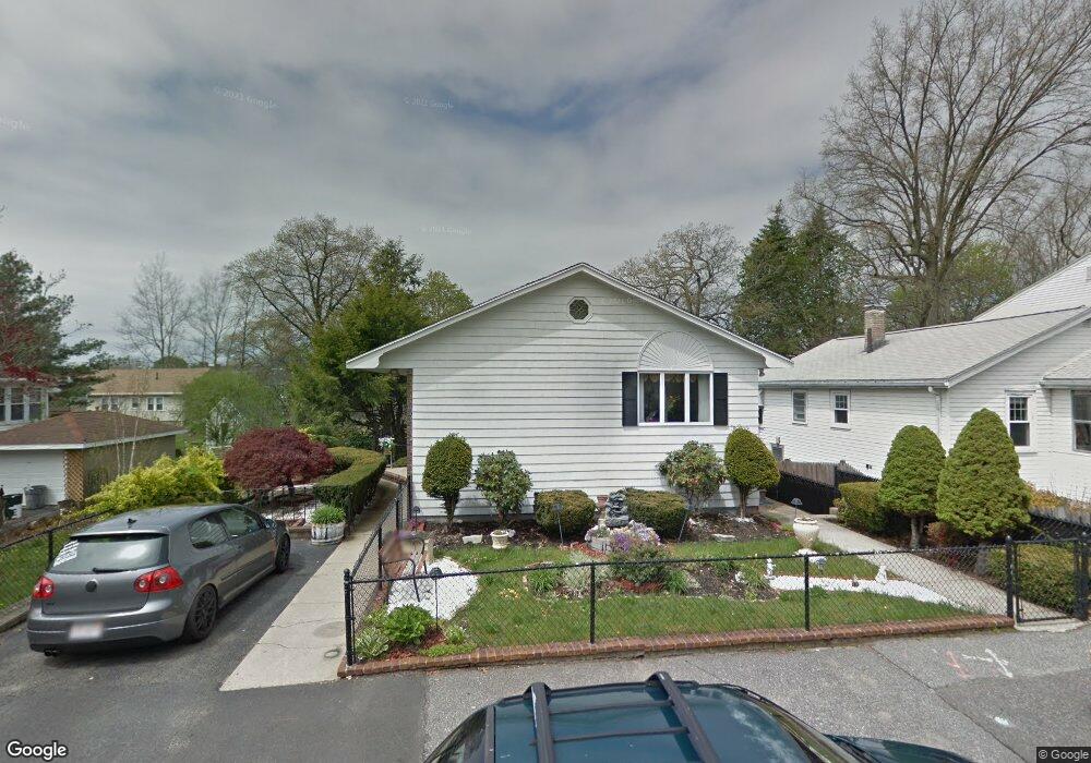
134 Fern Rd Medford, MA 02155
North Medford NeighborhoodEstimated Value: $894,000 - $1,108,000
3
Beds
3
Baths
2,111
Sq Ft
$466/Sq Ft
Est. Value
About This Home
This home is located at 134 Fern Rd, Medford, MA 02155 and is currently estimated at $984,315, approximately $466 per square foot. 134 Fern Rd is a home located in Middlesex County with nearby schools including Medford High School, Mystic Valley Regional Charter School, and St. Joseph School.
Ownership History
Date
Name
Owned For
Owner Type
Purchase Details
Closed on
Apr 9, 2018
Sold by
Guedes-Aparecida Maria
Bought by
Guedes-Aparecida Maria and Silva-Guedes Luan P
Current Estimated Value
Purchase Details
Closed on
Sep 11, 2007
Sold by
Hanlon Rosemarie
Bought by
Guedes Maria Aparecida
Home Financials for this Owner
Home Financials are based on the most recent Mortgage that was taken out on this home.
Original Mortgage
$417,000
Interest Rate
6.74%
Mortgage Type
Purchase Money Mortgage
Create a Home Valuation Report for This Property
The Home Valuation Report is an in-depth analysis detailing your home's value as well as a comparison with similar homes in the area
Home Values in the Area
Average Home Value in this Area
Purchase History
| Date | Buyer | Sale Price | Title Company |
|---|---|---|---|
| Guedes-Aparecida Maria | -- | -- | |
| Guedes Maria Aparecida | $445,000 | -- |
Source: Public Records
Mortgage History
| Date | Status | Borrower | Loan Amount |
|---|---|---|---|
| Previous Owner | Guedes Maria Aparecida | $417,000 |
Source: Public Records
Tax History Compared to Growth
Tax History
| Year | Tax Paid | Tax Assessment Tax Assessment Total Assessment is a certain percentage of the fair market value that is determined by local assessors to be the total taxable value of land and additions on the property. | Land | Improvement |
|---|---|---|---|---|
| 2025 | $6,853 | $778,700 | $375,800 | $402,900 |
| 2024 | $6,482 | $760,800 | $357,900 | $402,900 |
| 2023 | $5,882 | $680,000 | $334,500 | $345,500 |
| 2022 | $5,711 | $633,800 | $304,100 | $329,700 |
| 2021 | $5,436 | $577,700 | $289,600 | $288,100 |
| 2020 | $5,133 | $559,100 | $289,600 | $269,500 |
| 2019 | $5,114 | $532,700 | $263,200 | $269,500 |
| 2018 | $4,848 | $473,400 | $239,300 | $234,100 |
| 2017 | $4,794 | $454,000 | $223,600 | $230,400 |
| 2016 | $4,665 | $416,900 | $203,300 | $213,600 |
| 2015 | $4,616 | $394,500 | $193,600 | $200,900 |
Source: Public Records
Map
Nearby Homes
- 229 Fulton St
- 63 Doonan St
- 17 Raymond St
- 16 Walker St Unit 16
- 26 Foss St Unit 1
- 0 Gordon Rd
- 32 Almont St Unit 32-1
- 83 Court St
- 59-65 Valley St Unit 4G
- 59-65 Valley St Unit 5F
- 8 Guild St
- 11 Girard Rd
- 70 Tainter St
- 70 Tainter St Unit 1
- 52 Harrison St
- 500 Salem St Unit 304
- 500 Salem St Unit 708
- 19 Paris St Unit 302
- 31 Wilson St
- 35 Wilson St