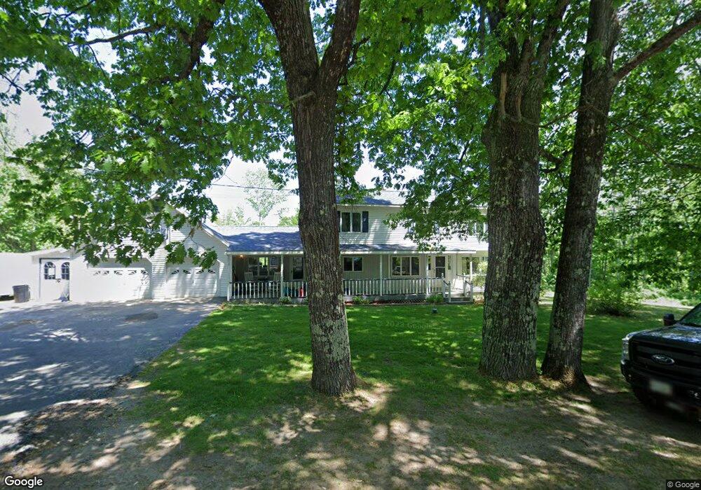
134 Gibbs Mill Rd Livermore, ME 04253
Estimated Value: $307,000 - $449,000
3
Beds
2
Baths
2,500
Sq Ft
$146/Sq Ft
Est. Value
About This Home
This home is located at 134 Gibbs Mill Rd, Livermore, ME 04253 and is currently estimated at $365,235, approximately $146 per square foot. 134 Gibbs Mill Rd is a home located in Androscoggin County with nearby schools including Spruce Mountain Primary School, Spruce Mountain Elementary School, and Spruce Mountain Middle School.
Ownership History
Date
Name
Owned For
Owner Type
Purchase Details
Closed on
Aug 11, 2025
Sold by
Pitcher Cea J and Pitcher Bethany J
Bought by
Langlin Seth and Langlin Rachel
Current Estimated Value
Purchase Details
Closed on
Jul 29, 2016
Sold by
Dressel Jennifer L and Dressel Brian C
Bought by
Langlin Rachel G and Langlin Seth A
Home Financials for this Owner
Home Financials are based on the most recent Mortgage that was taken out on this home.
Original Mortgage
$155,220
Interest Rate
3.54%
Mortgage Type
FHA
Create a Home Valuation Report for This Property
The Home Valuation Report is an in-depth analysis detailing your home's value as well as a comparison with similar homes in the area
Home Values in the Area
Average Home Value in this Area
Purchase History
| Date | Buyer | Sale Price | Title Company |
|---|---|---|---|
| Langlin Seth | -- | -- | |
| Langlin Seth | -- | -- | |
| Langlin Rachel G | -- | -- | |
| Langlin Rachel G | -- | -- |
Source: Public Records
Mortgage History
| Date | Status | Borrower | Loan Amount |
|---|---|---|---|
| Previous Owner | Langlin Rachel G | $155,220 |
Source: Public Records
Tax History Compared to Growth
Tax History
| Year | Tax Paid | Tax Assessment Tax Assessment Total Assessment is a certain percentage of the fair market value that is determined by local assessors to be the total taxable value of land and additions on the property. | Land | Improvement |
|---|---|---|---|---|
| 2025 | $4,078 | $215,754 | $33,380 | $182,374 |
| 2024 | $3,689 | $215,754 | $33,380 | $182,374 |
| 2023 | $3,506 | $215,754 | $33,380 | $182,374 |
| 2022 | $3,452 | $215,754 | $33,380 | $182,374 |
| 2021 | $3,452 | $215,754 | $33,380 | $182,374 |
| 2020 | $3,290 | $215,754 | $33,380 | $182,374 |
| 2019 | $3,150 | $193,845 | $29,380 | $164,465 |
| 2018 | $3,102 | $193,845 | $29,380 | $164,465 |
| 2017 | $3,179 | $193,845 | $29,380 | $164,465 |
| 2016 | $3,102 | $193,845 | $29,380 | $164,465 |
| 2015 | $3,102 | $193,845 | $29,380 | $164,465 |
| 2014 | $2,753 | $193,845 | $29,380 | $164,465 |
Source: Public Records
Map
Nearby Homes
- 129 Gibbs Mill Rd
- 137 Gibbs Mill Rd
- 154 Gibbs Mill Rd
- 155 Gibbs Mill Rd
- 24 Haynorville Rd
- lot 2 Gibbs Mill Rd
- 0 Emmons
- 175 Gibbs Mill Rd
- 62 Haynorville Rd
- 178 Gibbs Mill Rd
- 80 Gibbs Mill Rd
- 24 Emmons Rd
- 52 Haynorville Rd
- 190 Gibbs Mill Rd
- 28 Emmons Rd
- 189 Gibbs Mill Rd
- 7 Amber Acres Dr
- 8 Amber Acres Dr
- 198 Gibbs Mill Rd
- 201 Gibbs Mill Rd