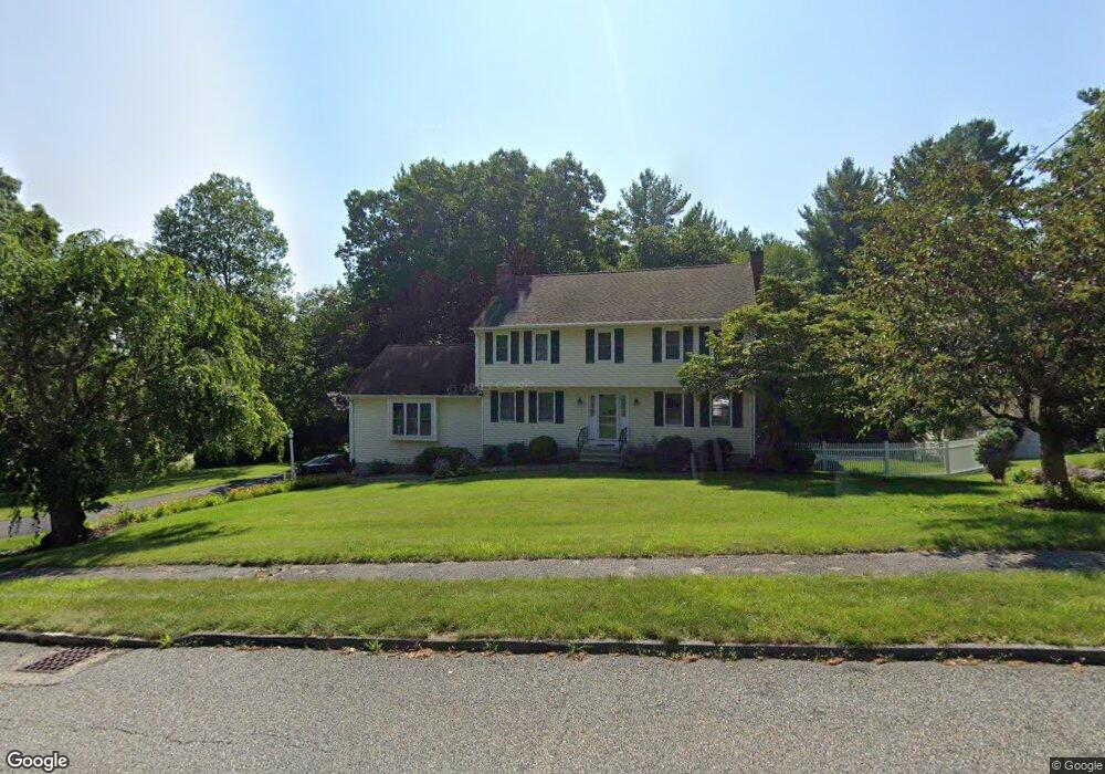
134 Jefferson Ave Northbridge, MA 01534
Estimated Value: $701,000 - $850,000
4
Beds
3
Baths
2,482
Sq Ft
$301/Sq Ft
Est. Value
About This Home
This home is located at 134 Jefferson Ave, Northbridge, MA 01534 and is currently estimated at $746,759, approximately $300 per square foot. 134 Jefferson Ave is a home located in Worcester County with nearby schools including Northbridge Elementary School, Northbridge Middle School, and Northbridge High School.
Ownership History
Date
Name
Owned For
Owner Type
Purchase Details
Closed on
May 28, 1993
Sold by
Yag Micahel C and Yag Margaret
Bought by
Dupre Steven and Dupre Nancy
Current Estimated Value
Home Financials for this Owner
Home Financials are based on the most recent Mortgage that was taken out on this home.
Original Mortgage
$100,000
Interest Rate
7.41%
Mortgage Type
Purchase Money Mortgage
Create a Home Valuation Report for This Property
The Home Valuation Report is an in-depth analysis detailing your home's value as well as a comparison with similar homes in the area
Home Values in the Area
Average Home Value in this Area
Purchase History
| Date | Buyer | Sale Price | Title Company |
|---|---|---|---|
| Dupre Steven | $201,000 | -- | |
| Dupre Steven | $201,000 | -- |
Source: Public Records
Mortgage History
| Date | Status | Borrower | Loan Amount |
|---|---|---|---|
| Open | Dupre Steven | $244,000 | |
| Closed | Dupre Steven | $100,000 | |
| Previous Owner | Dupre Steven | $148,000 |
Source: Public Records
Tax History Compared to Growth
Tax History
| Year | Tax Paid | Tax Assessment Tax Assessment Total Assessment is a certain percentage of the fair market value that is determined by local assessors to be the total taxable value of land and additions on the property. | Land | Improvement |
|---|---|---|---|---|
| 2025 | $7,101 | $602,300 | $185,100 | $417,200 |
| 2024 | $6,819 | $564,000 | $185,100 | $378,900 |
| 2023 | $6,619 | $510,700 | $169,700 | $341,000 |
| 2022 | $6,191 | $449,600 | $130,600 | $319,000 |
| 2021 | $6,086 | $420,000 | $124,400 | $295,600 |
| 2020 | $5,634 | $407,100 | $124,400 | $282,700 |
| 2019 | $5,045 | $389,000 | $124,400 | $264,600 |
| 2018 | $4,832 | $373,400 | $118,300 | $255,100 |
| 2017 | $4,794 | $354,300 | $118,300 | $236,000 |
| 2016 | $4,627 | $336,500 | $107,600 | $228,900 |
| 2015 | $4,502 | $336,500 | $107,600 | $228,900 |
| 2014 | $4,462 | $336,500 | $107,600 | $228,900 |
Source: Public Records
Map
Nearby Homes
- 150 Sprague St
- 86 Mikes Way Unit 86
- 84 Mikes Way Unit 84
- 2767 Providence Rd
- 395 Providence Rd Unit 4
- 19 Milford Rd
- 151 Fowler Rd
- 79-81 Upton St
- 12 Central Turnpike
- 7 Central Turnpike
- 191 Hartness Rd
- 1076 Hill St
- 731 Samuel Dr
- 58 Buttercup Ln
- 61 Tulip Cir
- 89 Buttercup Ln Unit 255
- 4 Greenlawn Ave
- 135 Windstone Dr
- 90 Leland Hill Rd
- 42 Shining Rock Dr
- 6 Lincoln Cir
- 544 Sutton St
- 10 Lincoln Cir
- 131 Jefferson Ave
- 145 Jefferson Ave
- 111 Jefferson Ave
- 12 Lincoln Cir
- 110 Jefferson Ave
- 9 Lincoln Cir
- 32 Lincoln Cir
- 174 Jefferson Ave
- 96 Jefferson Ave
- 7 Lincoln Cir
- 32 Roosevelt Dr
- 80 Lincoln Cir
- 44 Roosevelt Dr
- 50 Lincoln Cir
- 87 Jefferson Ave
- 187 Jefferson Ave
- 54 Roosevelt Dr