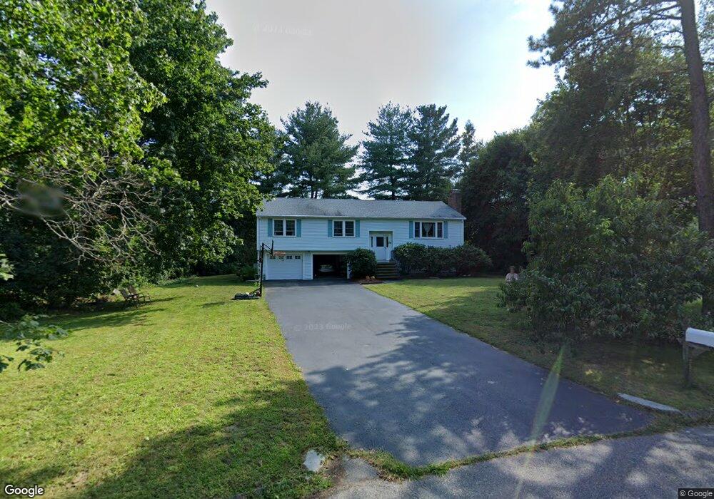
134 Kenney Ln Unit 1 Concord, MA 01742
Estimated Value: $1,086,360 - $1,398,000
4
Beds
3
Baths
2,525
Sq Ft
$478/Sq Ft
Est. Value
About This Home
This home is located at 134 Kenney Ln Unit 1, Concord, MA 01742 and is currently estimated at $1,207,590, approximately $478 per square foot. 134 Kenney Ln Unit 1 is a home located in Middlesex County with nearby schools including Alcott Elementary School, Concord Middle School, and The Fenn School.
Ownership History
Date
Name
Owned For
Owner Type
Purchase Details
Closed on
Apr 11, 2000
Sold by
Rajgopal Pathasarathy and Prakash Meena
Bought by
Ayandeh Siamack and Kushki Shahnaz
Current Estimated Value
Home Financials for this Owner
Home Financials are based on the most recent Mortgage that was taken out on this home.
Original Mortgage
$301,125
Outstanding Balance
$103,684
Interest Rate
8.3%
Mortgage Type
Purchase Money Mortgage
Estimated Equity
$1,103,906
Purchase Details
Closed on
May 31, 1991
Sold by
Bldrs Collaborative
Bought by
Rajgopal Pathasarathy and Prakash Meena
Purchase Details
Closed on
Apr 26, 1991
Sold by
Peters Edgar E and Peters Sheryl A
Bought by
Bldrs Collaborative
Create a Home Valuation Report for This Property
The Home Valuation Report is an in-depth analysis detailing your home's value as well as a comparison with similar homes in the area
Home Values in the Area
Average Home Value in this Area
Purchase History
| Date | Buyer | Sale Price | Title Company |
|---|---|---|---|
| Rajgopal Pathasarathy | $285,000 | -- | |
| Bldrs Collaborative | $280,000 | -- | |
| Ayandeh Siamack | $401,500 | -- | |
| Rajgopal Pathasarathy | $285,000 | -- | |
| Bldrs Collaborative | $280,000 | -- |
Source: Public Records
Mortgage History
| Date | Status | Borrower | Loan Amount |
|---|---|---|---|
| Open | Bldrs Collaborative | $301,125 | |
| Previous Owner | Bldrs Collaborative | $203,150 | |
| Previous Owner | Bldrs Collaborative | $203,150 |
Source: Public Records
Tax History Compared to Growth
Tax History
| Year | Tax Paid | Tax Assessment Tax Assessment Total Assessment is a certain percentage of the fair market value that is determined by local assessors to be the total taxable value of land and additions on the property. | Land | Improvement |
|---|---|---|---|---|
| 2025 | $131 | $987,800 | $581,200 | $406,600 |
| 2024 | $12,024 | $915,800 | $542,400 | $373,400 |
| 2023 | $11,534 | $890,000 | $516,600 | $373,400 |
| 2022 | $10,078 | $682,800 | $375,700 | $307,100 |
| 2021 | $10,017 | $680,500 | $375,700 | $304,800 |
| 2020 | $8,773 | $616,500 | $328,700 | $287,800 |
| 2019 | $8,870 | $625,100 | $337,300 | $287,800 |
| 2018 | $8,805 | $616,200 | $338,600 | $277,600 |
| 2017 | $8,300 | $589,900 | $322,500 | $267,400 |
| 2016 | $7,994 | $574,300 | $289,400 | $284,900 |
| 2015 | $8,297 | $580,600 | $306,300 | $274,300 |
Source: Public Records
Map
Nearby Homes
- 16 Hatch Farm Ln
- 10 Hatch Farm Ln
- 28 Hatch Farm Ln
- 644 Old Bedford Rd
- 58 Peter Spring Rd
- 86 Butternut Cir
- 6 Parker Rd
- 96 Independence Rd
- 646 Cambridge Turnpike
- 140 Revolutionary Rd
- 35 Chestnut St
- 16 Old Cambridge Turnpike
- 5 South Commons Unit D
- 36 Indian Camp Ln Unit D
- 29 S Commons Unit D
- 38-40 Court Ln
- 5 Clark Rd
- 9 Garland Rd
- 22 Selfridge Rd
- 61B Walden St
- 134 Kenney Ln
- 135 Kenney Ln
- 105 Philip Farm Rd
- 120 Kenney Ln
- 104 Philip Farm Rd
- 125 Kenney Ln
- 106 Kenney Ln
- 99 Philip Farm Rd
- 117 Kenney Ln
- 117 Kenney Ln Unit U
- 92 Philip Farm Rd
- 101 Kenney Ln
- 94 Kenney Ln
- 86 Philip Farm Rd
- 75 Philip Farm Rd
- 93 Kenney Ln
- 80 Philip Farm Rd
- 76 Kenney Ln
- 46 Kenney Ln
- 81 Kenney Ln