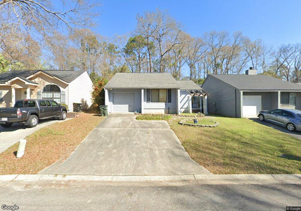
134 Lake Pointe Dr Warner Robins, GA 31088
Estimated Value: $154,987 - $164,000
--
Bed
2
Baths
1,394
Sq Ft
$115/Sq Ft
Est. Value
About This Home
This home is located at 134 Lake Pointe Dr, Warner Robins, GA 31088 and is currently estimated at $159,747, approximately $114 per square foot. 134 Lake Pointe Dr is a home located in Houston County with nearby schools including Russell Elementary School, Huntington Middle School, and Warner Robins High School.
Ownership History
Date
Name
Owned For
Owner Type
Purchase Details
Closed on
Sep 7, 2006
Sold by
Poole Jacob L
Bought by
Perez Deborah V
Current Estimated Value
Purchase Details
Closed on
Jan 28, 2005
Sold by
Westbrook Betty S
Bought by
Poole Jacob L
Home Financials for this Owner
Home Financials are based on the most recent Mortgage that was taken out on this home.
Original Mortgage
$83,400
Interest Rate
5.62%
Mortgage Type
New Conventional
Purchase Details
Closed on
Jun 30, 1992
Sold by
Hawkins Edward A
Bought by
Westbrook Betty S
Purchase Details
Closed on
Feb 7, 1990
Sold by
First Denver Investment Corp
Bought by
Hawkins Edward A
Create a Home Valuation Report for This Property
The Home Valuation Report is an in-depth analysis detailing your home's value as well as a comparison with similar homes in the area
Home Values in the Area
Average Home Value in this Area
Purchase History
| Date | Buyer | Sale Price | Title Company |
|---|---|---|---|
| Perez Deborah V | $87,000 | None Available | |
| Poole Jacob L | $83,400 | None Available | |
| Westbrook Betty S | $64,000 | -- | |
| Hawkins Edward A | $58,500 | -- |
Source: Public Records
Mortgage History
| Date | Status | Borrower | Loan Amount |
|---|---|---|---|
| Previous Owner | Poole Jacob L | $83,400 |
Source: Public Records
Tax History Compared to Growth
Tax History
| Year | Tax Paid | Tax Assessment Tax Assessment Total Assessment is a certain percentage of the fair market value that is determined by local assessors to be the total taxable value of land and additions on the property. | Land | Improvement |
|---|---|---|---|---|
| 2024 | $1,280 | $52,800 | $4,400 | $48,400 |
| 2023 | $1,005 | $44,120 | $4,400 | $39,720 |
| 2022 | $716 | $40,280 | $4,400 | $35,880 |
| 2021 | $567 | $33,680 | $4,400 | $29,280 |
| 2020 | $735 | $33,640 | $4,400 | $29,240 |
| 2019 | $735 | $33,640 | $4,400 | $29,240 |
| 2018 | $735 | $33,640 | $4,400 | $29,240 |
| 2017 | $736 | $33,640 | $4,400 | $29,240 |
| 2016 | $740 | $33,760 | $4,400 | $29,360 |
| 2015 | -- | $33,760 | $4,400 | $29,360 |
| 2014 | -- | $33,760 | $4,400 | $29,360 |
| 2013 | -- | $33,760 | $4,400 | $29,360 |
Source: Public Records
Map
Nearby Homes
- 230 Tallulah Trail
- 105 Ridge Pointe Ct
- 266 Southland Station Dr
- 236 Tallulah Trail
- 122 Tallulah Trail
- 254 Southland Station Dr
- 102 Tallulah Trail
- 303 Leisure Lake Dr
- 104 Crossing Place
- 104 Breeze Point Trail
- 101 Leisure Lake Ct
- 202 Lake Front Dr
- 116 Woodfield Dr
- 103 Leisure Lake Ct
- 105 Leisure Lake Ct
- 132 Lake Pointe Dr
- 136 Lake Pointe Dr
- 138 Lake Pointe Dr
- 130 Lake Pointe Dr
- 140 Lake Pointe Dr
- 128 Lake Pointe Dr
- 133 Lake Pointe Dr
- 131 Lake Pointe Dr
- 135 Lake Pointe Dr
- 137 Lake Pointe Dr
- 142 Lake Pointe Dr
- 121 Lake Pointe Dr
- 126 Lake Pointe Dr
- 139 Lake Pointe Dr
- 0 Tallulah Trail Unit LOT 3 3078778
- 256 Southland Station Dr
- 0 Tallulah Trail Unit 8018244
- 0 Tallulah Trail Unit 7109987
- 0 Tallulah Trail Unit 8953903
- 0 Tallulah Trail Unit 8976060