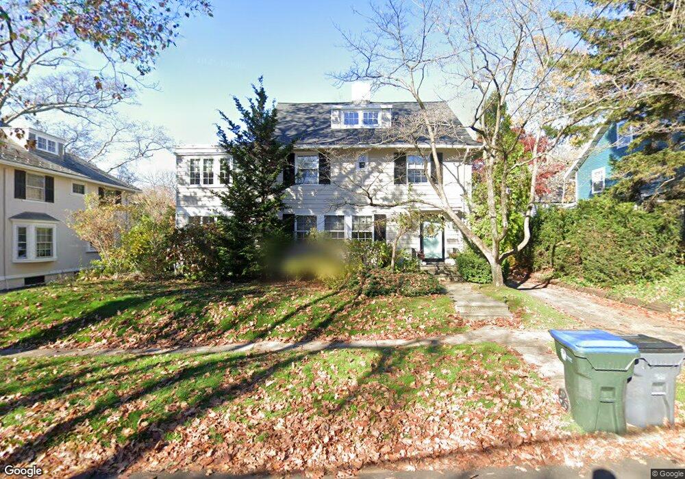
134 Laurel Ave Providence, RI 02906
Blackstone NeighborhoodEstimated Value: $1,237,737 - $1,365,000
6
Beds
4
Baths
3,021
Sq Ft
$432/Sq Ft
Est. Value
About This Home
This home is located at 134 Laurel Ave, Providence, RI 02906 and is currently estimated at $1,304,579, approximately $431 per square foot. 134 Laurel Ave is a home located in Providence County with nearby schools including Asa Messer Elementary School, Charles N. Fortes Elementary School, and Veazie Street Elementary School.
Ownership History
Date
Name
Owned For
Owner Type
Purchase Details
Closed on
May 9, 2011
Sold by
Black Michael J and Millward Eleanor Lee
Bought by
Newton Christopher J and Newton Cathryn V
Current Estimated Value
Home Financials for this Owner
Home Financials are based on the most recent Mortgage that was taken out on this home.
Original Mortgage
$583,200
Interest Rate
4.82%
Mortgage Type
Purchase Money Mortgage
Purchase Details
Closed on
Jul 6, 2000
Sold by
Felder Velma S
Bought by
Black Michael J and Millward Eleanor L
Home Financials for this Owner
Home Financials are based on the most recent Mortgage that was taken out on this home.
Original Mortgage
$200,000
Interest Rate
8.55%
Create a Home Valuation Report for This Property
The Home Valuation Report is an in-depth analysis detailing your home's value as well as a comparison with similar homes in the area
Home Values in the Area
Average Home Value in this Area
Purchase History
| Date | Buyer | Sale Price | Title Company |
|---|---|---|---|
| Newton Christopher J | $729,000 | -- | |
| Black Michael J | $488,500 | -- |
Source: Public Records
Mortgage History
| Date | Status | Borrower | Loan Amount |
|---|---|---|---|
| Open | Black Michael J | $549,450 | |
| Closed | Black Michael J | $583,200 | |
| Previous Owner | Black Michael J | $198,000 | |
| Previous Owner | Black Michael J | $200,000 |
Source: Public Records
Tax History Compared to Growth
Tax History
| Year | Tax Paid | Tax Assessment Tax Assessment Total Assessment is a certain percentage of the fair market value that is determined by local assessors to be the total taxable value of land and additions on the property. | Land | Improvement |
|---|---|---|---|---|
| 2025 | $8,613 | $1,025,400 | $534,800 | $490,600 |
| 2024 | $15,194 | $828,000 | $357,200 | $470,800 |
| 2023 | $15,194 | $828,000 | $357,200 | $470,800 |
| 2022 | $14,738 | $828,000 | $357,200 | $470,800 |
| 2021 | $15,156 | $617,100 | $278,300 | $338,800 |
| 2020 | $15,156 | $617,100 | $278,300 | $338,800 |
| 2019 | $15,156 | $617,100 | $278,300 | $338,800 |
| 2018 | $18,093 | $566,100 | $253,000 | $313,100 |
| 2017 | $18,093 | $566,100 | $253,000 | $313,100 |
| 2016 | $18,093 | $566,100 | $253,000 | $313,100 |
| 2015 | $18,251 | $551,400 | $244,100 | $307,300 |
| 2014 | $18,610 | $551,400 | $244,100 | $307,300 |
| 2013 | $18,610 | $551,400 | $244,100 | $307,300 |
Source: Public Records
Map
Nearby Homes
- 140 Freeman Pkwy
- 189 Laurel Ave Unit 189
- 22 Miles Ave Unit 1
- 160 Slater Ave
- 188 Blackstone Blvd
- 234 President Ave Unit 16
- 201 Arlington Ave
- 125 Taber Ave
- 360 Taber Ave
- 41 Stadium Rd
- 134 Irving Ave
- 294 Cole Ave
- 296 Cole Ave
- 184 Irving Ave Unit 1
- 80 Clarendon Ave
- 141 Elton St
- 41 Taber Ave
- 15 Taft Ave
- 428 Hope St
- 20 Taber Ave
- 140 Laurel Ave
- 169 Freeman Pkwy
- 181 Freeman Pkwy
- 458 Wayland Ave
- 161 Freeman Pkwy
- 120 Laurel Ave
- 137 Laurel Ave
- 185 Freeman Pkwy
- 121 Laurel Ave
- 450 Wayland Ave
- 231 Elmgrove Ave
- 245 Elmgrove Ave
- 115 Laurel Ave
- 174 Freeman Pkwy
- 1010 0 St
- 638 Hope St
- 438 Wayland Ave
- 9999999 Confidential
- 455 Wayland Ave
- 162 Freeman Pkwy