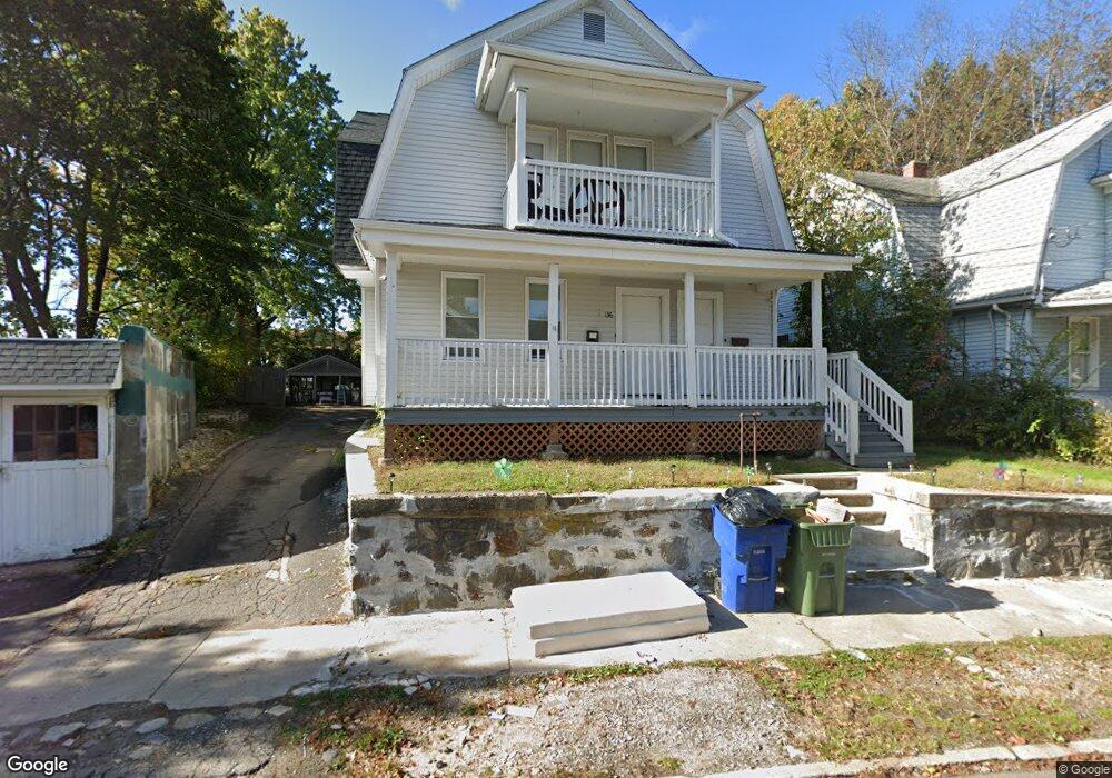
134 Lockhart Ave Waterbury, CT 06705
East End District NeighborhoodEstimated Value: $289,524 - $406,000
2
Beds
1
Bath
1,090
Sq Ft
$330/Sq Ft
Est. Value
About This Home
This home is located at 134 Lockhart Ave, Waterbury, CT 06705 and is currently estimated at $359,631, approximately $329 per square foot. 134 Lockhart Ave is a home located in New Haven County with nearby schools including H.S. Chase School, Michael F. Wallace Middle School, and Crosby High School.
Ownership History
Date
Name
Owned For
Owner Type
Purchase Details
Closed on
Aug 30, 2018
Sold by
Thurston Brenda
Bought by
M3 Properties Llc
Current Estimated Value
Purchase Details
Closed on
Apr 3, 2013
Sold by
Horgan Vincent T and Linden Christine
Bought by
Thurston Brenda
Home Financials for this Owner
Home Financials are based on the most recent Mortgage that was taken out on this home.
Original Mortgage
$40,000
Interest Rate
3.58%
Mortgage Type
New Conventional
Create a Home Valuation Report for This Property
The Home Valuation Report is an in-depth analysis detailing your home's value as well as a comparison with similar homes in the area
Home Values in the Area
Average Home Value in this Area
Purchase History
| Date | Buyer | Sale Price | Title Company |
|---|---|---|---|
| M3 Properties Llc | $60,000 | -- | |
| Thurston Brenda | $40,000 | -- |
Source: Public Records
Mortgage History
| Date | Status | Borrower | Loan Amount |
|---|---|---|---|
| Previous Owner | Thurston Brenda | $40,000 |
Source: Public Records
Tax History Compared to Growth
Tax History
| Year | Tax Paid | Tax Assessment Tax Assessment Total Assessment is a certain percentage of the fair market value that is determined by local assessors to be the total taxable value of land and additions on the property. | Land | Improvement |
|---|---|---|---|---|
| 2025 | $6,184 | $137,480 | $17,710 | $119,770 |
| 2024 | $6,797 | $137,480 | $17,710 | $119,770 |
| 2023 | $7,450 | $137,480 | $17,710 | $119,770 |
| 2022 | $4,285 | $71,160 | $17,730 | $53,430 |
| 2021 | $4,285 | $71,160 | $17,730 | $53,430 |
| 2020 | $4,285 | $71,160 | $17,730 | $53,430 |
| 2019 | $4,285 | $71,160 | $17,730 | $53,430 |
| 2018 | $4,285 | $71,160 | $17,730 | $53,430 |
| 2017 | $4,263 | $70,800 | $17,740 | $53,060 |
| 2016 | $4,263 | $70,800 | $17,740 | $53,060 |
| 2015 | $4,122 | $70,800 | $17,740 | $53,060 |
| 2014 | $4,122 | $70,800 | $17,740 | $53,060 |
Source: Public Records
Map
Nearby Homes
- 7 Alma St
- 204 Elliott Ave
- 50 Beecher Ave
- 149 Southmayd Rd
- 155 Southmayd Rd
- 1821 E Main St
- 31 Eastwood Ave
- 140 Meriden Rd
- 68 Englewood Ave
- 129 Fairlawn Ave
- 47 Wacona Ave
- 61 Harpers Ferry Rd
- 76 Brookdale Ln
- 66 Hinsdale Ave
- 0 Frost Rd Unit 24084658
- 17 Radcliffe Ave
- 40 Marlboro St
- 158 Monroe Ave
- 181 Plank Rd
- 49 Radcliffe Ave
- 128 Lockhart Ave Unit 2nd FL
- 130 Lockhart Ave
- 101 Beecher Ave
- 143 Elliott Ave
- 155 Elliott Ave
- 115 Beecher Ave
- 126 Lockhart Ave
- 109 Beecher Ave
- 139 Elliott Ave
- 95 Beecher Ave
- 127 Beecher Ave
- 125 Elliott Ave Unit 2nd FL
- 125 Elliott Ave
- 125 Elliott Ave Unit 2ND
- 125 Elliott Ave Unit 1st fl
- 119 Elliott Ave
- 133 Lockhart Ave
- 114 Lockhart Ave
- 89 Beecher Ave
- 133 Beecher Ave