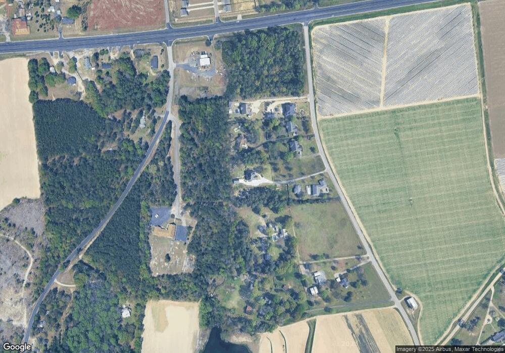
134 Lost Branch Rd Lexington, SC 29072
Estimated Value: $683,000 - $824,000
5
Beds
3
Baths
4,570
Sq Ft
$163/Sq Ft
Est. Value
About This Home
This home is located at 134 Lost Branch Rd, Lexington, SC 29072 and is currently estimated at $744,183, approximately $162 per square foot. 134 Lost Branch Rd is a home located in Lexington County with nearby schools including Rocky Creek Elementary School, Beechwood Middle School, and Lexington High School.
Ownership History
Date
Name
Owned For
Owner Type
Purchase Details
Closed on
Aug 1, 2022
Sold by
John Sease Iii
Bought by
Harper Family Revocable Living Trust
Current Estimated Value
Home Financials for this Owner
Home Financials are based on the most recent Mortgage that was taken out on this home.
Original Mortgage
$615,000
Outstanding Balance
$587,822
Interest Rate
5.81%
Mortgage Type
Balloon
Estimated Equity
$156,361
Purchase Details
Closed on
Feb 3, 2020
Sold by
Neal Mitchell F and Neal Doris T
Bought by
Sease John Lucius and Sease Angie Shealy
Purchase Details
Closed on
Oct 25, 2006
Sold by
Neal Mitchell F
Bought by
Neal Mitchell F and Neal Doris T
Home Financials for this Owner
Home Financials are based on the most recent Mortgage that was taken out on this home.
Original Mortgage
$231,000
Interest Rate
6.37%
Mortgage Type
Adjustable Rate Mortgage/ARM
Create a Home Valuation Report for This Property
The Home Valuation Report is an in-depth analysis detailing your home's value as well as a comparison with similar homes in the area
Home Values in the Area
Average Home Value in this Area
Purchase History
| Date | Buyer | Sale Price | Title Company |
|---|---|---|---|
| Harper Family Revocable Living Trust | $660,000 | None Listed On Document | |
| Sease John Lucius | $435,000 | None Available | |
| Neal Mitchell F | -- | None Available |
Source: Public Records
Mortgage History
| Date | Status | Borrower | Loan Amount |
|---|---|---|---|
| Open | Harper Family Revocable Living Trust | $615,000 | |
| Previous Owner | Neal Mitchell F | $231,000 |
Source: Public Records
Tax History Compared to Growth
Tax History
| Year | Tax Paid | Tax Assessment Tax Assessment Total Assessment is a certain percentage of the fair market value that is determined by local assessors to be the total taxable value of land and additions on the property. | Land | Improvement |
|---|---|---|---|---|
| 2024 | $3,942 | $26,400 | $2,128 | $24,272 |
| 2023 | $3,942 | $16,148 | $1,048 | $15,100 |
| 2022 | $2,405 | $16,148 | $1,048 | $15,100 |
| 2020 | $2,059 | $13,476 | $1,048 | $12,428 |
| 2019 | $1,973 | $12,687 | $1,048 | $11,639 |
| 2018 | $1,936 | $12,687 | $1,048 | $11,639 |
| 2017 | $1,878 | $12,687 | $1,048 | $11,639 |
| 2016 | $1,861 | $12,687 | $1,048 | $11,639 |
| 2014 | $1,871 | $13,335 | $1,049 | $12,286 |
| 2013 | -- | $13,340 | $1,050 | $12,290 |
Source: Public Records
Map
Nearby Homes
- 423 Windy Farm Rd
- 440 Windy Farm
- 410 Windy Farm Rd
- 406 Windy Farm Rd
- 413 Windy Farm Rd
- 185 Cochin Trace
- 132 Phoenix Ln
- 210 Wyndotte Ct
- 204 Cirrus Ln
- 500 Lost Branch Rd
- 206 Cirrus Way
- 916 Calks Ferry Rd
- 216 Bantam Place
- 212 Bantam Place
- 505 Lost Branch Rd
- 0 Augusta Hwy & Spoolwheel Rd Rd
- 720 Braekel Ct
- 233 Welsummer Way
- 261 Oakpointe Dr
- 149 Greenvale Dr
- 136 Lost Branch Rd Unit Lot 9
- 130 Lost Branch Rd
- 126 Lost Branch Rd
- 132 Lost Branch Rd
- 128 Lost Branch Rd
- 144 Lost Branch Rd
- 124 Lost Branch Rd
- 138 Lost Branch Rd
- 160 Lost Branch Rd
- 120 Lost Branch Rd
- 122 Lost Branch Rd
- 176 Lost Branch Rd
- 120 Windy Rd
- 168 Lost Branch Rd
- 100 Windy Rd
- 3115 Augusta Hwy
- 3119 Augusta Hwy
- 3152 Augusta Hwy
- 3129 Augusta Hwy
- 428 Windy Farm Rd
