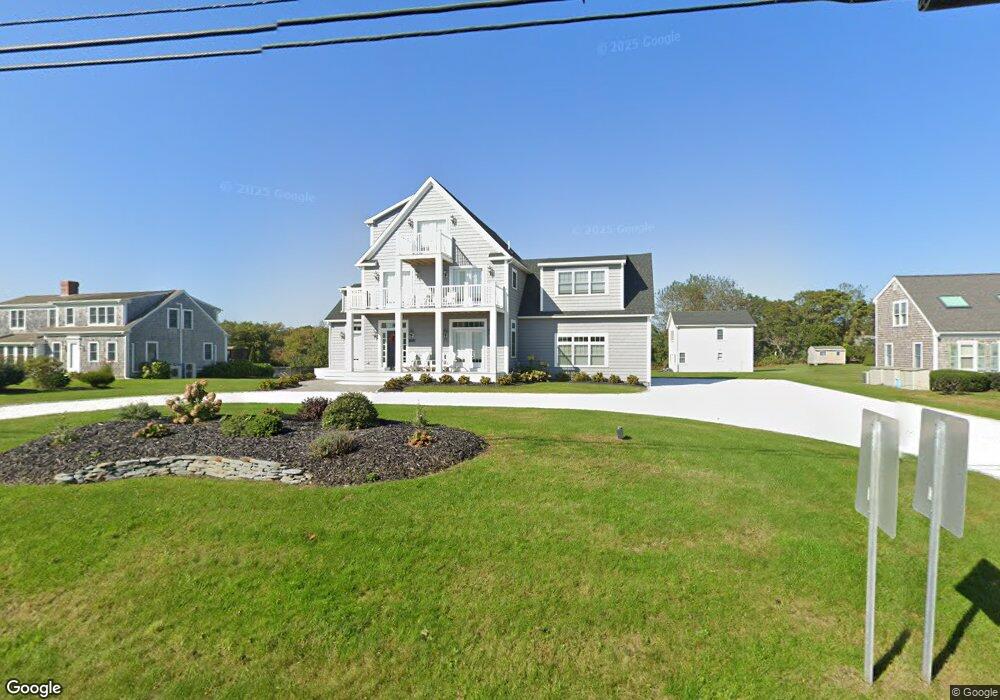
134 Lower County Rd Dennis Port, MA 2639
Dennis Port NeighborhoodEstimated Value: $820,000 - $1,562,000
4
Beds
4
Baths
2,660
Sq Ft
$463/Sq Ft
Est. Value
About This Home
This home is located at 134 Lower County Rd, Dennis Port, MA 2639 and is currently estimated at $1,231,561, approximately $462 per square foot. 134 Lower County Rd is a home located in Barnstable County with nearby schools including Dennis-Yarmouth Regional High School and St. Pius X. School.
Ownership History
Date
Name
Owned For
Owner Type
Purchase Details
Closed on
Sep 3, 1999
Sold by
Curry Stephen A
Bought by
Perugini Claudio and Perugini Sharon
Current Estimated Value
Home Financials for this Owner
Home Financials are based on the most recent Mortgage that was taken out on this home.
Original Mortgage
$136,000
Interest Rate
7.5%
Mortgage Type
Purchase Money Mortgage
Create a Home Valuation Report for This Property
The Home Valuation Report is an in-depth analysis detailing your home's value as well as a comparison with similar homes in the area
Home Values in the Area
Average Home Value in this Area
Purchase History
| Date | Buyer | Sale Price | Title Company |
|---|---|---|---|
| Perugini Claudio | $170,000 | -- | |
| Perugini Claudio | $170,000 | -- |
Source: Public Records
Mortgage History
| Date | Status | Borrower | Loan Amount |
|---|---|---|---|
| Open | Perugini Claudio | $200,000 | |
| Closed | Perugini Claudio | $136,000 | |
| Previous Owner | Perugini Claudio | $34,000 |
Source: Public Records
Tax History Compared to Growth
Tax History
| Year | Tax Paid | Tax Assessment Tax Assessment Total Assessment is a certain percentage of the fair market value that is determined by local assessors to be the total taxable value of land and additions on the property. | Land | Improvement |
|---|---|---|---|---|
| 2025 | $5,543 | $1,280,100 | $370,700 | $909,400 |
| 2024 | $6,581 | $1,499,200 | $445,700 | $1,053,500 |
| 2023 | $6,276 | $1,343,800 | $162,100 | $1,181,700 |
| 2022 | $7,150 | $1,276,800 | $365,000 | $911,800 |
| 2021 | $5,051 | $837,700 | $322,000 | $515,700 |
| 2020 | $3,020 | $495,100 | $322,000 | $173,100 |
| 2019 | $3,046 | $493,600 | $315,700 | $177,900 |
| 2018 | $2,579 | $406,800 | $253,800 | $153,000 |
| 2017 | $2,534 | $412,100 | $253,800 | $158,300 |
| 2016 | $2,197 | $336,500 | $193,700 | $142,800 |
| 2015 | $2,154 | $336,500 | $193,700 | $142,800 |
| 2014 | $2,108 | $332,000 | $193,700 | $138,300 |
Source: Public Records
Map
Nearby Homes
- 37 Ocean Dr Unit 2
- 64 Beaten Rd
- 80 Michaels Ave
- 31 Easy St
- 112 Old Wharf Rd Unit E4
- 112 Old Wharf Rd Unit E1
- 154 Old Wharf Rd Unit 26
- 154 Old Wharf Rd Unit 14
- 120 Old Wharf Rd Unit 11
- 217 Old Wharf Rd Unit 64
- 262 Old Wharf Rd Unit 67
- 262 Old Wharf Rd Unit 5
- 262 Old Wharf Rd Unit 5
- 262 Old Wharf Rd Unit 20
- 262 Old Wharf Rd Unit 87
- 241 Old Wharf Rd Unit 82
- 241 Old Wharf Rd Unit 127
- 241 Old Wharf Rd Unit 90
- 37 Beach Hills Rd
- 19 Standish Way
- 132 Lower County Rd
- 132 Lower County Rd
- 126 Lower County Rd Unit 18
- 126 Lower County Rd Unit U-19
- 126 Lower County Rd Unit 5
- 126 Lower County Rd Unit 20
- 126 Lower County Rd Unit 10
- 126 Lower County Rd Unit 1-2
- 126 Lower County Rd Unit 1
- 126 Lower County Rd Unit 2
- 126 Lower County Rd Unit 6
- 126 Lower County Rd Unit 4
- 126 Lower County Rd Unit 2-16
- 126 Lower County Rd Unit 3-20
- 126 Lower County Rd Unit 1-4
- 126 Lower County Rd Unit 2-15
- 126 Lower County Rd Unit 3-19
- 126 Lower County Rd Unit 1-5
- 126 Lower County Rd Unit 3-17
- 126 Lower County Rd Unit 1-1