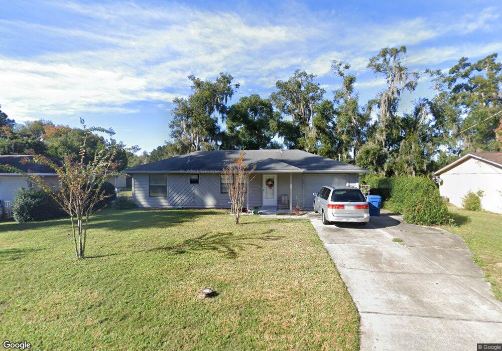
134 Lucie Ave Deland, FL 32720
Estimated Value: $229,000 - $272,000
3
Beds
2
Baths
1,666
Sq Ft
$147/Sq Ft
Est. Value
About This Home
This home is located at 134 Lucie Ave, Deland, FL 32720 and is currently estimated at $245,035, approximately $147 per square foot. 134 Lucie Ave is a home located in Volusia County with nearby schools including Woodward Avenue Elementary School, Deland High School, and Southwestern Middle School.
Ownership History
Date
Name
Owned For
Owner Type
Purchase Details
Closed on
Nov 20, 2023
Sold by
Kitchen Paul Le
Bought by
Kitchell Paul
Current Estimated Value
Purchase Details
Closed on
Jan 21, 2014
Sold by
Ray Janice S
Bought by
Kitchen Paul
Purchase Details
Closed on
Aug 18, 1997
Sold by
Ray Betty M
Bought by
Ray Betty M and Ray Jamiee S
Purchase Details
Closed on
Oct 15, 1985
Bought by
Kitchen Paul
Create a Home Valuation Report for This Property
The Home Valuation Report is an in-depth analysis detailing your home's value as well as a comparison with similar homes in the area
Home Values in the Area
Average Home Value in this Area
Purchase History
| Date | Buyer | Sale Price | Title Company |
|---|---|---|---|
| Kitchell Paul | $100 | None Listed On Document | |
| Kitchell Paul | $100 | None Listed On Document | |
| Kitchen Paul | $78,750 | Adams Cameron Title Svcs Inc | |
| Ray Betty M | -- | -- | |
| Kitchen Paul | $48,000 | -- |
Source: Public Records
Tax History Compared to Growth
Tax History
| Year | Tax Paid | Tax Assessment Tax Assessment Total Assessment is a certain percentage of the fair market value that is determined by local assessors to be the total taxable value of land and additions on the property. | Land | Improvement |
|---|---|---|---|---|
| 2025 | $1,042 | $85,720 | -- | -- |
| 2024 | $1,042 | $83,305 | -- | -- |
| 2023 | $1,042 | $80,879 | $0 | $0 |
| 2022 | $991 | $78,523 | $0 | $0 |
| 2021 | $996 | $76,236 | $0 | $0 |
| 2020 | $973 | $75,183 | $0 | $0 |
| 2019 | $998 | $73,493 | $0 | $0 |
| 2018 | $992 | $72,123 | $0 | $0 |
| 2017 | $981 | $70,640 | $0 | $0 |
| 2016 | $947 | $69,187 | $0 | $0 |
| 2015 | $966 | $68,706 | $0 | $0 |
| 2014 | $1,785 | $66,929 | $0 | $0 |
Source: Public Records
Map
Nearby Homes
- 0 N Spring Garden Ave Unit MFRO6340602
- 0 N Spring Garden Ave Unit 1112700
- 0 N Spring Garden Ave Unit V4920996
- W SR 44, New York Ave W
- 128 S Montgomery Ave
- 289 E Fiesta Key Loop
- 186 E Fiesta Key Loop
- 1126 W Minnesota Ave
- 243 S Hull Ave
- 807 W Church St
- 139 Crawl Key Ct
- 1405 Talton Ave
- 1314 Talton Ave
- 1415 Talton Ave
- 1628 Andover Ridge Dr
- 600 Brittle Fern Ave
- 0 No Name St Unit MFRV4945045
- 0 No Name Unit MFRNS1085318
- 0 No Name St Unit 1121841
- 1601 Andover Ridge Dr
- 132 Lucie Ave
- 138 Lucie Ave
- 130 Lucie Ave
- 243 Cranor Ave
- 137 Cranor Ave
- 133 Lucie Ave
- 139 Lucie Ave
- 247 Cranor Ave
- 131 Lucie Ave
- 133 Cranor Ave
- 141 Lucie Ave
- 129 Cranor Ave
- 249 Cranor Ave
- 145 Lucie Ave
- 125 Cranor Ave
- 216 N Spring Garden Ave
- 212 N Spring Garden Ave
- 121 Lucie Ave Unit 12
- 214 N Spring Garden Ave
- 1145 W New York Ave