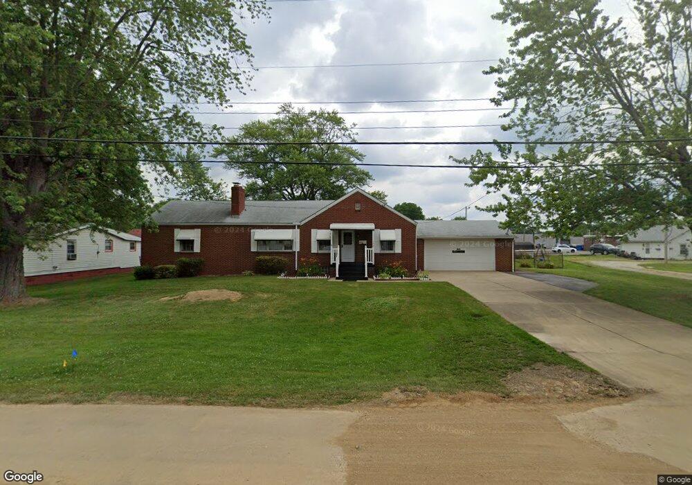
134 Newport Ave NW Massillon, OH 44646
Estimated Value: $170,104 - $190,000
3
Beds
2
Baths
1,344
Sq Ft
$135/Sq Ft
Est. Value
About This Home
This home is located at 134 Newport Ave NW, Massillon, OH 44646 and is currently estimated at $181,276, approximately $134 per square foot. 134 Newport Ave NW is a home located in Stark County with nearby schools including Edison Middle School, Pfeiffer Intermediate School, and Perry High School.
Ownership History
Date
Name
Owned For
Owner Type
Purchase Details
Closed on
Jul 7, 2004
Sold by
Deluca Kimberly K
Bought by
Deluca Jeffrey D
Current Estimated Value
Purchase Details
Closed on
Aug 27, 2002
Sold by
Brumbaugh Vicki A
Bought by
Deluca Jeffrey D and Deluca Kimberly K
Home Financials for this Owner
Home Financials are based on the most recent Mortgage that was taken out on this home.
Original Mortgage
$99,300
Interest Rate
6.63%
Mortgage Type
VA
Create a Home Valuation Report for This Property
The Home Valuation Report is an in-depth analysis detailing your home's value as well as a comparison with similar homes in the area
Home Values in the Area
Average Home Value in this Area
Purchase History
| Date | Buyer | Sale Price | Title Company |
|---|---|---|---|
| Deluca Jeffrey D | -- | -- | |
| Deluca Jeffrey D | $97,400 | -- |
Source: Public Records
Mortgage History
| Date | Status | Borrower | Loan Amount |
|---|---|---|---|
| Closed | Deluca Jeffrey D | $99,300 |
Source: Public Records
Tax History Compared to Growth
Tax History
| Year | Tax Paid | Tax Assessment Tax Assessment Total Assessment is a certain percentage of the fair market value that is determined by local assessors to be the total taxable value of land and additions on the property. | Land | Improvement |
|---|---|---|---|---|
| 2025 | -- | $47,050 | $14,740 | $32,310 |
| 2024 | -- | $47,050 | $14,740 | $32,310 |
| 2023 | $1,967 | $39,210 | $13,620 | $25,590 |
| 2022 | $1,978 | $39,210 | $13,620 | $25,590 |
| 2021 | $2,106 | $39,210 | $13,620 | $25,590 |
| 2020 | $1,812 | $32,350 | $11,450 | $20,900 |
| 2019 | $1,635 | $32,350 | $11,450 | $20,900 |
| 2018 | $1,615 | $32,350 | $11,450 | $20,900 |
| 2017 | $1,494 | $27,720 | $9,450 | $18,270 |
| 2016 | $1,502 | $27,720 | $9,450 | $18,270 |
| 2015 | $1,515 | $27,720 | $9,450 | $18,270 |
| 2014 | $1,504 | $27,090 | $9,240 | $17,850 |
| 2013 | $717 | $27,090 | $9,240 | $17,850 |
Source: Public Records
Map
Nearby Homes
- 0 Newport Ave NW Unit 5143464
- 212 Lennox Ave NW
- 226 Austin Ave NW
- 3412 Bailey St NW
- 232 Proudley Ave SW
- 141 Ingall Ave NW
- 420 Snively Ave NW
- 3103 Wattova Rd NW
- 302 Jackson Ave NW
- 138 Wrexham Ave SW
- 518 Jackson Ave NW
- 174 26th St SE
- 804 Jeffrey Ave NW
- 337 Harding Ave NW
- 334 Locke Ave NW
- 326 Locke Ave NW
- 951 Mill Ridge Path NE
- 3626 Hazelbrook St SW
- 831 27th St NE
- 0 Clark St SW Unit 5126336
- 202 Newport Ave NW
- 120 Newport Ave NW
- 135 Lennox Ave NW
- 137 Lennox Ave NW
- 118 Newport Ave NW
- 0 Newport Ave NW Unit 5133870
- 0 Newport Ave NW Unit 5123348
- 0 Newport Ave NW Unit 5099682
- 0 Newport Ave NW Unit 5082637
- 0 Newport Ave NW Unit 5060813
- 0 Newport Ave NW Unit 4494784
- 0 Newport Ave NW
- 144 Lot Newport Ave NW
- 212 Newport Ave NW
- 205 Lennox Ave NW
- 144 Newport Ave NW
- 131 Newport Ave NW
- 135 Newport Ave NW
- 123 Newport Ave NW
- 201 Newport Ave NW