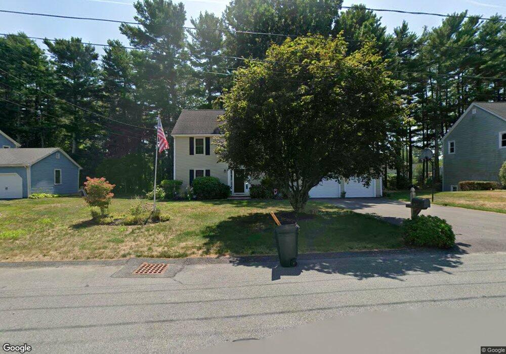
134 Partridge Cir Taunton, MA 02780
Whittenton NeighborhoodEstimated Value: $568,000 - $690,000
4
Beds
4
Baths
1,872
Sq Ft
$334/Sq Ft
Est. Value
About This Home
This home is located at 134 Partridge Cir, Taunton, MA 02780 and is currently estimated at $625,156, approximately $333 per square foot. 134 Partridge Cir is a home located in Bristol County with nearby schools including Benjamin Friedman Middle School, Joseph C. Chamberlain Elementary School, and Taunton High School.
Ownership History
Date
Name
Owned For
Owner Type
Purchase Details
Closed on
Oct 16, 1992
Sold by
Pringels Maurice R and Pringels Anita M
Bought by
Stephenson David M and Stephenson Michelle
Current Estimated Value
Home Financials for this Owner
Home Financials are based on the most recent Mortgage that was taken out on this home.
Original Mortgage
$151,000
Interest Rate
7.93%
Mortgage Type
Purchase Money Mortgage
Create a Home Valuation Report for This Property
The Home Valuation Report is an in-depth analysis detailing your home's value as well as a comparison with similar homes in the area
Home Values in the Area
Average Home Value in this Area
Purchase History
| Date | Buyer | Sale Price | Title Company |
|---|---|---|---|
| Stephenson David M | $168,000 | -- |
Source: Public Records
Mortgage History
| Date | Status | Borrower | Loan Amount |
|---|---|---|---|
| Closed | Stephenson David M | $155,990 | |
| Closed | Stephenson David M | $151,000 |
Source: Public Records
Tax History Compared to Growth
Tax History
| Year | Tax Paid | Tax Assessment Tax Assessment Total Assessment is a certain percentage of the fair market value that is determined by local assessors to be the total taxable value of land and additions on the property. | Land | Improvement |
|---|---|---|---|---|
| 2025 | $5,407 | $494,200 | $130,300 | $363,900 |
| 2024 | $5,002 | $447,000 | $130,300 | $316,700 |
| 2023 | $4,901 | $406,700 | $124,400 | $282,300 |
| 2022 | $4,792 | $363,600 | $113,500 | $250,100 |
| 2021 | $554 | $337,800 | $103,200 | $234,600 |
| 2020 | $4,623 | $311,100 | $103,200 | $207,900 |
| 2019 | $4,692 | $297,700 | $103,200 | $194,500 |
| 2018 | $4,527 | $288,000 | $104,200 | $183,800 |
| 2017 | $4,334 | $275,900 | $98,800 | $177,100 |
| 2016 | $4,180 | $266,600 | $95,900 | $170,700 |
| 2015 | $3,987 | $265,600 | $93,100 | $172,500 |
| 2014 | $3,968 | $271,600 | $93,100 | $178,500 |
Source: Public Records
Map
Nearby Homes
- 750 Whittenton St Unit 523
- 750 Whittenton St Unit 1021
- 169 Powderhorn Dr
- 59 Edgehill Rd
- 0 Montclair Ave Unit 72130752
- 16 Hunter St Unit A
- 86 Lakeview Ave
- 193 Fremont St
- 68 Sabbatia Ln
- 8 Spinnaker Ln Unit B
- 115 Ice House Rd
- 1559 Bay St Unit 53
- 0 Whittenton St
- 113 Scadding St
- 3 4th Ave
- 3 4th Ave Unit 1
- 3 4th Ave Unit 2
- 2 Upland Rd
- 214 Eldridge St
- 22 Garfield St
- 144 Partridge Cir
- 126 Partridge Cir
- 52 Paula Dr
- 156 Partridge Cir
- 68 Paula Dr
- 15 Quail Dr
- 114 Partridge Cir
- 129 Partridge Cir
- 44 Paula Dr
- 76 Paula Dr
- 8 Quail Dr
- 109 Partridge Cir
- 164 Partridge Cir
- 28 Paula Dr
- 108 Partridge Cir
- 27 Quail Dr
- 20 Quail Dr
- 20 Quail Dr Unit A-C
- 20 Quail Dr Unit C
- 20 Quail Dr Unit A