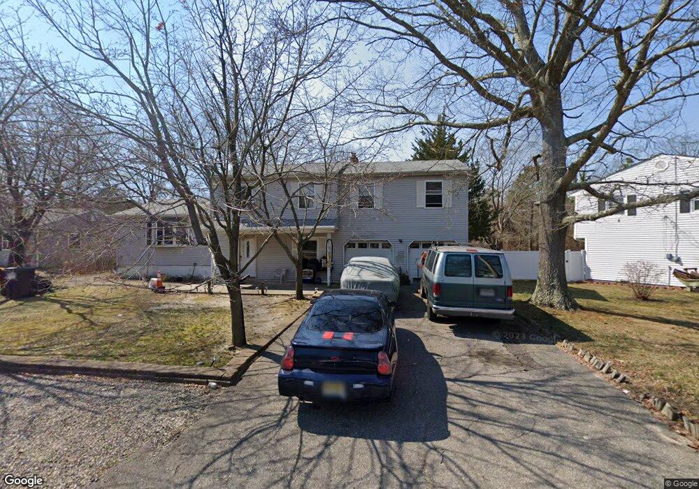
134 Pheasant Dr Bayville, NJ 08721
Estimated Value: $459,852 - $573,000
3
Beds
3
Baths
2,235
Sq Ft
$237/Sq Ft
Est. Value
About This Home
This home is located at 134 Pheasant Dr, Bayville, NJ 08721 and is currently estimated at $530,213, approximately $237 per square foot. 134 Pheasant Dr is a home located in Ocean County with nearby schools including Central Regional Middle School, Central Regional High School, and Ocean Academy.
Ownership History
Date
Name
Owned For
Owner Type
Purchase Details
Closed on
May 17, 1999
Sold by
Mata Jorge and Mata Sally
Bought by
Mata Jorge
Current Estimated Value
Purchase Details
Closed on
Apr 14, 1997
Sold by
Mata Jorge
Bought by
Sacramento Espirido and Sacramento Lidia
Home Financials for this Owner
Home Financials are based on the most recent Mortgage that was taken out on this home.
Original Mortgage
$145,000
Outstanding Balance
$18,192
Interest Rate
7.55%
Estimated Equity
$512,021
Purchase Details
Closed on
Dec 12, 1995
Sold by
Nj Residential Holdings
Bought by
Mata Jorge and Mata Sally
Create a Home Valuation Report for This Property
The Home Valuation Report is an in-depth analysis detailing your home's value as well as a comparison with similar homes in the area
Home Values in the Area
Average Home Value in this Area
Purchase History
| Date | Buyer | Sale Price | Title Company |
|---|---|---|---|
| Mata Jorge | -- | -- | |
| Sacramento Espirido | $160,000 | -- | |
| Mata Jorge | $56,500 | -- |
Source: Public Records
Mortgage History
| Date | Status | Borrower | Loan Amount |
|---|---|---|---|
| Open | Sacramento Espirido | $145,000 |
Source: Public Records
Tax History Compared to Growth
Tax History
| Year | Tax Paid | Tax Assessment Tax Assessment Total Assessment is a certain percentage of the fair market value that is determined by local assessors to be the total taxable value of land and additions on the property. | Land | Improvement |
|---|---|---|---|---|
| 2025 | $6,394 | $265,200 | $102,500 | $162,700 |
| 2024 | $6,153 | $265,200 | $102,500 | $162,700 |
| 2023 | $6,039 | $265,200 | $102,500 | $162,700 |
| 2022 | $6,039 | $265,200 | $102,500 | $162,700 |
| 2021 | $5,911 | $265,200 | $102,500 | $162,700 |
| 2020 | $5,911 | $265,200 | $102,500 | $162,700 |
| 2019 | $5,747 | $265,200 | $102,500 | $162,700 |
| 2018 | $5,728 | $265,200 | $102,500 | $162,700 |
| 2017 | $5,516 | $265,200 | $102,500 | $162,700 |
| 2016 | $5,487 | $265,200 | $102,500 | $162,700 |
| 2015 | $5,336 | $265,200 | $102,500 | $162,700 |
| 2014 | $5,185 | $265,200 | $102,500 | $162,700 |
Source: Public Records
Map
Nearby Homes
- 136 Pheasant Dr
- 132 Pheasant Dr
- 138 Pheasant Dr
- 129 Pheasant Dr
- 131 Pheasant Dr
- 127 Pheasant Dr
- 140 Pheasant Dr
- 133 Pheasant Dr
- 130 Pheasant Dr
- 142 Pheasant Dr
- 135 Pheasant Dr
- 125 Pheasant Dr
- 56 Mallard Rd
- 54 Mallard Rd
- 58 Mallard Rd
- 128 Pheasant Dr
- 137 Pheasant Dr
- 144 Pheasant Dr
- 60 Mallard Rd
- 123 Pheasant Dr