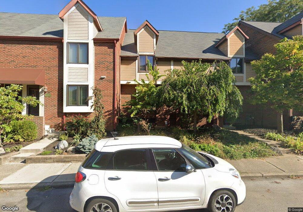
134 Price Ave Columbus, OH 43201
Short North NeighborhoodEstimated Value: $586,810 - $665,000
3
Beds
4
Baths
2,406
Sq Ft
$265/Sq Ft
Est. Value
About This Home
This home is located at 134 Price Ave, Columbus, OH 43201 and is currently estimated at $637,453, approximately $264 per square foot. 134 Price Ave is a home located in Franklin County with nearby schools including Hubbard Elementary School, Dominion Middle School, and Whetstone High School.
Ownership History
Date
Name
Owned For
Owner Type
Purchase Details
Closed on
Apr 27, 2010
Sold by
Smith Scott E
Bought by
Bray Erika R and Bray Jacob E
Current Estimated Value
Home Financials for this Owner
Home Financials are based on the most recent Mortgage that was taken out on this home.
Original Mortgage
$232,000
Outstanding Balance
$143,250
Interest Rate
3.5%
Mortgage Type
New Conventional
Estimated Equity
$494,203
Purchase Details
Closed on
Nov 2, 1992
Bought by
Smith Scott E
Purchase Details
Closed on
Nov 1, 1986
Create a Home Valuation Report for This Property
The Home Valuation Report is an in-depth analysis detailing your home's value as well as a comparison with similar homes in the area
Home Values in the Area
Average Home Value in this Area
Purchase History
| Date | Buyer | Sale Price | Title Company |
|---|---|---|---|
| Bray Erika R | $290,000 | Hummel Titl | |
| Smith Scott E | $65,000 | -- | |
| -- | $89,500 | -- |
Source: Public Records
Mortgage History
| Date | Status | Borrower | Loan Amount |
|---|---|---|---|
| Open | Bray Erika R | $232,000 |
Source: Public Records
Tax History Compared to Growth
Tax History
| Year | Tax Paid | Tax Assessment Tax Assessment Total Assessment is a certain percentage of the fair market value that is determined by local assessors to be the total taxable value of land and additions on the property. | Land | Improvement |
|---|---|---|---|---|
| 2024 | $7,283 | $162,270 | $77,000 | $85,270 |
| 2023 | $7,190 | $162,260 | $77,000 | $85,260 |
| 2022 | $7,552 | $145,610 | $31,920 | $113,690 |
| 2021 | $7,565 | $145,610 | $31,920 | $113,690 |
| 2020 | $7,575 | $145,610 | $31,920 | $113,690 |
| 2019 | $7,362 | $121,350 | $26,600 | $94,750 |
| 2018 | $7,145 | $121,350 | $26,600 | $94,750 |
| 2017 | $7,503 | $121,350 | $26,600 | $94,750 |
| 2016 | $7,649 | $115,470 | $27,720 | $87,750 |
| 2015 | $6,944 | $115,470 | $27,720 | $87,750 |
| 2014 | $6,961 | $115,470 | $27,720 | $87,750 |
| 2013 | $2,871 | $96,565 | $16,800 | $79,765 |
Source: Public Records
Map
Nearby Homes
- 915 Dennison Ave Unit 915
- 938 Hunter Ave
- 83 W 1st Ave
- 162 E 2nd Ave
- 1001 Dennison Ave
- 998 Ewing Alley Unit 998
- 85-91 W 1st Ave
- 969 Hunter Ave
- 986 Highland St
- 1025 Hunter Ave
- 884 Neil Ave
- 11 W 1st Ave Unit B
- 845 N High St Unit 404
- 845 N High St Unit 209
- 845 N High St Unit 501 & 502
- 1016 Neil Ave
- 17 W 3rd Ave Unit 212
- 17 W 3rd Ave Unit 213
- 1018 Neil Ave
- 1042 Neil Ave
- 132 Price Ave
- 136 Price Ave
- 130 Price Ave
- 138 Price Ave
- 128 Price Ave
- 140 Price Ave
- 126 Price Ave
- 142 Price Ave
- 144 Price Ave
- 120 Price Ave
- 146 Price Ave
- 125 W 2nd Ave
- 118 Price Ave
- 148 Price Ave
- 119 W 2nd Ave Unit 115
- 135 W 2nd Ave
- 115 W 2nd Ave
- 115 W 2nd Ave Unit B
- 115 W 2nd Ave Unit A
- 115 W 2nd Ave