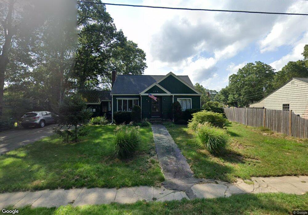
134 Raynor Ave Whitman, MA 02382
Estimated Value: $512,580 - $580,000
3
Beds
1
Bath
1,504
Sq Ft
$360/Sq Ft
Est. Value
About This Home
This home is located at 134 Raynor Ave, Whitman, MA 02382 and is currently estimated at $540,895, approximately $359 per square foot. 134 Raynor Ave is a home located in Plymouth County with nearby schools including St Bridget School.
Ownership History
Date
Name
Owned For
Owner Type
Purchase Details
Closed on
Jul 16, 2024
Sold by
Mitchell Scott
Bought by
Mitchell Ret and Mithcell
Current Estimated Value
Purchase Details
Closed on
Feb 12, 2010
Sold by
Thorp Pamela
Bought by
Mitchell Scott and Macdonald Christine
Home Financials for this Owner
Home Financials are based on the most recent Mortgage that was taken out on this home.
Original Mortgage
$247,761
Interest Rate
5.25%
Mortgage Type
FHA
Purchase Details
Closed on
Aug 22, 2005
Sold by
Zipeto Austin J and Zipeto Bonnie A
Bought by
Thorp Pamela
Create a Home Valuation Report for This Property
The Home Valuation Report is an in-depth analysis detailing your home's value as well as a comparison with similar homes in the area
Home Values in the Area
Average Home Value in this Area
Purchase History
| Date | Buyer | Sale Price | Title Company |
|---|---|---|---|
| Mitchell Ret | -- | None Available | |
| Mitchell Ret | -- | None Available | |
| Mitchell Scott | $265,000 | -- | |
| Thorp Pamela | $324,900 | -- | |
| Mitchell Scott | $265,000 | -- | |
| Thorp Pamela | $324,900 | -- |
Source: Public Records
Mortgage History
| Date | Status | Borrower | Loan Amount |
|---|---|---|---|
| Previous Owner | Mitchell Scott | $247,761 | |
| Previous Owner | Thorp Pamela | $203,000 | |
| Previous Owner | Thorp Pamela | $197,000 |
Source: Public Records
Tax History Compared to Growth
Tax History
| Year | Tax Paid | Tax Assessment Tax Assessment Total Assessment is a certain percentage of the fair market value that is determined by local assessors to be the total taxable value of land and additions on the property. | Land | Improvement |
|---|---|---|---|---|
| 2025 | $5,894 | $449,200 | $208,200 | $241,000 |
| 2024 | $5,482 | $430,300 | $204,100 | $226,200 |
| 2023 | $5,245 | $386,500 | $177,000 | $209,500 |
| 2022 | $5,180 | $355,800 | $160,900 | $194,900 |
| 2021 | $4,994 | $322,200 | $147,800 | $174,400 |
| 2020 | $4,904 | $309,400 | $140,800 | $168,600 |
| 2019 | $4,579 | $297,700 | $140,800 | $156,900 |
| 2018 | $4,425 | $276,400 | $132,700 | $143,700 |
| 2017 | $4,161 | $275,900 | $132,700 | $143,200 |
| 2016 | $4,097 | $262,800 | $125,700 | $137,100 |
| 2015 | $3,793 | $243,000 | $110,600 | $132,400 |
Source: Public Records
Map
Nearby Homes
- 40 Lazel St
- 170 Pleasant St
- 23 Reed Place
- 608 Plymouth St
- 110 South Ave Unit 14
- 110 South Ave
- 54-56 Stetson St
- 684 South Ave
- 48 Day St
- 20 Elm Place
- 63 Dewey Ave
- 21 Strawberry Ln
- 35 Dana St
- 532 Washington St
- 214 Winter St
- 53 Temple St
- 131 Holly Ridge Dr
- 135-137 Temple St
- 164 Warren Ave
- 150 Harvard St
- 142 Raynor Ave
- 126 Raynor Ave
- 90 Lazel St
- 87 Cherry St
- 135 Raynor Ave
- 125 Raynor Ave
- 95 Cherry St
- 100 Lazel St
- 84 Cherry St
- F2 Auburnville Way F2 Unit F2
- 90 Cherry St Unit 90
- 116 Raynor Ave
- 116 Raynor Ave Unit 116
- 83 Lazel St
- 60 Lazel St
- 95 Lazel St
- 157 Raynor Ave
- 47 Cherry St
- 115 Raynor Ave
- 103 Cherry St