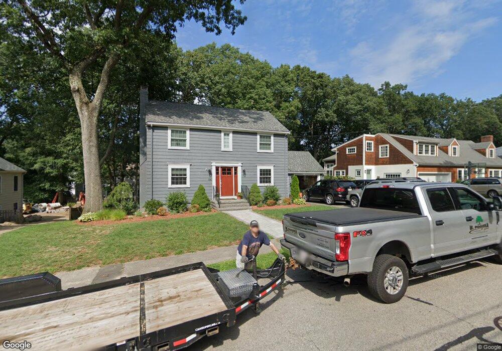
134 Richdale Rd Needham Heights, MA 02494
Estimated Value: $1,349,000 - $1,553,000
3
Beds
2
Baths
1,034
Sq Ft
$1,400/Sq Ft
Est. Value
About This Home
This home is located at 134 Richdale Rd, Needham Heights, MA 02494 and is currently estimated at $1,447,537, approximately $1,399 per square foot. 134 Richdale Rd is a home located in Norfolk County with nearby schools including Mitchell Elementary School, High Rock Middle School, and Pollard Middle School.
Ownership History
Date
Name
Owned For
Owner Type
Purchase Details
Closed on
Jul 10, 2018
Sold by
Brian J Hallahan Ret
Bought by
Friend Michael and Friend Meredith
Current Estimated Value
Home Financials for this Owner
Home Financials are based on the most recent Mortgage that was taken out on this home.
Original Mortgage
$600,000
Outstanding Balance
$521,139
Interest Rate
4.6%
Mortgage Type
New Conventional
Estimated Equity
$926,398
Purchase Details
Closed on
Apr 1, 2013
Sold by
Hallahan Brian J and Hallahan Mary C
Bought by
Brian J Hallahan Ret and Hallahan Brian J
Purchase Details
Closed on
Jul 10, 1985
Bought by
Hallahan Brian J and Hallahan Mary C
Create a Home Valuation Report for This Property
The Home Valuation Report is an in-depth analysis detailing your home's value as well as a comparison with similar homes in the area
Home Values in the Area
Average Home Value in this Area
Purchase History
| Date | Buyer | Sale Price | Title Company |
|---|---|---|---|
| Friend Michael | $888,000 | -- | |
| Brian J Hallahan Ret | -- | -- | |
| Hallahan Brian J | $218,000 | -- |
Source: Public Records
Mortgage History
| Date | Status | Borrower | Loan Amount |
|---|---|---|---|
| Open | Friend Michael | $600,000 | |
| Previous Owner | Hallahan Brian J | $100,000 | |
| Previous Owner | Hallahan Brian J | $135,000 | |
| Previous Owner | Hallahan Brian J | $152,000 |
Source: Public Records
Tax History Compared to Growth
Tax History
| Year | Tax Paid | Tax Assessment Tax Assessment Total Assessment is a certain percentage of the fair market value that is determined by local assessors to be the total taxable value of land and additions on the property. | Land | Improvement |
|---|---|---|---|---|
| 2025 | $13,585 | $1,281,600 | $772,500 | $509,100 |
| 2024 | $11,084 | $885,300 | $551,800 | $333,500 |
| 2023 | $11,242 | $862,100 | $551,800 | $310,300 |
| 2022 | $10,478 | $783,700 | $484,000 | $299,700 |
| 2021 | $10,212 | $783,700 | $484,000 | $299,700 |
| 2020 | $9,872 | $790,400 | $484,000 | $306,400 |
| 2019 | $8,350 | $673,900 | $440,000 | $233,900 |
| 2018 | $7,444 | $626,600 | $440,000 | $186,600 |
| 2017 | $7,171 | $603,100 | $440,000 | $163,100 |
| 2016 | $6,986 | $605,400 | $440,000 | $165,400 |
| 2015 | $6,835 | $605,400 | $440,000 | $165,400 |
| 2014 | $6,521 | $560,200 | $400,000 | $160,200 |
Source: Public Records
Map
Nearby Homes
- 23 Cheney St
- 190 Brookline St
- 332 Hillcrest Rd
- 9 Jayne Rd
- 143 Hunting Rd
- 556 Webster St
- 62 Washington Ave
- 36 Davenport Rd
- 40 Otis St Unit L
- 42 Otis St Unit R
- 400 Hunnewell St Unit 103
- 445 Hillside Ave
- 701 Greendale Ave
- 3 Crescent Rd
- 26 Pinewood Rd
- 379 Hunnewell St Unit 379
- 7 Avery St
- 62 Evelyn Rd
- 154 Warren St
- 1 Williams Ct
- 128 Richdale Rd
- 140 Richdale Rd
- 159 Parker Rd
- 159 Parker Rd Unit 159
- 153 Parker Rd
- 122 Richdale Rd
- 131 Richdale Rd
- 167 Parker Rd
- 146 Richdale Rd
- 139 Richdale Rd
- 147 Parker Rd
- 125 Richdale Rd
- 145 Richdale Rd
- 114 Richdale Rd
- 117 Richdale Rd
- 139 Parker Rd
- 177 Parker Rd
- 158 Parker Rd
- 166 Parker Rd
- 123 Paul Revere Rd