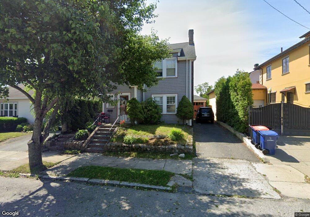
134 Ryan St New Bedford, MA 02740
Downtown New Bedford NeighborhoodEstimated Value: $436,851 - $469,000
4
Beds
2
Baths
1,100
Sq Ft
$411/Sq Ft
Est. Value
About This Home
This home is located at 134 Ryan St, New Bedford, MA 02740 and is currently estimated at $452,213, approximately $411 per square foot. 134 Ryan St is a home located in Bristol County with nearby schools including Betsey B. Winslow Elementary School, Keith Middle School, and New Bedford High School.
Ownership History
Date
Name
Owned For
Owner Type
Purchase Details
Closed on
Sep 26, 2003
Sold by
Santos Ryan A and Santos Annemarie
Bought by
Wang Xin Hai and Chen Xiu Hui
Current Estimated Value
Home Financials for this Owner
Home Financials are based on the most recent Mortgage that was taken out on this home.
Original Mortgage
$176,200
Interest Rate
6.29%
Mortgage Type
Purchase Money Mortgage
Purchase Details
Closed on
Jun 30, 1999
Sold by
Martin Clinton J and Martin Patricia A
Bought by
Santos Ryan A and Wilde Annemarie
Purchase Details
Closed on
Sep 28, 1990
Sold by
Clavin C Peter
Bought by
Arbec Patricia A
Create a Home Valuation Report for This Property
The Home Valuation Report is an in-depth analysis detailing your home's value as well as a comparison with similar homes in the area
Home Values in the Area
Average Home Value in this Area
Purchase History
| Date | Buyer | Sale Price | Title Company |
|---|---|---|---|
| Wang Xin Hai | $235,000 | -- | |
| Wang Xin Hai | $235,000 | -- | |
| Santos Ryan A | $134,600 | -- | |
| Santos Ryan A | $134,600 | -- | |
| Arbec Patricia A | $115,000 | -- |
Source: Public Records
Mortgage History
| Date | Status | Borrower | Loan Amount |
|---|---|---|---|
| Open | Arbec Patricia A | $165,000 | |
| Closed | Arbec Patricia A | $176,200 |
Source: Public Records
Tax History Compared to Growth
Tax History
| Year | Tax Paid | Tax Assessment Tax Assessment Total Assessment is a certain percentage of the fair market value that is determined by local assessors to be the total taxable value of land and additions on the property. | Land | Improvement |
|---|---|---|---|---|
| 2025 | $4,377 | $387,000 | $99,700 | $287,300 |
| 2024 | $4,154 | $346,200 | $95,000 | $251,200 |
| 2023 | $4,574 | $320,100 | $85,100 | $235,000 |
| 2022 | $4,129 | $265,700 | $81,000 | $184,700 |
| 2021 | $3,971 | $254,700 | $81,000 | $173,700 |
| 2020 | $3,841 | $237,700 | $84,100 | $153,600 |
| 2019 | $3,722 | $226,000 | $85,700 | $140,300 |
| 2018 | $3,471 | $208,700 | $85,700 | $123,000 |
| 2017 | $3,348 | $200,600 | $85,700 | $114,900 |
| 2016 | $3,169 | $192,200 | $81,000 | $111,200 |
| 2015 | $3,033 | $192,800 | $84,100 | $108,700 |
| 2014 | $2,940 | $193,900 | $85,700 | $108,200 |
Source: Public Records
Map
Nearby Homes
- 128 Ryan St
- 538 Rockdale Ave
- 536 Rockdale Ave
- 75 Reed St
- 534 Rockdale Ave
- 554 Rockdale Ave
- 99 Reed St
- 82 Reed St
- 537 Rockdale Ave Unit 539
- 74 Reed St
- 490 Bedford St
- 478 Bedford St
- 560 Rockdale Ave
- 150 Ryan St
- 96 Reed St
- 107 Reed St
- 531 Rockdale Ave Unit 533
- 520 Rockdale Ave
- 520 Rockdale Ave Unit 2
- 151 Ryan St