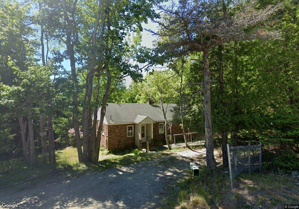
134 Seal Cove Rd Southwest Harbor, ME 04679
Estimated Value: $464,000 - $661,000
2
Beds
1
Bath
1,416
Sq Ft
$373/Sq Ft
Est. Value
About This Home
This home is located at 134 Seal Cove Rd, Southwest Harbor, ME 04679 and is currently estimated at $528,057, approximately $372 per square foot. 134 Seal Cove Rd is a home with nearby schools including Pemetic Elementary School and Mt. Desert Island High School.
Ownership History
Date
Name
Owned For
Owner Type
Purchase Details
Closed on
May 9, 2025
Sold by
Willey-Ward Diane M and Willey Allen B
Bought by
Willey Shana
Current Estimated Value
Home Financials for this Owner
Home Financials are based on the most recent Mortgage that was taken out on this home.
Original Mortgage
$160,000
Outstanding Balance
$159,145
Interest Rate
6.65%
Mortgage Type
Purchase Money Mortgage
Estimated Equity
$368,912
Purchase Details
Closed on
Apr 4, 2025
Sold by
Willey Berten W Est and Willey-Ward
Bought by
Willey-Ward Diane M and Willey Allen B
Home Financials for this Owner
Home Financials are based on the most recent Mortgage that was taken out on this home.
Original Mortgage
$160,000
Outstanding Balance
$159,145
Interest Rate
6.65%
Mortgage Type
Purchase Money Mortgage
Estimated Equity
$368,912
Create a Home Valuation Report for This Property
The Home Valuation Report is an in-depth analysis detailing your home's value as well as a comparison with similar homes in the area
Home Values in the Area
Average Home Value in this Area
Purchase History
| Date | Buyer | Sale Price | Title Company |
|---|---|---|---|
| Willey Shana | $200,000 | None Available | |
| Willey Shana | $200,000 | None Available | |
| Willey Shana | $200,000 | None Available | |
| Willey-Ward Diane M | -- | None Available | |
| Willey-Ward Diane M | -- | None Available | |
| Willey-Ward Diane M | -- | None Available |
Source: Public Records
Mortgage History
| Date | Status | Borrower | Loan Amount |
|---|---|---|---|
| Open | Willey Shana | $160,000 | |
| Closed | Willey Shana | $160,000 |
Source: Public Records
Tax History Compared to Growth
Tax History
| Year | Tax Paid | Tax Assessment Tax Assessment Total Assessment is a certain percentage of the fair market value that is determined by local assessors to be the total taxable value of land and additions on the property. | Land | Improvement |
|---|---|---|---|---|
| 2024 | $3,932 | $435,900 | $244,100 | $191,800 |
| 2023 | $3,327 | $204,600 | $111,700 | $92,900 |
| 2022 | $3,008 | $204,600 | $111,700 | $92,900 |
| 2021 | $2,999 | $204,600 | $111,700 | $92,900 |
| 2020 | $2,985 | $204,600 | $111,700 | $92,900 |
| 2019 | $2,854 | $204,600 | $111,700 | $92,900 |
| 2018 | $3,379 | $204,600 | $111,700 | $92,900 |
| 2017 | $5,027 | $204,600 | $111,700 | $92,900 |
| 2016 | $1,483 | $204,600 | $111,700 | $92,900 |
| 2015 | $2,631 | $204,600 | $111,700 | $92,900 |
| 2014 | $2,631 | $204,600 | $111,700 | $92,900 |
| 2013 | $2,631 | $204,600 | $111,700 | $92,900 |
Source: Public Records
Map
Nearby Homes
- 16 Long Pond Rd
- 17 Freeman Ridge Rd
- 142 Seal Cove Rd
- 25 Long Pond Rd
- 14 Seal Cove Rd
- 00 Fernald Point Rd
- 109 Freeman Ridge Rd
- 471 Main St
- 10 Robinson Ln Unit 18
- 120 Clark Point Rd
- 100 Bass Harbor Rd
- 113 Bass Harbor Rd
- 77 Manchester Rd
- 000 Seawall Map Lot 17 11-01 Rd
- 000
- 3 and 5 Graves Lane Harbor NE
- 30 Neighborhood Rd
- 28 Mount Gilboa Way
- 65 Summit Rd
- 49 Summit Rd
- 138 Seal Cove Rd
- 12 Freeman Ridge Rd
- #4 Granite Rd Off Freeman Ridge Rd
- 4 Freeman Ridge Rd
- 5 Long Pond Rd
- 131 Seal Cove Rd
- 143 Seal Cove Rd
- 1 Sea Heather Ln
- 8 Freeman Ridge Rd
- 124 Seal Cove Rd
- 14 Freeman Ridge Rd
- 28 Freeman Ridge Rd
- 150 Seal Cove Rd
- 146 Seal Cove Rd
- 80 Long Pond Rd
- 7 Freeman Ridge Rd
- 0 Long Pond Rd
- 9 Freeman Ridge Rd
- 4 Long Pond Rd
- 133 Seal Cove Rd