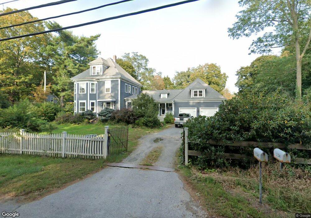
134 Spring St Hanson, MA 02341
Estimated Value: $703,000 - $978,000
4
Beds
2
Baths
2,160
Sq Ft
$391/Sq Ft
Est. Value
About This Home
This home is located at 134 Spring St, Hanson, MA 02341 and is currently estimated at $844,408, approximately $390 per square foot. 134 Spring St is a home located in Plymouth County.
Ownership History
Date
Name
Owned For
Owner Type
Purchase Details
Closed on
Jul 29, 2024
Sold by
Mulledy Thomas P and Mulledy Leslie J
Bought by
Mulledy
Current Estimated Value
Purchase Details
Closed on
Mar 12, 2004
Sold by
Ainslie Lawrence D
Bought by
Mulledy Thomas P and Mulledy Leslie J
Create a Home Valuation Report for This Property
The Home Valuation Report is an in-depth analysis detailing your home's value as well as a comparison with similar homes in the area
Home Values in the Area
Average Home Value in this Area
Purchase History
| Date | Buyer | Sale Price | Title Company |
|---|---|---|---|
| Mulledy | -- | None Available | |
| Mulledy | -- | None Available | |
| Mulledy Thomas P | $400,000 | -- | |
| Mulledy Thomas P | $400,000 | -- |
Source: Public Records
Mortgage History
| Date | Status | Borrower | Loan Amount |
|---|---|---|---|
| Previous Owner | Mulledy Thomas P | $406,955 | |
| Previous Owner | Mulledy Thomas P | $50,000 |
Source: Public Records
Tax History
| Year | Tax Paid | Tax Assessment Tax Assessment Total Assessment is a certain percentage of the fair market value that is determined by local assessors to be the total taxable value of land and additions on the property. | Land | Improvement |
|---|---|---|---|---|
| 2025 | $8,871 | $663,000 | $164,900 | $498,100 |
| 2024 | $8,615 | $643,900 | $160,200 | $483,700 |
| 2023 | $8,244 | $581,400 | $160,200 | $421,200 |
| 2022 | $8,058 | $534,000 | $145,600 | $388,400 |
| 2021 | $7,286 | $482,500 | $140,000 | $342,500 |
| 2020 | $6,713 | $439,600 | $135,200 | $304,400 |
| 2019 | $5,827 | $375,200 | $132,600 | $242,600 |
| 2018 | $5,715 | $361,000 | $127,600 | $233,400 |
| 2017 | $4,875 | $305,100 | $121,500 | $183,600 |
| 2016 | $4,919 | $297,200 | $121,500 | $175,700 |
| 2015 | $4,674 | $293,600 | $121,500 | $172,100 |
Source: Public Records
Map
Nearby Homes
- 724 Whitman St
- Lot 5 Princeton Way
- 84 Liberty St
- 22 Howland Trail Unit 34
- 17 Hayford Trail Unit 12
- 7 Hayford Trail Unit 12
- 5 Hayford Trail Unit 11
- 23 Live Oak Way
- 139 Fairwood Dr
- 26 Stonebridge Dr
- 361 County Rd
- 10 Proud Foot Way
- 361A County Rd
- 161 Winter St Unit 11
- 108 Waterford Dr
- Lot 6 Way
- 430 Brook Bend Rd
- 10 Birch Bottom Cir
- 214 Winter St
- 61 Sawmill Ln Unit 61
Your Personal Tour Guide
Ask me questions while you tour the home.