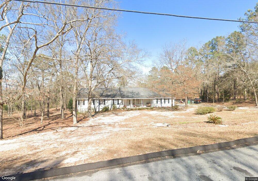
134 Stewart Dr Warner Robins, GA 31093
Estimated Value: $244,000 - $277,247
3
Beds
2
Baths
2,211
Sq Ft
$118/Sq Ft
Est. Value
About This Home
This home is located at 134 Stewart Dr, Warner Robins, GA 31093 and is currently estimated at $260,312, approximately $117 per square foot. 134 Stewart Dr is a home located in Houston County with nearby schools including Northside Elementary School, Northside Middle School, and Northside High School.
Ownership History
Date
Name
Owned For
Owner Type
Purchase Details
Closed on
Jun 27, 1996
Sold by
Clements Larry P
Bought by
Clements Larry P and Clements Marie*
Current Estimated Value
Purchase Details
Closed on
Apr 8, 1996
Sold by
Clements Larry P and Clements Marie
Bought by
Clements Larry P
Purchase Details
Closed on
Aug 8, 1988
Sold by
Dawson Harmon O
Bought by
Clements Larry P and Clements Marie
Purchase Details
Closed on
Oct 16, 1985
Sold by
First National Bank Of Atlanta
Bought by
Dawson Harmon O
Purchase Details
Closed on
Oct 1, 1985
Sold by
Clements Elton L
Bought by
First National Bank Of Atlanta
Create a Home Valuation Report for This Property
The Home Valuation Report is an in-depth analysis detailing your home's value as well as a comparison with similar homes in the area
Home Values in the Area
Average Home Value in this Area
Purchase History
| Date | Buyer | Sale Price | Title Company |
|---|---|---|---|
| Clements Larry P | -- | -- | |
| Clements Larry P | -- | -- | |
| Clements Larry P | -- | -- | |
| Dawson Harmon O | -- | -- | |
| First National Bank Of Atlanta | -- | -- |
Source: Public Records
Tax History Compared to Growth
Tax History
| Year | Tax Paid | Tax Assessment Tax Assessment Total Assessment is a certain percentage of the fair market value that is determined by local assessors to be the total taxable value of land and additions on the property. | Land | Improvement |
|---|---|---|---|---|
| 2024 | $1,923 | $82,400 | $11,480 | $70,920 |
| 2023 | $1,598 | $68,120 | $11,480 | $56,640 |
| 2022 | $1,433 | $61,280 | $10,520 | $50,760 |
| 2021 | $1,326 | $56,560 | $10,520 | $46,040 |
| 2020 | $1,241 | $52,840 | $10,520 | $42,320 |
| 2019 | $1,241 | $52,840 | $10,520 | $42,320 |
| 2018 | $1,241 | $52,840 | $10,520 | $42,320 |
| 2017 | $1,242 | $52,840 | $10,520 | $42,320 |
| 2016 | $1,244 | $52,840 | $10,520 | $42,320 |
| 2015 | $1,247 | $52,840 | $10,520 | $42,320 |
| 2014 | -- | $52,840 | $10,520 | $42,320 |
| 2013 | -- | $56,960 | $10,520 | $46,440 |
Source: Public Records
Map
Nearby Homes
- 1089 Dunbar Rd
- 300 Air View Dr Unit 1
- Magnolia Plan at Ridgeview
- Oakwood Plan at Ridgeview
- Cypress Plan at Ridgeview
- Jackson Plan at Ridgeview
- Aspen Plan at Ridgeview
- 302 Air View Dr Unit 2
- 302 Air View Dr
- 312 Air View Dr Unit 7
- 317 Air View Dr Unit 15
- 304 Air View Dr Unit 3
- 304 Air View Dr
- 307 Air View Dr
- 307 Air View Dr Unit 17
- 107 Stonefield Ct
- 403 Fieldstone Rd
- 409 Fieldstone Rd
- 108 Jessica Dr
- 411 High View Way
- 132 Stewart Dr
- 122 Stewart Dr
- 133 Stewart Dr
- 131 Stewart Dr
- 135 Stewart Dr
- 203 Briar Ridge Dr
- 137 Stewart Dr
- 201 Echeconnee Ln
- 142 Stewart Dr
- 139 Stewart Dr
- 141 Stewart Dr
- 123 Stewart Dr
- 121 Stewart Dr
- 148 Stewart Dr
- 145 Stewart Dr
- 204 Echeconnee Ln
- 207 Echeconnee Ln
- 150 Stewart Dr
- 147 Stewart Dr
- 114 Stewart Dr