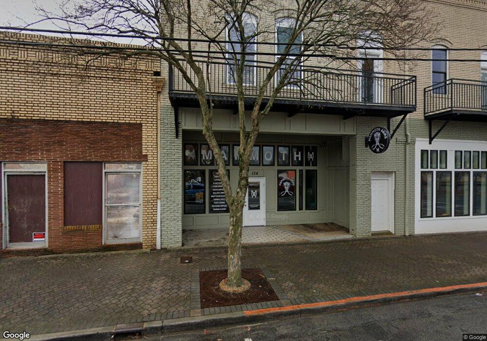
134 W Broad St Unit &136 Griffin, GA 30223
Spalding County NeighborhoodEstimated Value: $684,349
--
Bed
--
Bath
11,389
Sq Ft
$60/Sq Ft
Est. Value
About This Home
This home is located at 134 W Broad St Unit &136, Griffin, GA 30223 and is currently estimated at $684,349, approximately $60 per square foot. 134 W Broad St Unit &136 is a home located in Spalding County with nearby schools including Crescent Road Elementary School, Rehoboth Road Middle School, and Griffin High School.
Ownership History
Date
Name
Owned For
Owner Type
Purchase Details
Closed on
May 1, 2025
Sold by
Morris Steve
Bought by
Nguyen Tuyen Anle
Current Estimated Value
Home Financials for this Owner
Home Financials are based on the most recent Mortgage that was taken out on this home.
Original Mortgage
$650,000
Outstanding Balance
$583,988
Interest Rate
6.64%
Mortgage Type
New Conventional
Estimated Equity
$100,361
Purchase Details
Closed on
Jun 18, 2020
Sold by
Heath Virgil W
Bought by
Morris Steve
Purchase Details
Closed on
Aug 9, 2018
Sold by
Bailey Winfred L
Bought by
Heath Virgil W
Purchase Details
Closed on
May 22, 2001
Sold by
Callahan Brinson
Bought by
Mathison Home Builders Inc
Purchase Details
Closed on
Nov 6, 1989
Sold by
Smaha Joseph A
Bought by
Callahan Brinson
Purchase Details
Closed on
Sep 1, 1986
Sold by
Smaha Margaret F
Bought by
Smaha Joseph A
Purchase Details
Closed on
Jul 22, 1981
Sold by
Smaha Mrs George Bolis Estate
Bought by
Smaha Margaret F
Purchase Details
Closed on
Jun 23, 1928
Bought by
Smaha Mrs George Bolis Estate
Create a Home Valuation Report for This Property
The Home Valuation Report is an in-depth analysis detailing your home's value as well as a comparison with similar homes in the area
Home Values in the Area
Average Home Value in this Area
Purchase History
| Date | Buyer | Sale Price | Title Company |
|---|---|---|---|
| Nguyen Tuyen Anle | $675,000 | -- | |
| Morris Steve | $50,000 | -- | |
| Heath Virgil W | $85,000 | -- | |
| Mathison Home Builders Inc | $150,000 | -- | |
| Callahan Brinson | $40,000 | -- | |
| Smaha Joseph A | -- | -- | |
| Smaha Margaret F | -- | -- | |
| Smaha Mrs George Bolis Estate | -- | -- |
Source: Public Records
Mortgage History
| Date | Status | Borrower | Loan Amount |
|---|---|---|---|
| Open | Nguyen Tuyen Anle | $650,000 |
Source: Public Records
Tax History Compared to Growth
Tax History
| Year | Tax Paid | Tax Assessment Tax Assessment Total Assessment is a certain percentage of the fair market value that is determined by local assessors to be the total taxable value of land and additions on the property. | Land | Improvement |
|---|---|---|---|---|
| 2024 | $5,456 | $141,399 | $15,400 | $125,999 |
| 2023 | $4,098 | $72,121 | $17,600 | $54,521 |
| 2022 | $2,882 | $72,121 | $17,600 | $54,521 |
| 2021 | $1,508 | $37,736 | $16,000 | $21,736 |
| 2020 | $1,508 | $37,736 | $16,000 | $21,736 |
| 2019 | $1,384 | $37,736 | $16,000 | $21,736 |
| 2018 | $1,594 | $37,736 | $16,000 | $21,736 |
| 2017 | $1,560 | $37,736 | $16,000 | $21,736 |
| 2016 | $1,585 | $37,736 | $16,000 | $21,736 |
| 2015 | $1,611 | $37,736 | $16,000 | $21,736 |
| 2014 | $1,661 | $37,757 | $16,000 | $21,757 |
Source: Public Records
Map
Nearby Homes
- 218 W Central Ave
- 102 N Hill St Unit 304
- 102 N Hill St Unit 303
- 215 W Chappell St
- 216 N 6th St
- 321 N 10th St
- 222 E Chappell St
- 325 W Quilly St
- 333 N 10th St
- 223 N 5th St
- 833 A&b E Tinsley St
- 205 W Tinsley St
- 418 N 9th St
- 218 E Tinsley St
- 411 Palace St
- 421 N 6th St
- 314 E Quilly St
- 233 E Tinsley St
- 525 W Quilly St
- 406 E Solomon St
- 134 W Broad St
- 130 W Broad St
- 202 W Broad St
- 0 Wesminster Cir Unit LOT 1 3004005
- 0 Wesminster Cir Unit LOT 4 3003991
- 0 Wesminster Cir Unit LOT 2 3003964
- 0 Wesminster Cir Unit LOT 7 3003922
- 0 Wesminster Cir Unit LOT 3 3003978
- 0 Wesminster Cir Unit 3259492
- 0 Wesminster Cir Unit 7540789
- 0 Wesminster Cir Unit 8355411
- 0 Wesminster Cir Unit 8886349
- 0 Wesminster Cir Unit 8910137
- 0 Wesminster Cir Unit 3002412
- 0 Wesminster Cir Unit 3224130
- 213 W Broad St
- 113 W Slaton Ave
- 131 N Hill St
- 127-B W Solomon St
- 508 W Broadway St