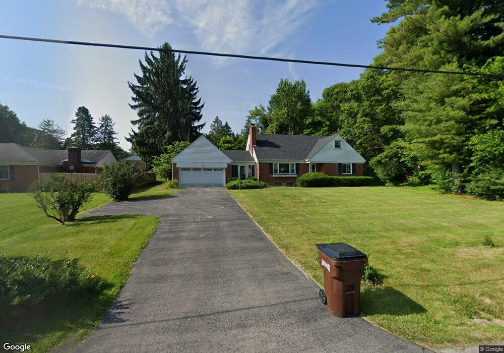
134 Westbrook Rd Dayton, OH 45415
Estimated Value: $208,603 - $231,000
4
Beds
2
Baths
1,742
Sq Ft
$126/Sq Ft
Est. Value
About This Home
This home is located at 134 Westbrook Rd, Dayton, OH 45415 and is currently estimated at $219,401, approximately $125 per square foot. 134 Westbrook Rd is a home located in Montgomery County with nearby schools including Valerie Elementary School, Imagine Schools - Woodbury Academy, and Horizon Science Academy-Dayton Elementary School.
Ownership History
Date
Name
Owned For
Owner Type
Purchase Details
Closed on
May 22, 2002
Sold by
Linder Cory D and Linder Lyndall H
Bought by
Linder Gina L and Linder Lyndall H
Current Estimated Value
Home Financials for this Owner
Home Financials are based on the most recent Mortgage that was taken out on this home.
Original Mortgage
$83,500
Outstanding Balance
$35,433
Interest Rate
7%
Estimated Equity
$183,968
Purchase Details
Closed on
Oct 13, 2000
Sold by
Ryan Nicholas A
Bought by
Linder Cory D and Linder Lyndall H
Home Financials for this Owner
Home Financials are based on the most recent Mortgage that was taken out on this home.
Original Mortgage
$81,442
Interest Rate
7.9%
Mortgage Type
FHA
Create a Home Valuation Report for This Property
The Home Valuation Report is an in-depth analysis detailing your home's value as well as a comparison with similar homes in the area
Home Values in the Area
Average Home Value in this Area
Purchase History
| Date | Buyer | Sale Price | Title Company |
|---|---|---|---|
| Linder Gina L | -- | -- | |
| Linder Cory D | $81,500 | -- |
Source: Public Records
Mortgage History
| Date | Status | Borrower | Loan Amount |
|---|---|---|---|
| Open | Linder Gina L | $83,500 | |
| Closed | Linder Cory D | $81,442 |
Source: Public Records
Tax History Compared to Growth
Tax History
| Year | Tax Paid | Tax Assessment Tax Assessment Total Assessment is a certain percentage of the fair market value that is determined by local assessors to be the total taxable value of land and additions on the property. | Land | Improvement |
|---|---|---|---|---|
| 2024 | $2,513 | $50,630 | $3,600 | $47,030 |
| 2023 | $2,513 | $50,630 | $3,600 | $47,030 |
| 2022 | $2,124 | $34,680 | $2,470 | $32,210 |
| 2021 | $2,113 | $34,680 | $2,470 | $32,210 |
| 2020 | $2,107 | $34,680 | $2,470 | $32,210 |
| 2019 | $1,652 | $26,870 | $2,470 | $24,400 |
| 2018 | $1,654 | $26,870 | $2,470 | $24,400 |
| 2017 | $1,642 | $26,870 | $2,470 | $24,400 |
| 2016 | $1,491 | $24,450 | $2,470 | $21,980 |
| 2015 | $1,419 | $24,450 | $2,470 | $21,980 |
| 2014 | $1,419 | $24,450 | $2,470 | $21,980 |
| 2012 | -- | $29,500 | $5,430 | $24,070 |
Source: Public Records
Map
Nearby Homes
- 71 Westbrook Rd
- 7815 N Main St Unit 14
- 7725 Harrington Ave
- 0 Springway Dr Unit 927025
- 161 Ashbrook Rd
- 7935 Harrington Ave
- 228 Prospect Ave
- 7851 Volk Dr
- 8175 Inwood Ave
- 6229 Cheri Lynne Dr
- 4400 Berquist Dr
- 5326 Greencroft Dr Unit 5324
- 5400 Bromwick Dr
- 159 Burgess Ave
- 0 Elgin Roof Rd
- 5025 Basore Rd
- 5146 Weddington Dr
- 1555 1557 Shiloh Springs Rd Unit 1555 1557
- 6552 Stillcrest Way
- 5615 Denlinger Rd
- 5969 Barbanna Ln
- 144 Westbrook Rd
- 5949 Barbanna Ln
- 5968 Algoma St
- 125 Westbrook Rd
- 125 Westbrook Rd
- 5950 Algoma St
- 135 Westbrook Rd
- 5966 Barbanna Ln
- 115 Westbrook Rd
- 5923 Barbanna Ln
- 145 Westbrook Rd
- 5924 Algoma St
- 215 Westbrook Rd
- 5950 Barbanna Ln
- 56 Westbrook Rd
- 5969 Algoma St
- 5907 Barbanna Ln
- 0 Westbrook Rd
- 5924 Barbanna Ln