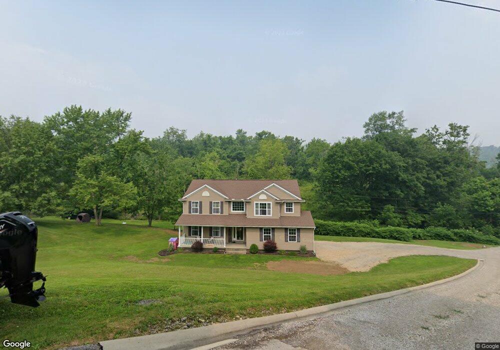
134 Westview Dr Barnesville, OH 43713
Estimated Value: $182,000 - $369,169
4
Beds
3
Baths
2,022
Sq Ft
$140/Sq Ft
Est. Value
About This Home
This home is located at 134 Westview Dr, Barnesville, OH 43713 and is currently estimated at $282,292, approximately $139 per square foot. 134 Westview Dr is a home with nearby schools including Barnesville Elementary School, Barnesville Middle School, and Barnesville High School.
Ownership History
Date
Name
Owned For
Owner Type
Purchase Details
Closed on
Mar 6, 2015
Sold by
Hannahs Tommy J and Hannahs Jeannie K
Bought by
Vanhorn Scott and Vanhorn Casey
Current Estimated Value
Purchase Details
Closed on
Oct 17, 2012
Sold by
Smith Terry L and Smith Nancy K
Bought by
Hannahs Tommy J and Hannahs Jeanne K
Purchase Details
Closed on
Mar 5, 1996
Sold by
Smith Terry L and Smith Nancy K
Bought by
Smith Terry L and Smith Nancy K
Purchase Details
Closed on
Jan 9, 1992
Sold by
Cook Donald C and Cook Violet E
Bought by
Cook Donald C and Cook Violet E
Purchase Details
Closed on
Jan 1, 1986
Sold by
Price Samuel
Bought by
Price Samuel
Create a Home Valuation Report for This Property
The Home Valuation Report is an in-depth analysis detailing your home's value as well as a comparison with similar homes in the area
Home Values in the Area
Average Home Value in this Area
Purchase History
| Date | Buyer | Sale Price | Title Company |
|---|---|---|---|
| Vanhorn Scott | -- | Attorney | |
| Hannahs Tommy J | $5,000 | Attorney | |
| Yarnall Brian | $12,500 | Attorney | |
| Smith Terry L | -- | -- | |
| Cook Donald C | $5,000 | -- | |
| Price Samuel | -- | -- |
Source: Public Records
Tax History Compared to Growth
Tax History
| Year | Tax Paid | Tax Assessment Tax Assessment Total Assessment is a certain percentage of the fair market value that is determined by local assessors to be the total taxable value of land and additions on the property. | Land | Improvement |
|---|---|---|---|---|
| 2024 | $4,047 | $125,350 | $6,910 | $118,440 |
| 2023 | $3,264 | $96,930 | $4,490 | $92,440 |
| 2022 | $3,262 | $96,932 | $4,490 | $92,442 |
| 2021 | $3,269 | $96,932 | $4,490 | $92,442 |
| 2020 | $2,849 | $80,780 | $3,740 | $77,040 |
| 2019 | $2,851 | $80,780 | $3,740 | $77,040 |
| 2018 | $2,596 | $80,780 | $3,740 | $77,040 |
| 2017 | $2,358 | $64,050 | $2,270 | $61,780 |
| 2016 | $2,206 | $64,050 | $2,270 | $61,780 |
| 2015 | $78 | $2,270 | $2,270 | $0 |
| 2014 | $71 | $2,070 | $2,070 | $0 |
| 2013 | $222 | $6,340 | $3,030 | $3,310 |
Source: Public Records
Map
Nearby Homes
- 311 Washington St
- TBD W Main St
- 502 W Main St
- 423 W Main St
- 618 Park St
- 612 N Broadway St
- 61900 Fairview Rd
- 136 E Walnut St
- 143 Cherry St
- 145 Kennard Ave
- 329 S Chestnut St
- 406 S Chestnut St
- 323 S Lincoln Ave
- 62239 Hillcrest Rd
- 215 Railroad St
- 501 E Main St
- 613 E Main St
- 105 Bethesda St
- 166 Bethesda St
- 185 Bethesda St
- 132 Westview Dr
- 132 Westview Dr
- 133 Westview Dr
- 200 Westview Dr
- 131 Westview Dr
- 128 Westview Dr
- 129 Westview Dr
- 322 Washington St
- 316 Washington St
- 330 Washington St
- 310 Washington St
- 127 Westview Dr
- 306 Washington St
- 332 Washington St
- 302 Washington St
- 117 Westview Ct
- 119 Westview Ct
- 127 Broomhall Dr
- 220 Washington St
- 125 Westview Dr