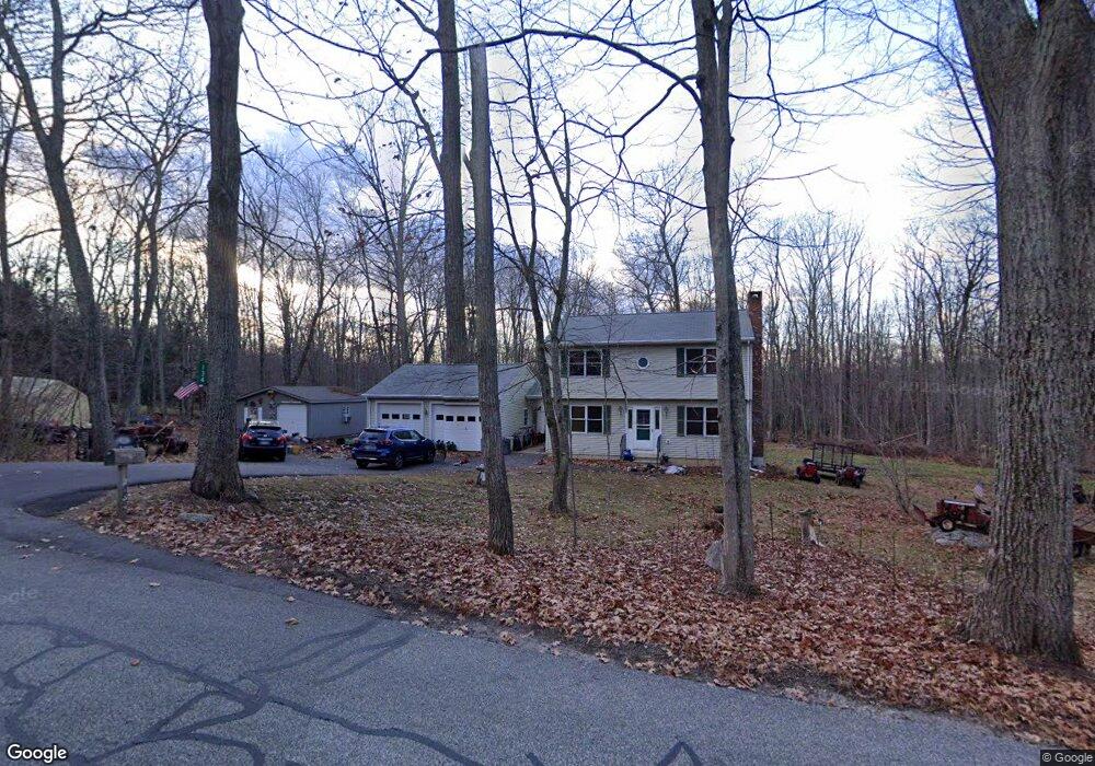
134 Wheeling Rd Andover, CT 06232
Estimated Value: $372,994 - $489,000
3
Beds
2
Baths
1,600
Sq Ft
$267/Sq Ft
Est. Value
About This Home
This home is located at 134 Wheeling Rd, Andover, CT 06232 and is currently estimated at $426,665, approximately $266 per square foot. 134 Wheeling Rd is a home located in Tolland County with nearby schools including Andover Elementary School, RHAM Middle School, and RHAM High School.
Ownership History
Date
Name
Owned For
Owner Type
Purchase Details
Closed on
Dec 23, 1998
Sold by
Savings Institute
Bought by
Ruggiero Anthony and Ruggiero Susan
Current Estimated Value
Purchase Details
Closed on
Feb 27, 1997
Sold by
Est Reed Ernest J and Reed Brian
Bought by
Fiano Francis and Fiano Donna
Purchase Details
Closed on
Feb 14, 1997
Sold by
B & E Development
Bought by
Ruggiero Anthony and Ruggiero Susan
Create a Home Valuation Report for This Property
The Home Valuation Report is an in-depth analysis detailing your home's value as well as a comparison with similar homes in the area
Home Values in the Area
Average Home Value in this Area
Purchase History
| Date | Buyer | Sale Price | Title Company |
|---|---|---|---|
| Ruggiero Anthony | $44,000 | -- | |
| Ruggiero Anthony | $44,000 | -- | |
| Fiano Francis | $18,500 | -- | |
| Ruggiero Anthony | $179,800 | -- | |
| B & E Development Co | $36,000 | -- | |
| B & E Development Co | $36,000 | -- | |
| B & E Development Co | $36,000 | -- |
Source: Public Records
Mortgage History
| Date | Status | Borrower | Loan Amount |
|---|---|---|---|
| Open | B & E Development Co | $296,000 | |
| Closed | B & E Development Co | $300,000 |
Source: Public Records
Tax History
| Year | Tax Paid | Tax Assessment Tax Assessment Total Assessment is a certain percentage of the fair market value that is determined by local assessors to be the total taxable value of land and additions on the property. | Land | Improvement |
|---|---|---|---|---|
| 2025 | $5,377 | $170,210 | $42,810 | $127,400 |
| 2024 | $5,355 | $170,210 | $42,810 | $127,400 |
| 2023 | $5,326 | $170,210 | $42,810 | $127,400 |
| 2022 | $5,431 | $170,210 | $42,810 | $127,400 |
| 2021 | $5,707 | $158,530 | $53,730 | $104,800 |
| 2020 | $5,678 | $159,440 | $50,840 | $108,600 |
| 2019 | $5,579 | $159,440 | $50,840 | $108,600 |
| 2018 | $5,413 | $159,440 | $50,840 | $108,600 |
| 2017 | $5,182 | $159,440 | $50,840 | $108,600 |
| 2016 | $5,272 | $171,610 | $48,710 | $122,900 |
| 2015 | $5,272 | $171,610 | $48,710 | $122,900 |
| 2014 | $5,272 | $171,610 | $48,710 | $122,900 |
Source: Public Records
Map
Nearby Homes
- 0 Skinner Hill Rd Unit 24077239
- 0 Wheeling Rd Unit 24116879
- 0 Hinkel Mae Dr
- 17 Ireland Dr
- 27 Fox Trail
- 8 Times Farm Rd
- 0 Rr 6 Route Unit 24048071
- 35 Ridge Rd
- 2478 Main St
- 0 Daly Rd Unit 24146464
- 152 Cheney Ln
- 198 Forest Rd
- 222 Spring Rd
- 25 Wolf Hill Rd
- 17 Route 6
- 0 Boston Turnpike Unit 24128587
- 864 Boston Turnpike
- 0 Woodland Rd
- 34 Hanover Farms Rd
- 37 Wolf Hill Lot (#40) Rd
- 120 Wheeling Rd
- 130 Wheeling Rd
- 156 Wheeling Rd
- 158 Wheeling Rd
- 160 Wheeling Rd
- 184 Wheeling Rd
- 182 Wheeling Rd
- 37 Skinner Hill Rd
- 41 Skinner Hill Rd
- 172 Wheeling Rd
- 128 Wheeling Rd
- 170 Wheeling Rd
- 116 Wheeling Rd
- 147 Wheeling Rd
- 153 Wheeling Rd
- 159 Wheeling Rd
- 104 Wheeling Rd
- 165 Wheeling Rd
- 21 Skinner Hill Rd
- 173 Wheeling Rd
Your Personal Tour Guide
Ask me questions while you tour the home.