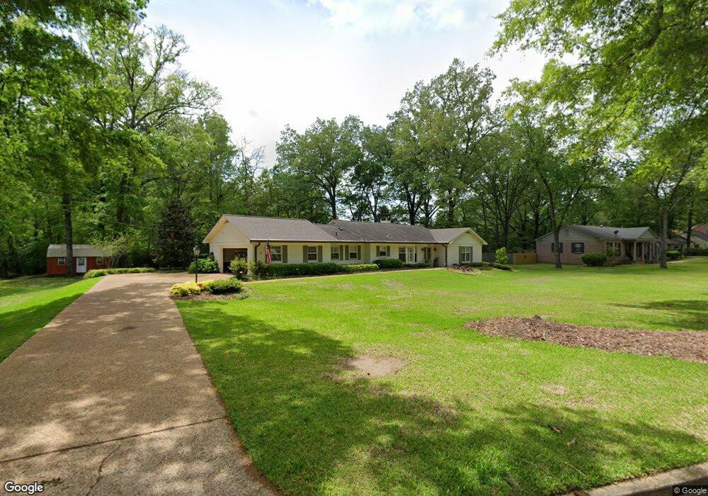
1340 Hickory Dr West Point, MS 39773
Estimated Value: $284,177 - $297,000
3
Beds
--
Bath
2,846
Sq Ft
$102/Sq Ft
Est. Value
About This Home
This home is located at 1340 Hickory Dr, West Point, MS 39773 and is currently estimated at $289,294, approximately $101 per square foot. 1340 Hickory Dr is a home located in Clay County with nearby schools including East Side Elementary School, West Clay Elementary School, and Church Hill Elementary School.
Ownership History
Date
Name
Owned For
Owner Type
Purchase Details
Closed on
Feb 27, 2018
Sold by
Pitre Larry J and Pitre Nancy M
Bought by
Vickers Mark and Vickers Resa
Current Estimated Value
Create a Home Valuation Report for This Property
The Home Valuation Report is an in-depth analysis detailing your home's value as well as a comparison with similar homes in the area
Purchase History
We collect this data history from publicly available records. To have your information removed, we recommend requesting removal directly through your county’s website.
| Date | Buyer | Sale Price | Title Company |
|---|---|---|---|
| Vickers Mark | -- | -- |
Source: Public Records
Tax History
| Year | Tax Paid | Tax Assessment Tax Assessment Total Assessment is a certain percentage of the fair market value that is determined by local assessors to be the total taxable value of land and additions on the property. | Land | Improvement |
|---|---|---|---|---|
| 2025 | $1,087 | $22,817 | $3,125 | $19,692 |
| 2024 | $1,087 | $22,817 | $3,125 | $19,692 |
| 2023 | $2,702 | $20,060 | $3,125 | $16,935 |
| 2022 | $943 | $20,060 | $3,125 | $16,935 |
| 2021 | $941 | $20,060 | $3,125 | $16,935 |
| 2020 | $940 | $20,060 | $3,125 | $16,935 |
| 2019 | $868 | $19,690 | $3,125 | $16,565 |
| 2018 | $604 | $19,690 | $3,125 | $16,565 |
| 2017 | $527 | $18,145 | $3,125 | $15,020 |
| 2016 | $714 | $18,145 | $3,125 | $15,020 |
| 2015 | $668 | $16,593 | $3,125 | $13,468 |
| 2014 | $569 | $16,593 | $3,125 | $13,468 |
| 2013 | $569 | $16,593 | $3,125 | $13,468 |
Source: Public Records
Map
Nearby Homes
- Lot 2 Waverly Rd
- Lot 6 Waverly Rd
- Lot 5 Waverly Rd
- Lot 3 Waverly Rd
- Lot 10 Waverly Rd
- Lot 8 Waverly Rd
- Lot 7 Waverly Rd
- Lot 9 Waverly Rd
- Lot 4 Waverly Rd
- Lot 11 Waverly Rd
- 161 Mapleview Rd
- 264 Mapleview Rd
- 389 Mapleview Rd
- 3986 E Church Hill Rd
- 112 Meadow Hill Rd
- 229 Clark Cir
- 170 Meadow Hill Rd
- 0 Old Tibbee Rd
- 289 Meadowbrook Cir
- 1414 E Brame Ave
- 132 Hickory Dr
- 1234 Hickory Dr
- 1492 Pinewood Rd
- 1311 Hickory Dr
- 1407 Hickory Dr
- 1321 Hickory Dr
- 129 Hickory Dr
- 1232 Hickory Dr
- 1455 Pinewood Rd
- 1418 Hickory Dr
- 1343 Mapleview Rd
- 1361 Pinewood Rd
- 1449 Pinewood Rd
- 1476 Walnut Rd
- 26 Mapleview Rd
- 1485 Walnut Rd
- 1230 Hickory Dr
- 1473 Walnut Rd
- 1456 Walnut Rd
- 1344 Mapleview Rd
Your Personal Tour Guide
Ask me questions while you tour the home.