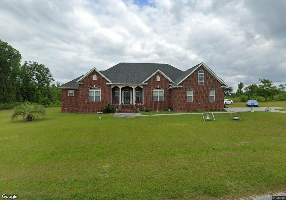
1340 Mattie Ave Manning, SC 29102
Estimated Value: $365,000 - $651,000
About This Home
This home is located at 1340 Mattie Ave, Manning, SC 29102 and is currently estimated at $471,357, approximately $176 per square foot. 1340 Mattie Ave is a home.
Ownership History
We collect this data history from publicly available records. To have your information removed, we recommend requesting removal directly through your county’s website.
Purchase Details
Home Financials for this Owner
Home Financials are based on the most recent Mortgage that was taken out on this home.Home Values in the Area
Average Home Value in this Area
Purchase History
We collect this data history from publicly available records. To have your information removed, we recommend requesting removal directly through your county’s website.
| Date | Buyer | Sale Price | Title Company |
|---|---|---|---|
| -- | None Available |
Mortgage History
We collect this data history from publicly available records. To have your information removed, we recommend requesting removal directly through your county’s website.
| Date | Status | Borrower | Loan Amount |
|---|---|---|---|
| Closed | $175,000 |
Tax History
We collect this data history from publicly available records. To have your information removed, we recommend requesting removal directly through your county’s website.
| Year | Tax Paid | Tax Assessment Tax Assessment Total Assessment is a certain percentage of the fair market value that is determined by local assessors to be the total taxable value of land and additions on the property. | Land | Improvement |
|---|---|---|---|---|
| 2025 | $1,838 | $11,060 | $480 | $10,580 |
| 2024 | $1,838 | $11,060 | $480 | $10,580 |
| 2023 | $1,802 | $11,060 | $480 | $10,580 |
| 2022 | $1,781 | $11,060 | $480 | $10,580 |
| 2021 | $1,456 | $9,628 | $220 | $9,408 |
| 2020 | $1,456 | $9,628 | $220 | $9,408 |
| 2019 | $1,348 | $9,628 | $220 | $9,408 |
| 2018 | $1,267 | $9,628 | $0 | $0 |
| 2017 | $1,267 | $9,628 | $0 | $0 |
| 2016 | $1,227 | $9,628 | $0 | $0 |
| 2015 | $1,259 | $9,716 | $220 | $9,496 |
| 2014 | $1,239 | $9,716 | $220 | $9,496 |
| 2013 | -- | $9,716 | $220 | $9,496 |
Map
- 1655 Beaver Dr
- 1229 Wyboo Ave
- 1175 Pond View Rd
- 0000 Wyboo Avenue Wyboo Ave
- 1343 Morello Rd
- 2551 Patriot Rd
- 1430 Copeland Dr
- 1043 Lesesne Dr
- 1229 Lemon Ave
- 1176 Lesesne Dr
- 1226 Lesesne Dr
- 1136 Lemon Ave
- 1294 Landing Rd
- 1026 Carolina Way
- 1724 Camp Shelor Rd
- 1107 Cypress Pointe
- 1702 Camp Shelor Rd
- 1203 Cypress Pointe Unit A203
- 1083 Copperhead Rd
- 1156 W A Gamble Rd
- 1544 Malibu Dr
- 1464 Malibu Dr
- 1243 Mattie Ave
- 1968 Patriot Rd
- 1134 Mattie Ave
- 1996 Patriot Rd
- TBD Malibu Dr
- 1479 Beaver Dr
- 1871 Patriot Rd
- 1501 Beaver Dr
- 1062 Rockfish Dr
- 1519 Beaver Dr
- 1465 Beaver Dr
- 2060 Patriot Rd
- Lot 19 Patriot Rd
- Lot 2 Patriot Rd
- Lot 1 Patriot Rd
- 2589 Patriot Rd
- 2 Patriot Rd
- 2-2A Patriot Rd
Ask me questions while you tour the home.