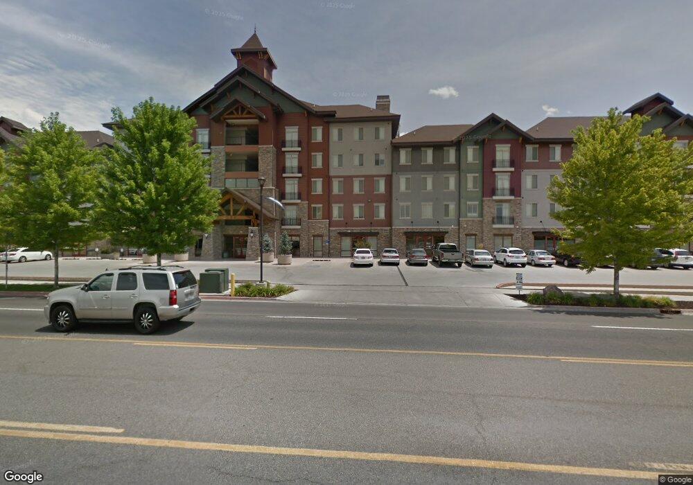
1340 N Freedom Blvd Provo, UT 84604
Riverside NeighborhoodEstimated Value: $342,339 - $367,000
4
Beds
1
Bath
1,016
Sq Ft
$349/Sq Ft
Est. Value
About This Home
This home is located at 1340 N Freedom Blvd, Provo, UT 84604 and is currently estimated at $354,835, approximately $349 per square foot. 1340 N Freedom Blvd is a home located in Utah County with nearby schools including Rock Canyon Elementary School, Centennial Middle School, and Timpview High School.
Ownership History
Date
Name
Owned For
Owner Type
Purchase Details
Closed on
Nov 9, 2022
Sold by
Vern Mumford and Vern Carol Lee
Bought by
Bristol Family Trust
Current Estimated Value
Purchase Details
Closed on
Jun 23, 2009
Sold by
Tueller Vern M and Tueller Carol
Bought by
Tueller Vern Mumford and Tueller Carol Lee Pitcher
Purchase Details
Closed on
Jun 30, 2008
Sold by
G & S Properties #2 Llc
Bought by
Tueller Vern M and Tueller Carol
Purchase Details
Closed on
Mar 3, 2008
Sold by
New Star Property Group Llc
Bought by
G & S Properties #2 Llc
Create a Home Valuation Report for This Property
The Home Valuation Report is an in-depth analysis detailing your home's value as well as a comparison with similar homes in the area
Home Values in the Area
Average Home Value in this Area
Purchase History
| Date | Buyer | Sale Price | Title Company |
|---|---|---|---|
| Bristol Family Trust | -- | United West Title | |
| Tueller Vern Mumford | -- | Title West Spanish Fork O | |
| Tueller Vern M | -- | Century Title Company | |
| G & S Properties #2 Llc | -- | Century Title Company |
Source: Public Records
Tax History Compared to Growth
Tax History
| Year | Tax Paid | Tax Assessment Tax Assessment Total Assessment is a certain percentage of the fair market value that is determined by local assessors to be the total taxable value of land and additions on the property. | Land | Improvement |
|---|---|---|---|---|
| 2025 | $1,869 | $203,115 | $41,000 | $328,300 |
| 2024 | $1,869 | $183,975 | $0 | $0 |
| 2023 | $1,849 | $179,465 | $0 | $0 |
| 2022 | $2,072 | $202,730 | $0 | $0 |
| 2021 | $1,742 | $297,200 | $35,700 | $261,500 |
| 2020 | $1,717 | $274,700 | $33,000 | $241,700 |
| 2019 | $1,494 | $248,600 | $30,000 | $218,600 |
| 2018 | $1,473 | $248,600 | $30,000 | $218,600 |
| 2017 | $1,281 | $118,800 | $0 | $0 |
| 2016 | $1,375 | $118,800 | $0 | $0 |
| 2015 | $1,259 | $110,000 | $0 | $0 |
| 2014 | $1,208 | $110,000 | $0 | $0 |
Source: Public Records
Map
Nearby Homes
- 98 W 1230 N Unit 225
- 1559 N Riverside Ave Unit 4
- 360 Sumac Ln
- 836 N University Ave Unit 111
- 1254 N 800 W
- 182 E 2090 N
- 186 E 2100 N
- 556 W 800 N Unit 18
- 1661 Willowbrook Dr
- 828 N 600 W
- 810 N 600 W
- 1939 N 700 W
- 920 W Columbia Ln
- 1149 N 850 W
- 1633 Woodland Dr
- 1685 Hickory Ln
- 1500 Jordan Ave
- 2244 N Canyon Rd Unit 305
- 2244 N Canyon Rd Unit 207
- 1763 Willowbrook Dr Unit 4D1
- 1340 N Freedom Blvd
- 1340 N Freedom Blvd
- 1340 N Freedom Blvd
- 1340 N Freedom Blvd
- 1340 N Freedom Blvd
- 1340 N Freedom Blvd
- 1340 N Freedom Blvd
- 1340 N Freedom Blvd
- 1340 N Freedom Blvd
- 1340 N Freedom Blvd
- 1340 N Freedom Blvd
- 1340 N Freedom Blvd
- 1340 N Freedom Blvd
- 1340 N Freedom Blvd
- 1340 N Freedom Blvd
- 1340 N Freedom Blvd
- 1340 N Freedom Blvd
- 1340 N Freedom Blvd
- 1340 N Freedom Blvd
- 1340 N Freedom Blvd