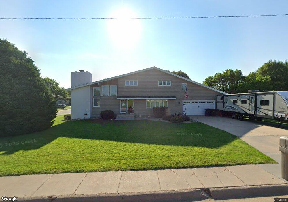
1340 Pershing Rd Hastings, NE 68901
Estimated Value: $303,000 - $366,000
4
Beds
3
Baths
2,172
Sq Ft
$156/Sq Ft
Est. Value
About This Home
This home is located at 1340 Pershing Rd, Hastings, NE 68901 and is currently estimated at $339,859, approximately $156 per square foot. 1340 Pershing Rd is a home located in Adams County with nearby schools including Hastings Senior High School, St. Michael's Preschool & Elementary School, and Zion Lutheran School.
Ownership History
Date
Name
Owned For
Owner Type
Purchase Details
Closed on
Jun 20, 2009
Sold by
Woodward Robb Alan and Woodward Renee Marie
Bought by
Runcie Douglas E and Runcie Melinda J
Current Estimated Value
Home Financials for this Owner
Home Financials are based on the most recent Mortgage that was taken out on this home.
Original Mortgage
$209,000
Interest Rate
4.84%
Mortgage Type
New Conventional
Create a Home Valuation Report for This Property
The Home Valuation Report is an in-depth analysis detailing your home's value as well as a comparison with similar homes in the area
Home Values in the Area
Average Home Value in this Area
Purchase History
| Date | Buyer | Sale Price | Title Company |
|---|---|---|---|
| Runcie Douglas E | -- | -- |
Source: Public Records
Mortgage History
| Date | Status | Borrower | Loan Amount |
|---|---|---|---|
| Closed | Runcie Douglas E | $209,000 |
Source: Public Records
Tax History Compared to Growth
Tax History
| Year | Tax Paid | Tax Assessment Tax Assessment Total Assessment is a certain percentage of the fair market value that is determined by local assessors to be the total taxable value of land and additions on the property. | Land | Improvement |
|---|---|---|---|---|
| 2024 | $4,884 | $305,786 | $43,572 | $262,214 |
| 2023 | $5,980 | $289,826 | $43,572 | $246,254 |
| 2022 | $5,001 | $222,027 | $43,572 | $178,455 |
| 2021 | $4,538 | $206,928 | $35,337 | $171,591 |
| 2020 | $4,286 | $198,757 | $35,337 | $163,420 |
| 2019 | $3,982 | $186,652 | $35,337 | $151,315 |
| 2018 | $4,091 | $190,785 | $39,470 | $151,315 |
| 2017 | $4,088 | $190,785 | $0 | $0 |
| 2016 | $3,797 | $177,030 | $39,470 | $137,560 |
| 2011 | -- | $0 | $0 | $0 |
Source: Public Records
Map
Nearby Homes
- 1330 Heritage Dr
- 1223 Westwood Terrace
- 1201 Pershing Rd
- 1225 Heritage Dr
- 1802 Westchester Dr
- 1334 W 12th St
- 1108 N Baltimore Ave
- 1402 Arapahoe Ave
- 1513 Crane Ave
- 1505 Crane Ave
- 1911 W 11th St
- 1314 N Laird Ave
- 904 N Washington Ave
- 1001 N Webster Ave
- 1814 Boyce St
- 1619 Boyce St
- 1127 N Bellevue Ave
- 1123-1125 N Bellevue Ave
- 1011 N Bellevue Ave
- 2330 W 11th St
- 1332 Pershing Rd
- 1638 Morningside Dr
- 1710 W 14th St
- 1345 Pershing Rd
- 1621 W 14th St
- 1405 Macarthur Rd
- 1339 Pershing Rd
- 1624 Morningside Dr
- 1401 Pershing Rd
- 1726 W 14th St
- 1331 Pershing Rd
- 1410 Pershing Rd
- 1409 Macarthur Rd
- 1404 Macarthur Rd
- 1620 Morningside Dr
- 1316 Pershing Rd
- 1323 Pershing Rd
- 1342 Heritage Dr
- 1413 Pershing Rd
- 1635 Morningside Dr