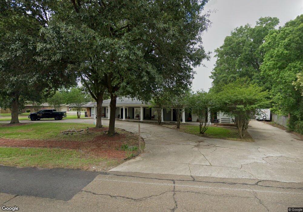
1340 Sharp Rd Baton Rouge, LA 70815
Broadmoor/Sherwood NeighborhoodEstimated Value: $313,000 - $441,000
5
Beds
4
Baths
3,879
Sq Ft
$99/Sq Ft
Est. Value
About This Home
This home is located at 1340 Sharp Rd, Baton Rouge, LA 70815 and is currently estimated at $385,778, approximately $99 per square foot. 1340 Sharp Rd is a home located in East Baton Rouge Parish with nearby schools including Broadmoor Elementary School, Southeast Middle School, and Broadmoor Senior High School.
Ownership History
Date
Name
Owned For
Owner Type
Purchase Details
Closed on
Jul 8, 2010
Sold by
Casanova Robie I
Bought by
Hicks Anthony J
Current Estimated Value
Home Financials for this Owner
Home Financials are based on the most recent Mortgage that was taken out on this home.
Original Mortgage
$181,455
Outstanding Balance
$119,246
Interest Rate
4.5%
Mortgage Type
FHA
Estimated Equity
$266,532
Create a Home Valuation Report for This Property
The Home Valuation Report is an in-depth analysis detailing your home's value as well as a comparison with similar homes in the area
Home Values in the Area
Average Home Value in this Area
Purchase History
| Date | Buyer | Sale Price | Title Company |
|---|---|---|---|
| Hicks Anthony J | $183,900 | -- |
Source: Public Records
Mortgage History
| Date | Status | Borrower | Loan Amount |
|---|---|---|---|
| Open | Hicks Anthony J | $181,455 |
Source: Public Records
Tax History
| Year | Tax Paid | Tax Assessment Tax Assessment Total Assessment is a certain percentage of the fair market value that is determined by local assessors to be the total taxable value of land and additions on the property. | Land | Improvement |
|---|---|---|---|---|
| 2024 | $3,410 | $33,400 | $2,000 | $31,400 |
| 2023 | $3,223 | $29,400 | $2,000 | $27,400 |
| 2022 | $3,610 | $29,400 | $2,000 | $27,400 |
| 2021 | $3,530 | $29,400 | $2,000 | $27,400 |
| 2020 | $3,508 | $29,400 | $2,000 | $27,400 |
| 2019 | $3,176 | $25,400 | $2,000 | $23,400 |
| 2018 | $3,138 | $25,400 | $2,000 | $23,400 |
| 2017 | $997 | $7,500 | $2,000 | $5,500 |
| 2016 | $1,329 | $17,210 | $2,000 | $15,210 |
| 2015 | $1,879 | $21,900 | $2,000 | $19,900 |
| 2014 | $1,873 | $21,900 | $2,000 | $19,900 |
| 2013 | -- | $21,900 | $2,000 | $19,900 |
Source: Public Records
Map
Nearby Homes
- 10656 Rondo Ave
- 10525 Rondo Ave
- 10841 Classique Dr
- 1653 Sharp Rd
- 1749 Stonegate Ct
- 1595 Bellfort Dr
- 1867 Stonegate Ct
- 1905 Stonegate Ct
- 10926 Old Hammond Hwy Unit 20
- 10926 Old Hammond Hwy Unit 27
- 10926 Old Hammond Hwy Unit 3
- 10926 Old Hammond Hwy Unit 7
- 869 Heather Dr
- 886 Hedgewood Dr
- 11019 Goodwood Blvd
- 14139 Old Hammond Hwy
- 14141 Old Hammond Hwy
- 11025 Goodwood Blvd
- 11146 Goodwood Blvd
- 10344 Old Hammond Hwy
- 10687 Browning Dr
- 10679 Browning Dr
- 10688 Browning Dr
- 1400 Sharp Rd
- 10682 Browning Dr
- 1337 Sharp Rd
- 10850 Lynell St
- 10657 Browning Dr
- 10868 Major Oaks Dr
- 10844 Lynell St
- 10868 Major Oak Dr
- 10640 Browning Dr
- 1350 Sharp Rd
- 1347 Sharp Rd
- 10637 Browning Dr
- 10838 Lynell St
- 10884 Major Oaks Dr
- 10884 Major Oak Dr
- 1296 Sharp Rd
- 10892 Major Oaks Dr
Your Personal Tour Guide
Ask me questions while you tour the home.