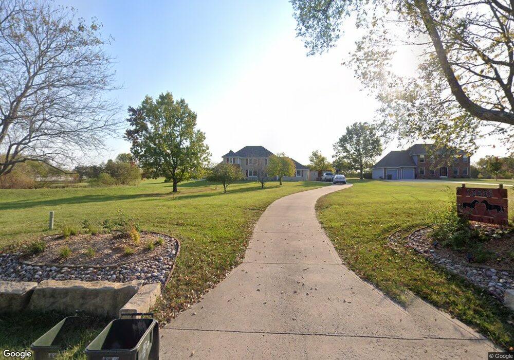
13401 Smart Rd Lees Summit, MO 64086
Estimated Value: $544,000 - $714,000
4
Beds
4
Baths
2,542
Sq Ft
$251/Sq Ft
Est. Value
About This Home
This home is located at 13401 Smart Rd, Lees Summit, MO 64086 and is currently estimated at $639,037, approximately $251 per square foot. 13401 Smart Rd is a home located in Jackson County with nearby schools including Woodland Elementary School, Pleasant Lea Middle School, and Lee's Summit Senior High School.
Ownership History
Date
Name
Owned For
Owner Type
Purchase Details
Closed on
Apr 8, 2009
Sold by
Goodman W Dean and Goodman Nancy
Bought by
Dedonder Thomas J and Dedonder Leanda K
Current Estimated Value
Home Financials for this Owner
Home Financials are based on the most recent Mortgage that was taken out on this home.
Original Mortgage
$211,500
Outstanding Balance
$134,347
Interest Rate
5.03%
Mortgage Type
Purchase Money Mortgage
Estimated Equity
$504,690
Purchase Details
Closed on
May 31, 2005
Sold by
Kinmarsor Llc
Bought by
Goodman Custom Homes Llc
Create a Home Valuation Report for This Property
The Home Valuation Report is an in-depth analysis detailing your home's value as well as a comparison with similar homes in the area
Purchase History
| Date | Buyer | Sale Price | Title Company |
|---|---|---|---|
| Dedonder Thomas J | -- | Kansas City Title | |
| Goodman Custom Homes Llc | -- | Coffelt Land Title Inc |
Source: Public Records
Mortgage History
| Date | Status | Borrower | Loan Amount |
|---|---|---|---|
| Open | Dedonder Thomas J | $211,500 |
Source: Public Records
Tax History
| Year | Tax Paid | Tax Assessment Tax Assessment Total Assessment is a certain percentage of the fair market value that is determined by local assessors to be the total taxable value of land and additions on the property. | Land | Improvement |
|---|---|---|---|---|
| 2025 | $6,437 | $98,500 | $25,650 | $72,850 |
| 2024 | $6,371 | $92,335 | $13,346 | $78,989 |
| 2023 | $6,371 | $92,335 | $13,346 | $78,989 |
| 2022 | $5,841 | $74,480 | $12,113 | $62,367 |
| 2021 | $5,586 | $74,480 | $12,113 | $62,367 |
| 2020 | $5,418 | $69,544 | $12,113 | $57,431 |
| 2019 | $5,294 | $69,544 | $12,113 | $57,431 |
| 2018 | $3,865 | $47,154 | $6,472 | $40,682 |
| 2016 | $3,569 | $43,149 | $6,308 | $36,841 |
Source: Public Records
Map
Nearby Homes
- 24611 Woodland Cir
- 24908 Timberlake Dr
- 25002 Woodland Cir
- 12714 S Harris Rd
- 12517 S Harris Rd
- 14017 Crawford Creek Cir
- 13904 Crawford Creek Cir
- 14412 Stringtown Ct
- 13932 Crawford Creek Ct
- 14409 Stringtown Ct
- 14516 Stringtown Dr
- 14403 Stringtown Ct
- 13908 Crawford Creek Cir
- 14502 Stringtown Cir
- 27302 Herring Rd
- 27013 E Olive Dr
- 12500 S White Ash Ln
- 27010 E Dogwood Ln
- 27012 E Dogwood Ln
- 27020 E Olive Dr
- 13413 Smart Rd
- 13315 Smart Rd
- 24410 Haines Rd
- 13311 Smart Rd
- 24307 Bob White Ln
- 13422 Smart Rd
- 24510 Haines Rd
- 24411 Haines Rd
- 24306 Bob White Ln
- 24606 Haines Rd
- 24209 Bob White Ln
- 24505 Haines Rd
- 24212 Bob White Ln
- 24113 Bob White Ln
- 24611 Haines Rd
- 13218 Smart Rd
- 24407 Woodland Cir
- 24407 Woodland Cir
- 24503 Woodland Cir
- 24110 Bob White Ln
Your Personal Tour Guide
Ask me questions while you tour the home.