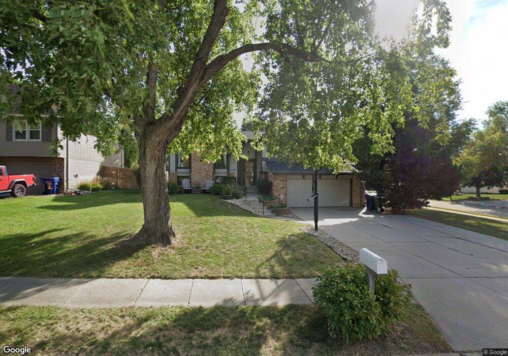
13405 S 27th Cir Bellevue, NE 68123
Estimated Value: $297,000 - $319,000
3
Beds
5
Baths
2,122
Sq Ft
$146/Sq Ft
Est. Value
About This Home
This home is located at 13405 S 27th Cir, Bellevue, NE 68123 and is currently estimated at $309,612, approximately $145 per square foot. 13405 S 27th Cir is a home located in Sarpy County with nearby schools including Leonard Lawrence Elementary School, Lewis & Clark Middle School, and Bellevue West High School.
Ownership History
Date
Name
Owned For
Owner Type
Purchase Details
Closed on
Jul 29, 2019
Sold by
Mills Holly J
Bought by
Mills Ross E
Current Estimated Value
Purchase Details
Closed on
Feb 13, 2004
Sold by
Kruid Mark F and Kruid Denise S
Bought by
Mills Ross E and Mills Holly J
Home Financials for this Owner
Home Financials are based on the most recent Mortgage that was taken out on this home.
Original Mortgage
$152,503
Outstanding Balance
$70,728
Interest Rate
5.67%
Mortgage Type
FHA
Estimated Equity
$238,884
Purchase Details
Closed on
Jul 12, 1998
Sold by
Vore Steven L and Vore Dawn R
Bought by
Kruid Mark F and Kruid Denise S
Home Financials for this Owner
Home Financials are based on the most recent Mortgage that was taken out on this home.
Original Mortgage
$124,400
Interest Rate
6.94%
Mortgage Type
VA
Create a Home Valuation Report for This Property
The Home Valuation Report is an in-depth analysis detailing your home's value as well as a comparison with similar homes in the area
Home Values in the Area
Average Home Value in this Area
Purchase History
| Date | Buyer | Sale Price | Title Company |
|---|---|---|---|
| Mills Ross E | -- | None Available | |
| Mills Ross E | $154,000 | -- | |
| Kruid Mark F | $122,000 | -- |
Source: Public Records
Mortgage History
| Date | Status | Borrower | Loan Amount |
|---|---|---|---|
| Open | Mills Ross E | $152,503 | |
| Previous Owner | Kruid Mark F | $124,400 |
Source: Public Records
Tax History Compared to Growth
Tax History
| Year | Tax Paid | Tax Assessment Tax Assessment Total Assessment is a certain percentage of the fair market value that is determined by local assessors to be the total taxable value of land and additions on the property. | Land | Improvement |
|---|---|---|---|---|
| 2025 | $4,459 | $273,050 | $46,000 | $227,050 |
| 2024 | $4,459 | $255,987 | $44,000 | $211,987 |
| 2023 | $5,013 | $237,396 | $39,000 | $198,396 |
| 2022 | $4,588 | $213,199 | $35,000 | $178,199 |
| 2021 | $4,175 | $191,951 | $30,000 | $161,951 |
| 2020 | $3,999 | $183,241 | $30,000 | $153,241 |
| 2019 | $3,845 | $177,314 | $30,000 | $147,314 |
| 2018 | $3,472 | $164,432 | $25,000 | $139,432 |
| 2017 | $3,357 | $157,866 | $25,000 | $132,866 |
| 2016 | $3,179 | $152,799 | $25,000 | $127,799 |
| 2015 | $3,072 | $148,509 | $25,000 | $123,509 |
| 2014 | $2,925 | $140,508 | $25,000 | $115,508 |
| 2012 | -- | $142,345 | $25,000 | $117,345 |
Source: Public Records
Map
Nearby Homes
- 13403 S 28th St
- 13211 S 26th Ave
- 2512 Nottingham Dr
- 2923 Blackhawk Dr
- 12901 S 29th Place
- 2939 Lone Tree Rd
- 12722 S 28th Ave
- 3105 Mirror Cir
- 2810 Bar Harbor Dr
- 2940 Leawood Dr
- 3102 Redwing Dr
- 3309 Lookingglass Dr
- 3105 Leawood Dr
- 14002 Tregaron Ridge Ave Unit B
- 3504 Sheridan Cir
- 14112 S 22nd St
- 3113 Tammy St
- 3508 Jason Cir
- 3506 Lynnwood Dr
- 13602 S 36th St
- 13405 S 27th Cr
- 13403 S 27th Cir
- 13406 S 26th Ave
- 13404 S 26th Ave
- 2611 Sheridan Rd
- 13401 S 27th Cr
- 2613 Sheridan Rd
- 13401 S 27th Cir
- 2609 Sheridan Rd
- 13406 S 27th Cir
- 13404 S 27th Cir
- 2701 Sheridan Rd
- 13402 S 26th Ave
- 2607 Sheridan Rd
- 13402 S 27th Cir
- 13309 S 27th Cir
- 2616 Blackhawk Dr
- 2702 Blackhawk Dr
- 2614 Blackhawk Dr
- 13310 S 26th Ave