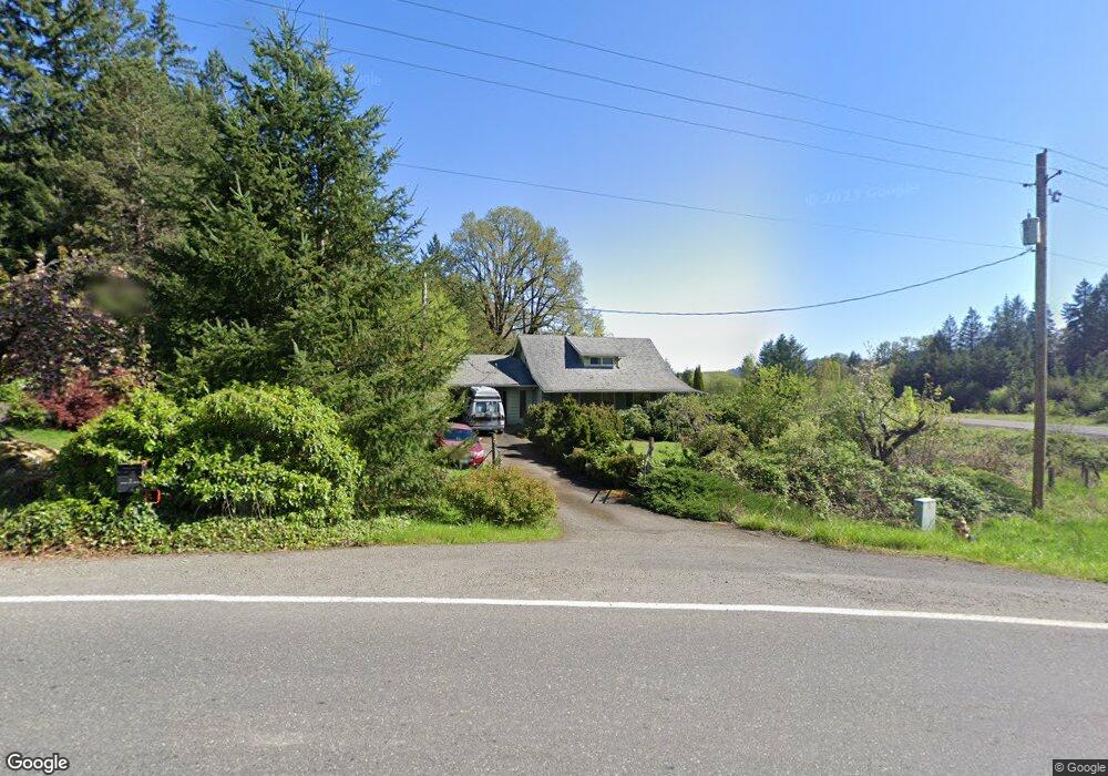
13406 NE 299th St Battle Ground, WA 98604
Estimated Value: $797,914 - $883,000
3
Beds
3
Baths
2,134
Sq Ft
$392/Sq Ft
Est. Value
About This Home
This home is located at 13406 NE 299th St, Battle Ground, WA 98604 and is currently estimated at $836,229, approximately $391 per square foot. 13406 NE 299th St is a home located in Clark County with nearby schools including Yacolt Primary School, Amboy Middle School, and Battle Ground High School.
Ownership History
Date
Name
Owned For
Owner Type
Purchase Details
Closed on
Jan 21, 2014
Sold by
Fannie Mae
Bought by
Franklin Melissa
Current Estimated Value
Purchase Details
Closed on
Feb 11, 2013
Sold by
White Robert and White Deborah
Bought by
Federal National Mortgage Association
Purchase Details
Closed on
Oct 25, 2011
Sold by
Gray Deborah and White Debbie
Bought by
White Robert
Purchase Details
Closed on
Jun 27, 2005
Sold by
Hochhalter Hildred Winona
Bought by
White Robert and White Debbie
Home Financials for this Owner
Home Financials are based on the most recent Mortgage that was taken out on this home.
Original Mortgage
$260,000
Interest Rate
5.25%
Mortgage Type
Purchase Money Mortgage
Create a Home Valuation Report for This Property
The Home Valuation Report is an in-depth analysis detailing your home's value as well as a comparison with similar homes in the area
Home Values in the Area
Average Home Value in this Area
Purchase History
| Date | Buyer | Sale Price | Title Company |
|---|---|---|---|
| Franklin Melissa | -- | Stewart Title | |
| Federal National Mortgage Association | $356,162 | None Available | |
| White Robert | -- | None Available | |
| White Robert | $408,000 | Stewart Title |
Source: Public Records
Mortgage History
| Date | Status | Borrower | Loan Amount |
|---|---|---|---|
| Previous Owner | White Robert | $260,000 |
Source: Public Records
Tax History Compared to Growth
Tax History
| Year | Tax Paid | Tax Assessment Tax Assessment Total Assessment is a certain percentage of the fair market value that is determined by local assessors to be the total taxable value of land and additions on the property. | Land | Improvement |
|---|---|---|---|---|
| 2025 | $6,029 | $715,783 | $303,898 | $411,885 |
| 2024 | $5,645 | $683,755 | $303,898 | $379,857 |
| 2023 | $5,737 | $720,172 | $319,155 | $401,017 |
| 2022 | $4,979 | $669,772 | $283,638 | $386,134 |
| 2021 | $5,063 | $539,060 | $214,330 | $324,730 |
| 2020 | $4,848 | $500,965 | $205,377 | $295,588 |
| 2019 | $3,998 | $470,230 | $205,377 | $264,853 |
| 2018 | $5,036 | $443,508 | $0 | $0 |
| 2017 | $4,242 | $427,938 | $0 | $0 |
| 2016 | $4,182 | $391,219 | $0 | $0 |
| 2015 | $4,148 | $355,466 | $0 | $0 |
| 2014 | -- | $335,949 | $0 | $0 |
| 2013 | -- | $306,483 | $0 | $0 |
Source: Public Records
Map
Nearby Homes
- 30108 NE Mcbride Rd
- 13706 NE River Bend Rd
- 29311 NE 124th Ave
- 9701 NE 299th St
- 29139 NE Hammond Ct
- 29815 NE 152nd Ave
- 0 NE 279th St Unit 717779825
- 0 NE 279th St Unit 24075001
- 0 NE 279th St Unit 24073819
- 0 NE 279th St Unit 24101609
- 16401 NE 278th St
- 28900 NE 112th Ave
- 11700 NE 279th St
- 16808 NE 281st Cir
- 17003 NE 281st Cir
- 16906 NE 281st Cir
- 16807 NE 281st Cir
- 16905 NE 281st Cir
- 16803 NE 281st Cir
- 17000 NE 281st Cir
- 0 XXX NE Lewisville Hwy
- 0 NE Mcbride Rd Unit 5081120
- 30001 NE 136th Ct
- 30001 NE 136th Ct Unit 3
- 29700 NE 136th Ct
- 13200 NE 299th St
- 29807 NE 136th Ct
- 29809 NE 136th Ct
- 13206 NE 299th St
- 29904 NE Mcbride Rd
- 29805 NE 136th Ct
- 29718 NE 132nd Ave
- 29903 NE Mcbride Rd
- 29619 NE 136th Ct
- 29615 NE 136th Ct
- 29008 NE 136th Ct Unit Lot 8
- 29001 NE 136th Ct Unit 2
- 29008 NE 136th Ct Unit 8